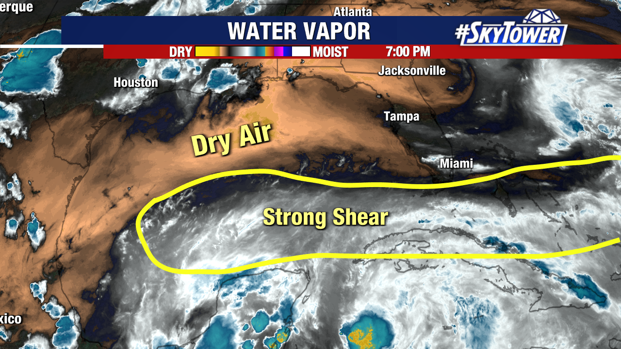
It did not take long to get the Atlantic Hurricane Season underway. On the second day of the season we now have advisories being issued on what will likely become Tropical Storm Alex by Friday. Wind shear continues to be an issue for this system and will continue to present a hostile environment over the next couple of days.

Large areas of convection have been bursting well to the east of the broad area of low pressure. The center appears to be forming closer to the northern tip of the Yucatan. The disorganized system with the lack of a well defined center presents a forecasting challenge for the various computer models to pinpoint the exact track. There continues to be a spread in the various model guidance because of the disorganized nature of this developing system.

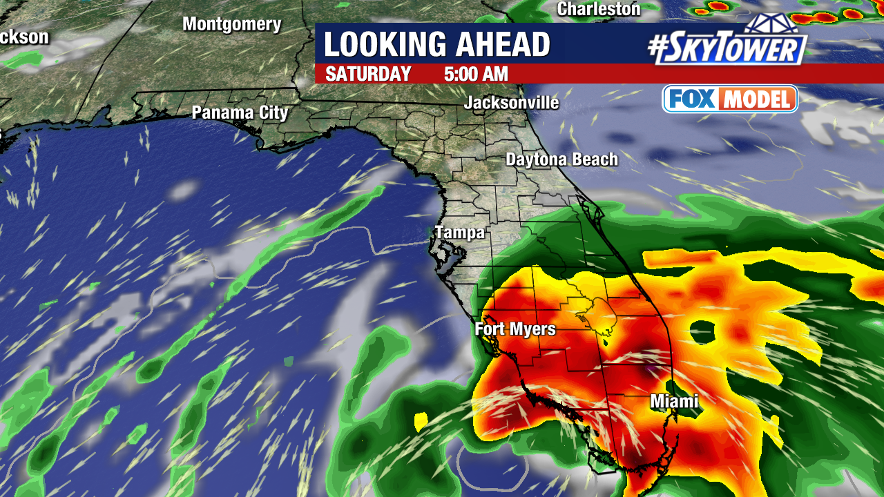
There is a distinct possibility that we will see the center of this storm jumping around or reforming as it continues to evolve and move toward the Florida coastline. This will result in adjustments to the eventual track of what looks to become Tropical Storm Alex. The strongest portion, with the heaviest rainfall is the right hand side of the storm which still puts the strongest side of this storm over south Florida. Shifts in the track one way or the other could bring more rain over central Florida or lessen our rain coverage. South Florida could see between 4-8 inches of rainfall with isolated areas of up to 12 inches of rain.

The rainfall will begin to spread over the state on Friday and by the afternoon we could see some rain overspreading central Florida since much of this storm is displaced to the east. Saturday will be a wet an breezy day with torrential rains over south Florida. This will be followed by quick clearing and drier conditions on Sunday.

The sun setting over the Gulf and Caribbean this evening reveals the intense convection on the eastern side of this storm and a center beginning to form just north of the Yucatan peninsula.


