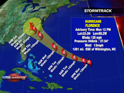
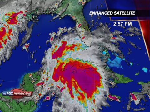
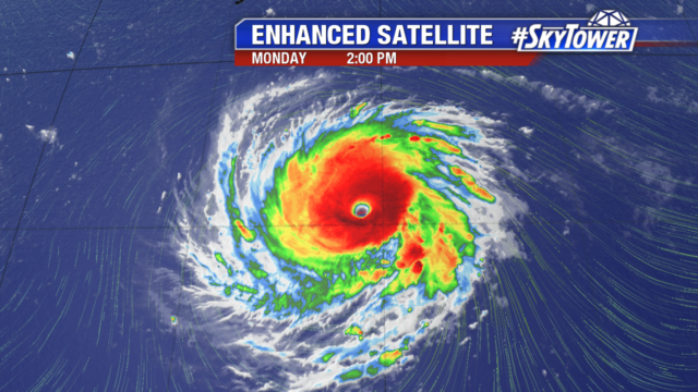
Hurricane Florence went through an eyewall replacement cycle early this morning. During this time the inner eyewall collapses and become ragged for several hours as a new eyewall reforms outside of the original. During this process it is normal for the hurricane to loose intensity as was noted this morning but once this process it complete it begins to ramp up in strength once again.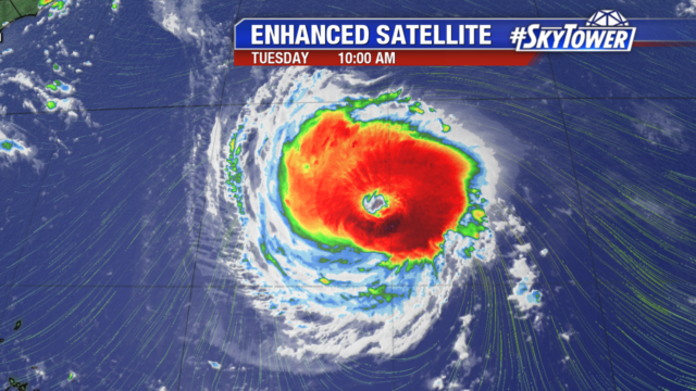
As of mid-morning on Tuesday the eye still has a somewhat ragged appearance as this process completes. It is likely to start regaining strength later this afternoon. Overall, the forecast remains unchanged with a major hurricane moving onshore early on Friday morning along the North Carolina coastline. The exact path will continue to shift back and forth as things evolve so much of South Carolina is still in the cone.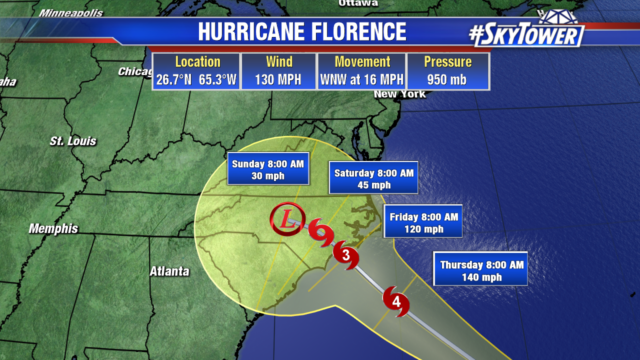
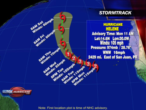
A hurricane watch has now been issued from the North Carolina/Virginia border southward to Edisto Beach in South Carolina.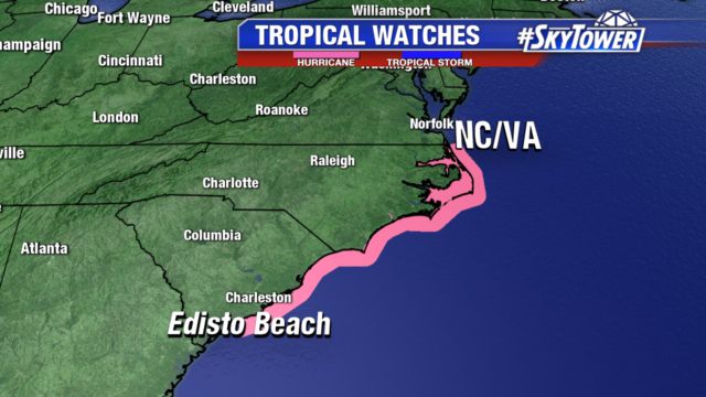
To the right of the center will be the areas affected by the storm surge. The sounds in North Carolina could be hit especially hard with a storm surge. The current forecast calls for a surge between 10-15 feet in these sounds. Further down the coast near Wilmington the surge could be between 6-10 feet. This will change as the exact intensity and track shift over the coming days.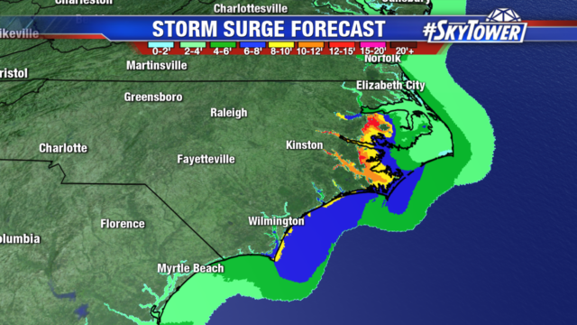
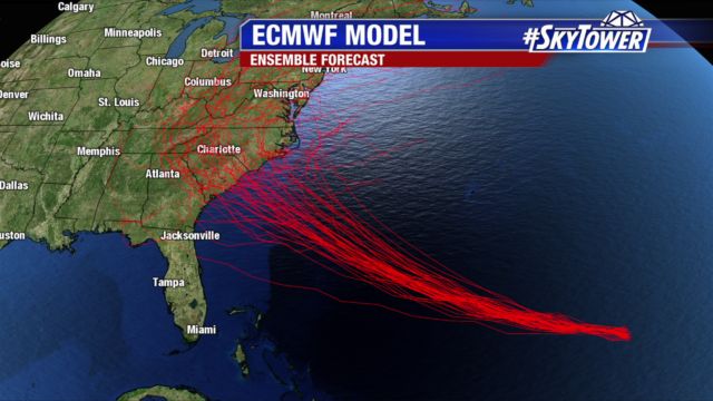
The various models have been suggesting for days that a ridge will build to the over the Great Lakes and will cause Florence to stall and begin to meander. There is growing concern that this could happen close the coast which would allow Florence to continue to tap energy from the Atlantic Ocean.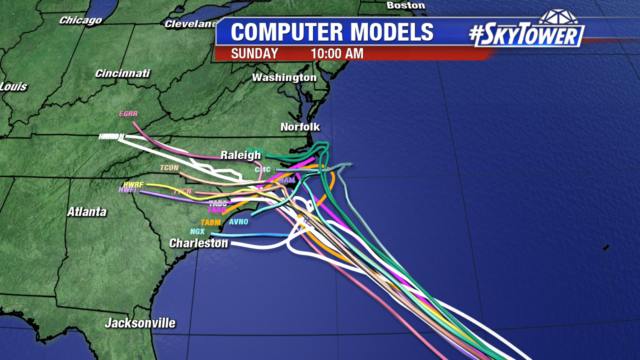
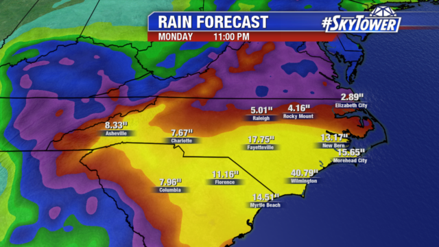
The rainfall totals from a stalled system along the Carolina coastline are disturbing. It is important not to focus on exact totals but rather the potential of extremely large amounts of rain that would produce catastrophic flooding. Exact amounts will shift depending on many factors including the forward motion of the hurricane after landfall.
This is a particularly dangerous situation and it is important for those ordered to evacuate follow the orders from emergency officials.
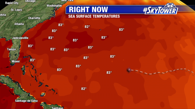
 Water temperatures will continue to support more intensification over the coming days as SST temperatures are approaching 85° F. Wind shear will remain light over the system as well giving a very favorable environment to support a major hurricane.