Tropical Storm Karen dissipated yesterday evening but we are still watching Hurricane Lorenzo.
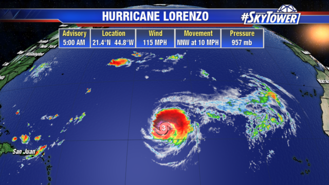
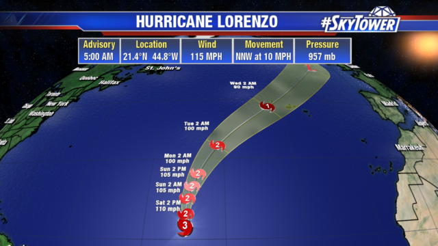
Lorenzo is battling wind shear and has weakened to a category 3 hurricane with 155 mph winds. The hurricane force winds extend out 50 miles from the center and tropical storm force winds extend out 290 miles. The Lesser Antilles and northeastern South America are seeing large swells and dangerous rip currents from the large storm. Lorenzo will stay out over the open Atlantic as it steadily weakens next week, due to cooler water and wind shear. Some islands in the western Azores may see strong winds by midweek.
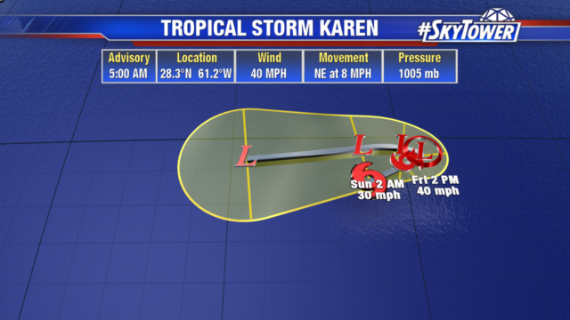
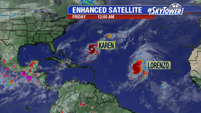 Tropical Storm Karen remains a disorganized and weak tropical storm. It currently has 40 mph winds and is battling dry and wind shear. Karen is no threat to land and will stall tonight before weakening into a remnant low this weekend.
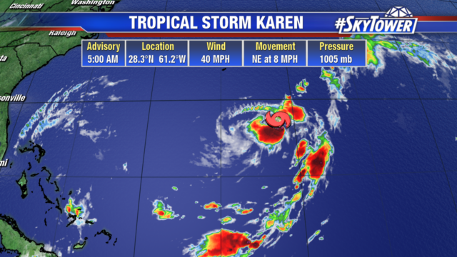
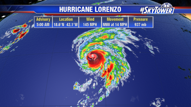
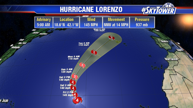
 Lorenzo is a category 4 hurricane with 145 mph winds The storm is maintaining its strength with a well defined eye wall. It is a large hurricane with hurricane force winds extending out 45 mph from the center, tropical storm force winds extend out 265 miles. Although Lorenzo will not directly impact any land areas the next few days, large swells will reach the Windward Islands and northeastern coast of South America starting today.