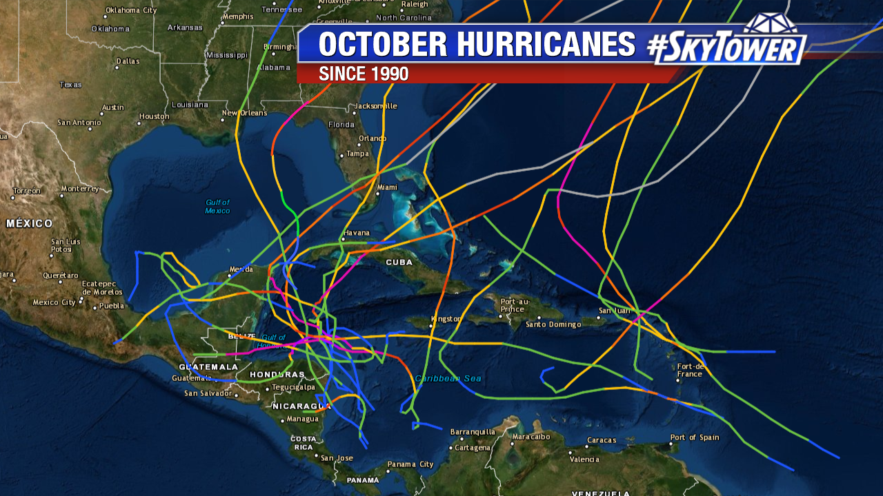
This time of the year the main area for development in the tropics shifts from the Central Atlantic to the Caribbean and Gulf of Mexico. In some ways, it can be one of the more dangerous parts of the hurricane season, as this ‘home-grown’ development can happen quickly, leaving little time for preparation.
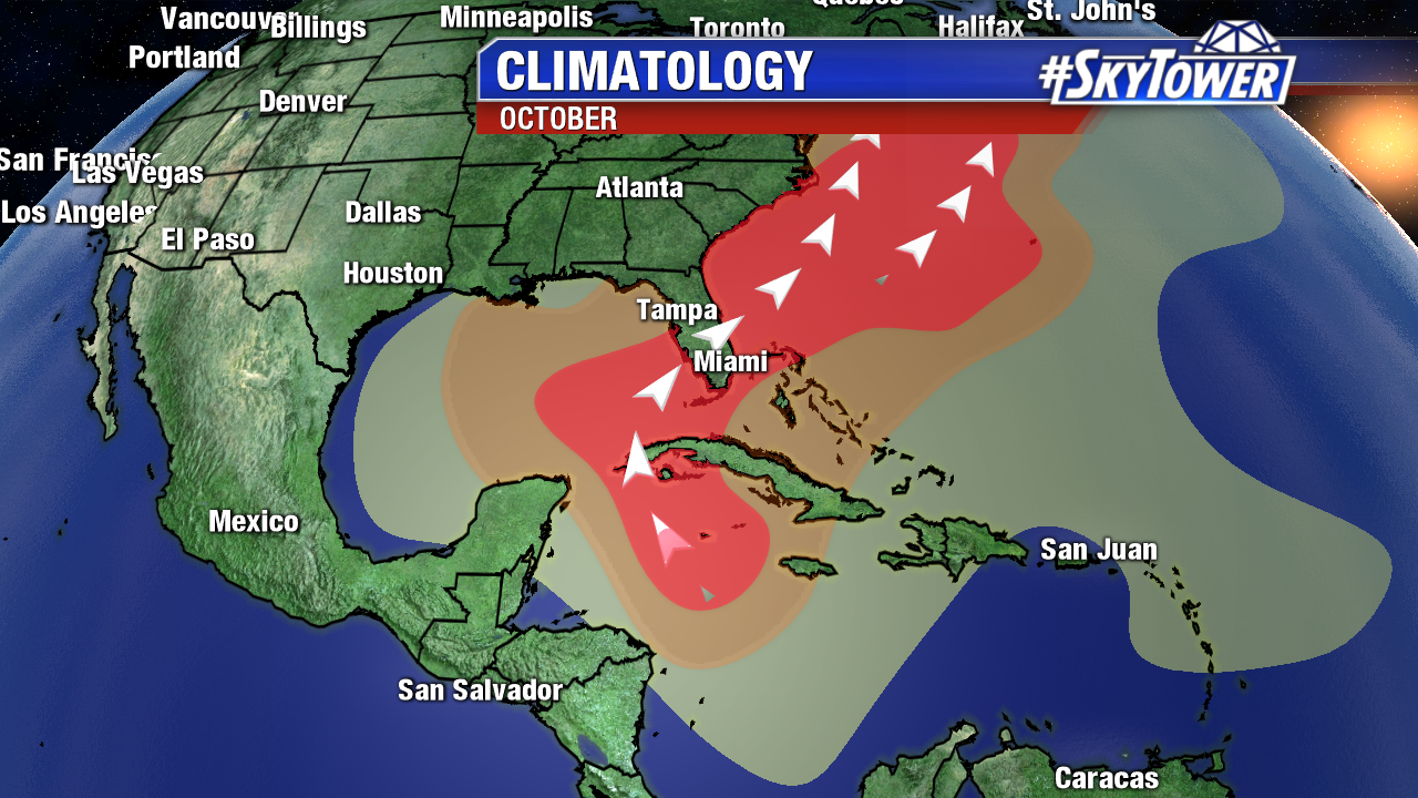
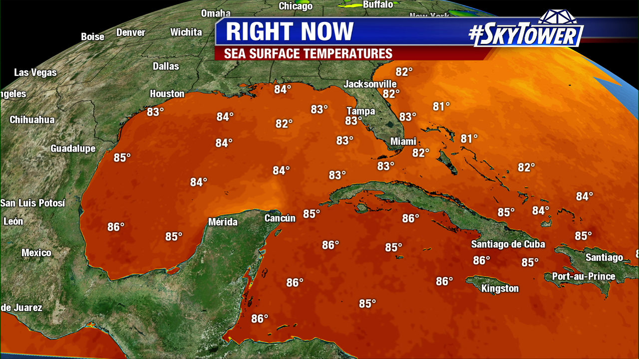
Even though tropical activity overall is winding down across the Atlantic basin this time of year, the ingredients are there for storms to rapidly develop in this part of the world. Sea-surface temperatures are about as warm as they get at any point in the season and wind shear isn’t quite as abundant. Areas of disturbed weather sparked by Central American Gyres (broad areas of low pressure of Central America), as well early Fall cold fronts moving south off the Continental U.S., can rapidly develop in this favorable environment.
This happened in 2017 with Hurricane Nate, and again last year with Hurricane Michael. Other notable October storms in recent memory include Hurricane Opal (1995), Hurricane Mitch (1998), Hurricane Wilma (2005), Hurricane Matthew (2016).
The are some signs in long-term models that we’ll have something trying to spin up in the Western Caribbean during the third week of October, but as you know, anything beyond 5-7 days is nearly impossible to predict when it comes to tropical forecasting. For now, we simply take it as a reminder that hurricane season isn’t over quite yet and we need to stay prepared.
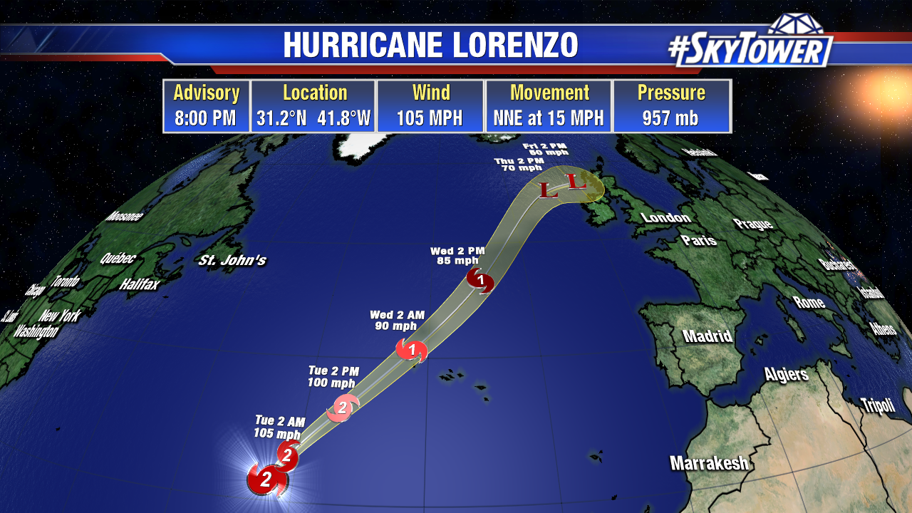
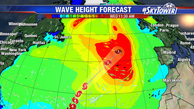
Not to be forgotten, Hurricane Lorenzo continues to moves northeast in the middle of the Atlantic. It’ll move past the Azores late Tuesday into Wednesday, and could brings some significant wind and rain to parts of the United Kingdom by the end of the week.