Nor’easter Becomes Sub-Tropical Storm Melissa

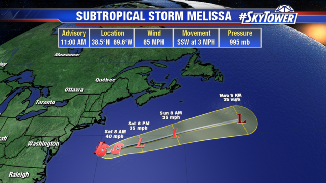
The nor’easter we have been watching off the New England coast has become Sub-Tropical Storm Melissa. Earlier this morning the storm became better organized around the center with an eye like feature developing. The impacts along the east coast remain the same: coastal flooding, heavy rainfall, rough surf and strong winds.

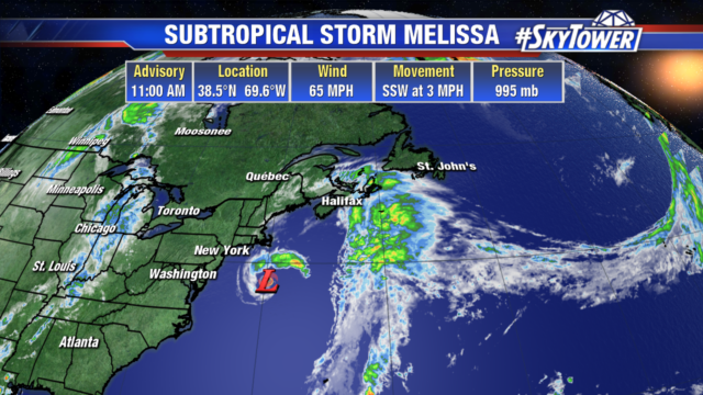
Melissa will accelerate to the east tomorrow and weaken as it runs into stronger wind shear.

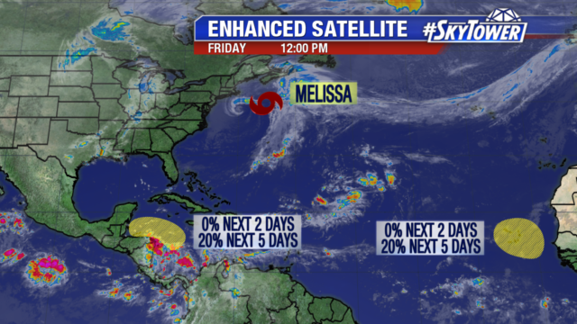
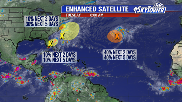
There are 2 other areas we are monitoring for possible development. A wave in the western Caribbean could organize a little over the weekend, if it stays over water. Another wave is forecast to come off the African coast on Sunday. Although the eastern Atlantic isn’t climatologically favorable for development this late in hurricane season, the wave has minimal chances of organizing early next week.

Trough Brings Beneficial Rain to Florida; Monitoring 2 Other Non-Tropical Lows

There are 3 areas we are watching in the tropics. The first is a trough of low pressure sitting over southern Florida. It is bringing much needed rainfall to the state and will head northeast into the Atlantic later today. Little development is expected as it will be absorbed into a low pressure system sitting off the southeast coast.

The non-tropical low pressure system sitting off the southeast coast of the United States, is the second area we are watching. It has a 30% chance of development over the next few days. It may take on some subtropical characteristics as it moves north-northeast in the Atlantic. It poses no threat to Florida but the northeast should monitor its progress.

The third area, is also a non-tropical low pressure system. It could become a tropical or sub-tropical system later today or early Wednesday morning. It has a 40% chance of developing within a narrow window. By Wednesday evening, upper level winds become unfavorable for further development.