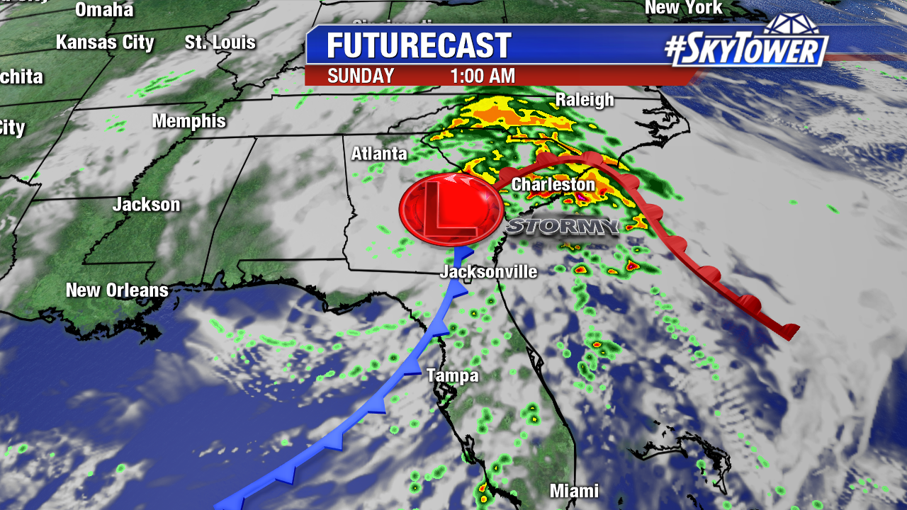
The low pressure system that was previously Nestor, continues to bring heavy rain to the Mid-Atlantic states this morning. It will head out into the Atlantic later today.
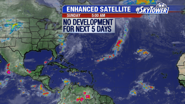
Otherwise, the tropics have quieted down and the National Hurricane Center isn’t expecting any tropical development for the next 5 days.
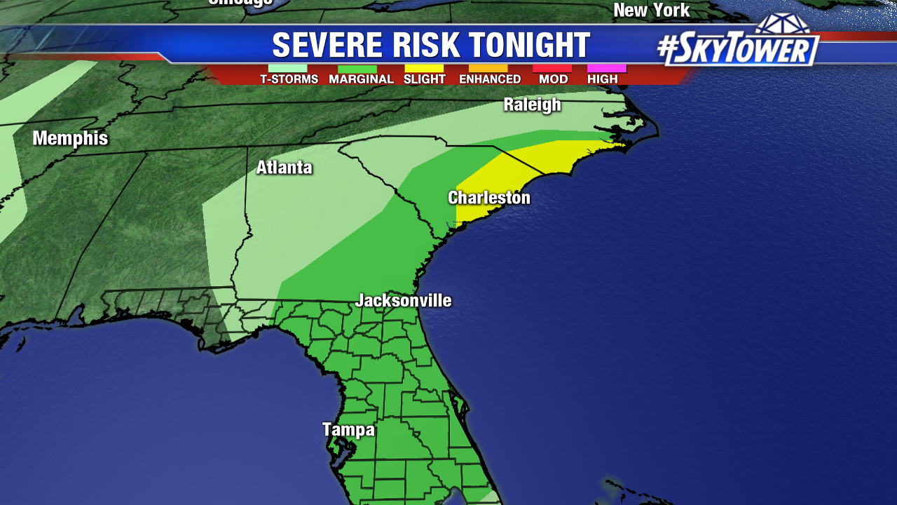
It’s been an active 24 hours across the state of Florida with gusty winds and rain, coastal flooding, and a few confirmed tornadoes.
Nestor has lost all tropical characteristics and is essentially a mid-latitude storm system at this point. There are no longer any tropical warnings or watches in effect. That being said, the threat for severe weather will be spreading northward along the coast of Georgia and the Carolinas tonight through early Sunday morning. This will include the potential for damaging winds and a few tornadoes.
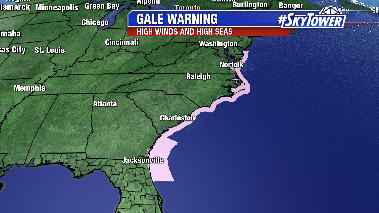
In addition, Gale-force winds and high seas will be present in coastal waters up and down the East Coast, from northeast Florida up through the Mid-Atlantic.
At this time there are no other areas of interest in the tropical Atlantic.