Earliest 5th Named Storm On Record – Edouard Forms In The Atlantic

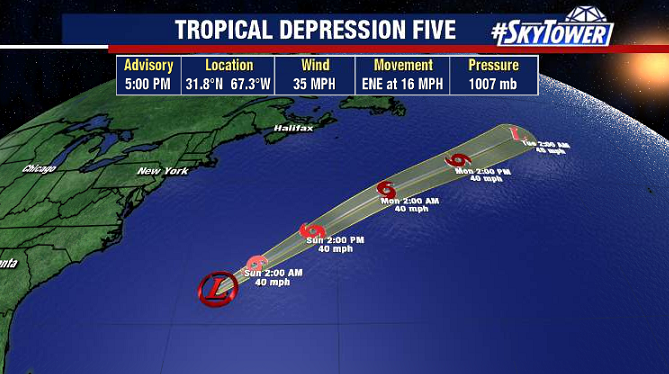
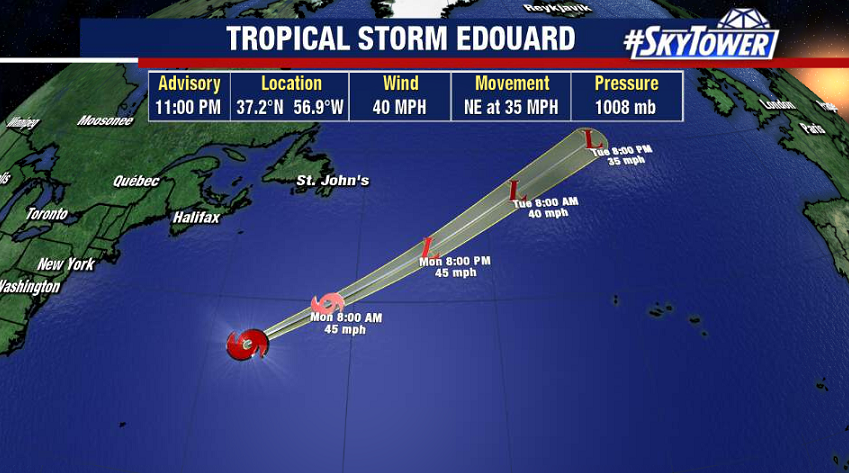
Tropical Storm Edouard formed in the North Atlantic Sunday evening. It’s the earliest ‘E’ storm on record in the Atlantic. This will be racing northeast the next few days, with its remnants moving across the United Kingdom late next week.

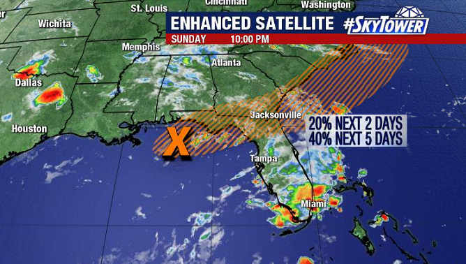
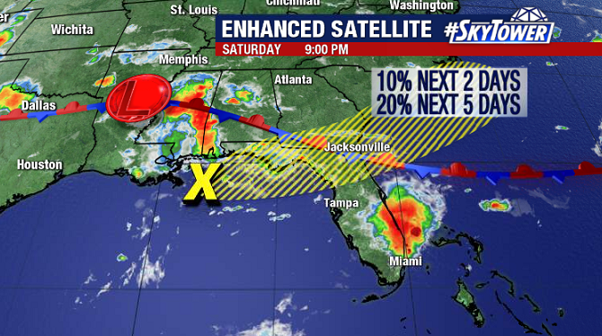
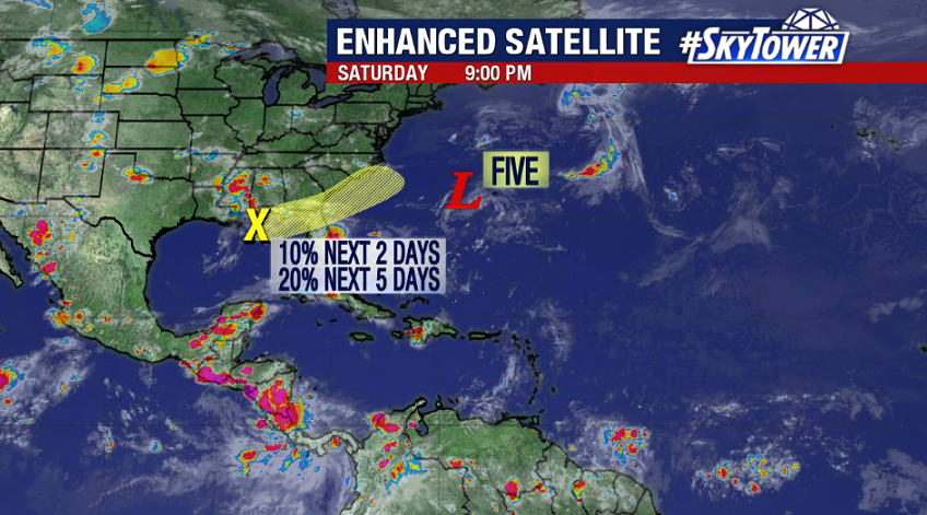
In the northeastern Gulf, a weak area of low pressure is producing little to no convection at the moment. Development chances are slim before this crosses over Florida/Georgia. Once it emerges over the Atlantic in a few days, conditions will be favorable for some development, especially if it stays far enough offshore to avoid too much land interaction. We’ll keep you posted.

Tropical Depression Five Forms Near Bermuda; Weak Low Trying To Spin Up In Northern Gulf

Hope you’re having a safe and happy 4th of July weekend! Activity has picked up a little in the tropics over the last 24 hours. Tropical Depression Five formed a couple hundred miles west of Bermuda on Saturday morning. It’ll be passing just north of the island late Saturday night. This system will be held in check by dry air and wind shear as it races northeast, but it may strengthen just enough to become our fifth named storm of the season – Edouard.

There’s also an area in the northern Gulf that we’ll be keeping an eye on the rest of the weekend. Nothing significant is expected here, but any time you have a stalled front in the vicinity of warm Gulf waters this time of year it has to be watched. More than likely this will simply end up being a weak area of low pressure moving east across north Florida/south Georgia and into the Atlantic in the next day or two – doing nothing more than helping to spark additional scattered downpours.