Keeping An Eye On Tropical Wave Moving Into The Gulf This Week

A tropical wave near the southern Bahamas will be moving west toward the Florida Straits over the next day or so, and eventually into the southern Gulf sometime late Tuesday. The environment in the Gulf is somewhat conducive for development, so we’ll be watching closely as this disturbance heads toward the western Gulf Coast later this week.

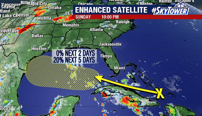
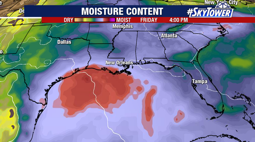
As of Sunday evening, the National Hurricane Center has development odds only at 20% over the next five days, and recent model runs aren’t doing a whole lot with this. Most likely, this will simply be a slug of moisture moving west through the Gulf that will help to enhance rainfall coverage across parts of south Texas, and perhaps Louisiana, late next week.

In The Wake of Tropical Storm Fay Last Week, All Is Quiet In The Atlantic For Now

Six named storms in the books, and it’s only mid-July – no doubt we’re in the midst of a very active hurricane season in the Atlantic.

Following Tropical Storm Fay along the East Coast of the U.S. last week, we’re in a bit of a lull right now with no areas of interest. Saharan dust is still abundant across the central Atlantic, which will continue to suppress tropical activity.

Courtesy: CIMSS – University of Wisconsin

That being said, the atmosphere is set up in a such a way that should lead to a very active West African Monsoon over the next week or two, and subsequently several tropical waves rolling off the continent that we’ll need to keep an eye on.