Isaias Makes Landfall In NC; Wind And Rain Quickly Heading Up The East Coast

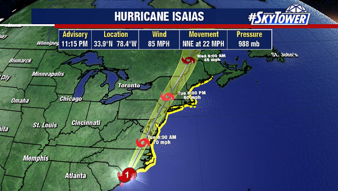
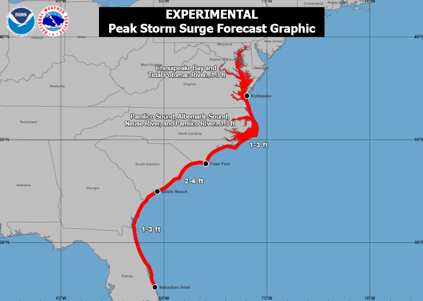
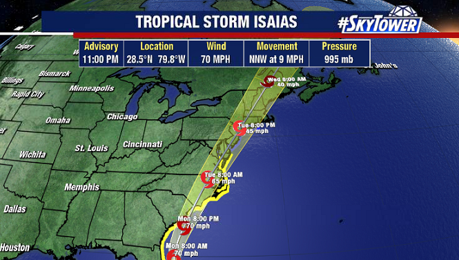
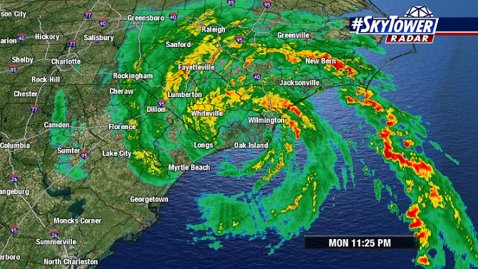
Isaias officially made landfall at Ocean Isle Beach, NC late Monday evening as a category 1 hurricane with winds of 85 mph. Storm surge, wind, and rain has been lashing parts of the SC/NC coast through the evening, but conditions will improve overnight as the storm races north.

Tropical storm-force winds and rain will rapidly move up the I-95 corridor through New England and into eastern Canada over the next 36-48 hours.

Isaias Paralleling Florida’s East Coast; Will Threaten Carolinas By Monday Night

It has been the best case scenario for Florida, with Isaias staying safely offshore as it moved north on Sunday. Through the day the storm has lacked organization, but continues to produce vigorous deep convection.

It will be battling some southwesterly shear as it heads north toward the Carolinas; but feeding off the warm waters of the Gulf Stream, some slight strengthening is possible – enough to possibly reclaim hurricane intensity.

A landfall is looking likely either in NE South Carolina or SE North Carolina late Monday night. Those in these areas need to be preparing for tropical storm-force winds in addition to a storm surge of 2-4 feet, especially near and east of where the storm ultimately comes ashore.

Thereafter, Isaias will continue moving north up I-95 bringing wind and rain all they up into New England.