Sally Strengthening; Storm Surge And Heavy Rain Headed For Northern Gulf Coast

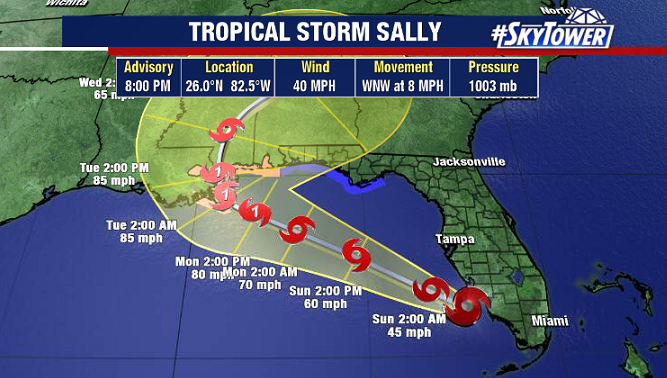
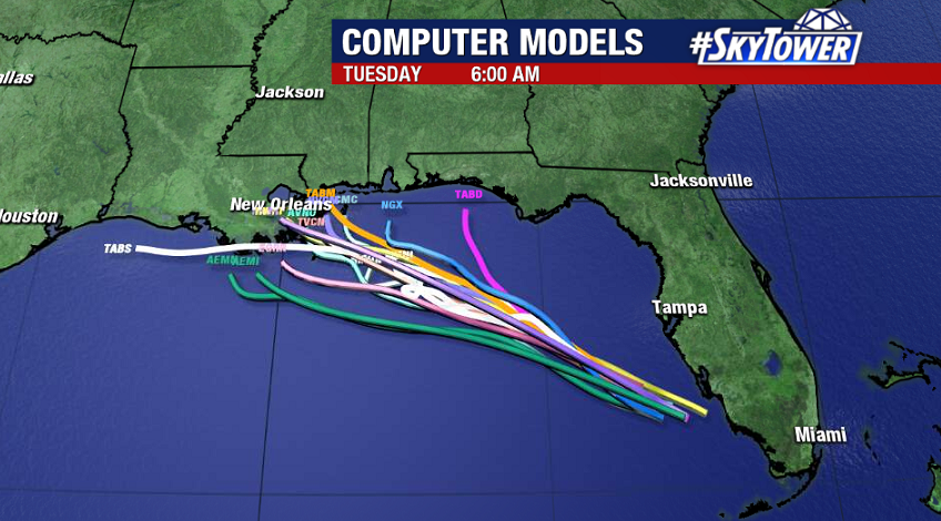
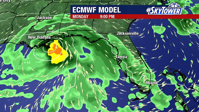
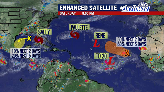
As of 8pm Sunday evening, Tropical Storm Sally was located about 200 miles ESE of the mouth of the Mississippi River. It’s a slow-moving system, and it’s going to slow down even more. Yes, wind speeds will continue to increase and Sally is likely to become a hurricane, but it is this slow forward speed that is going to create some big problems when it comes to storm surge and heavy rainfall for parts of the northern Gulf Coast. The storm should be nearing the coast late Monday night.

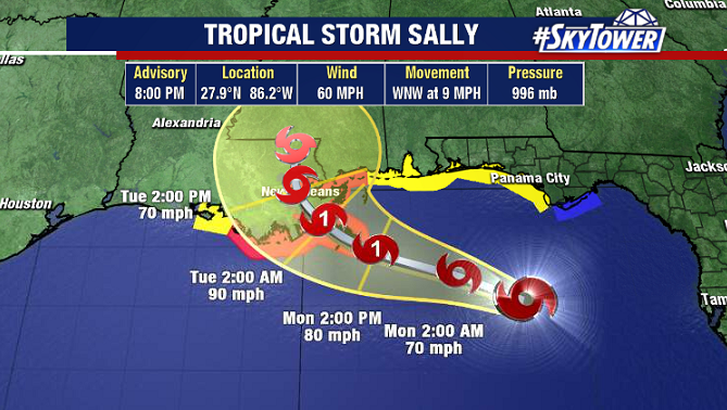
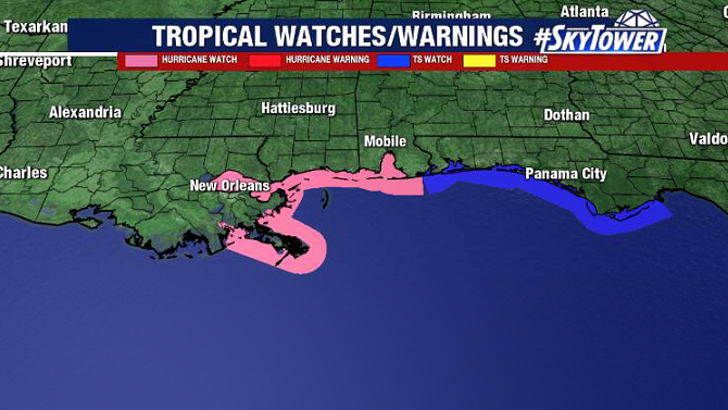
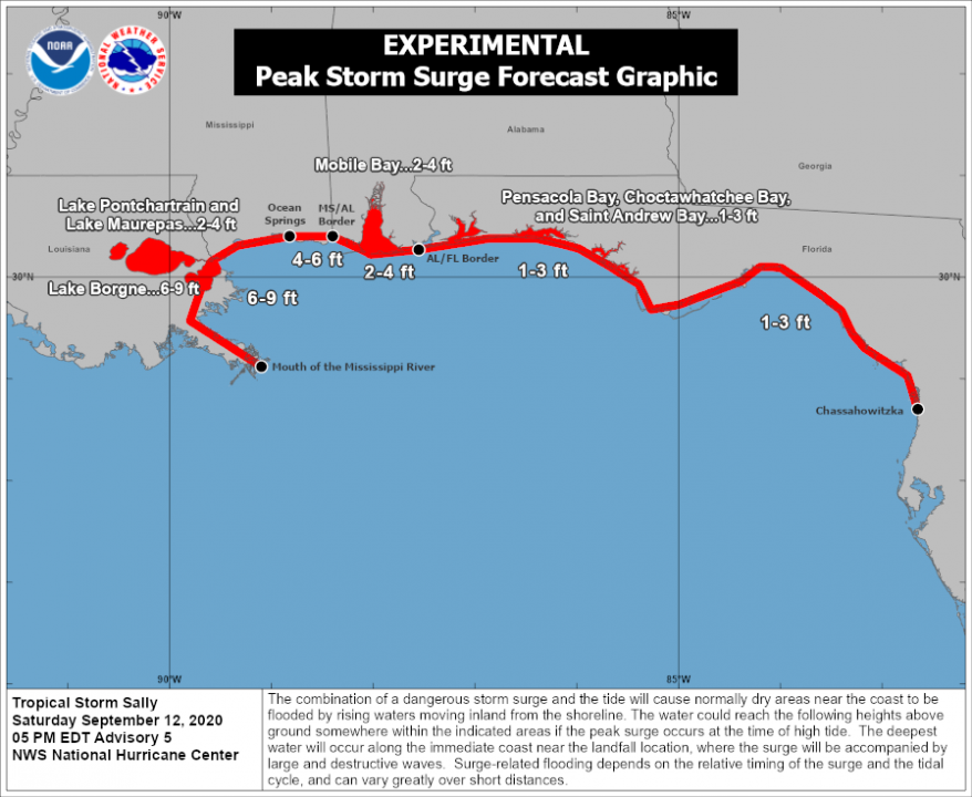
The track will still need some fine tuning, but along and just east of where the center comes ashore storm surge could be as high as 11 feet. The areas that especially need to be on guard for this are southeast Louisiana and coastal Mississippi.

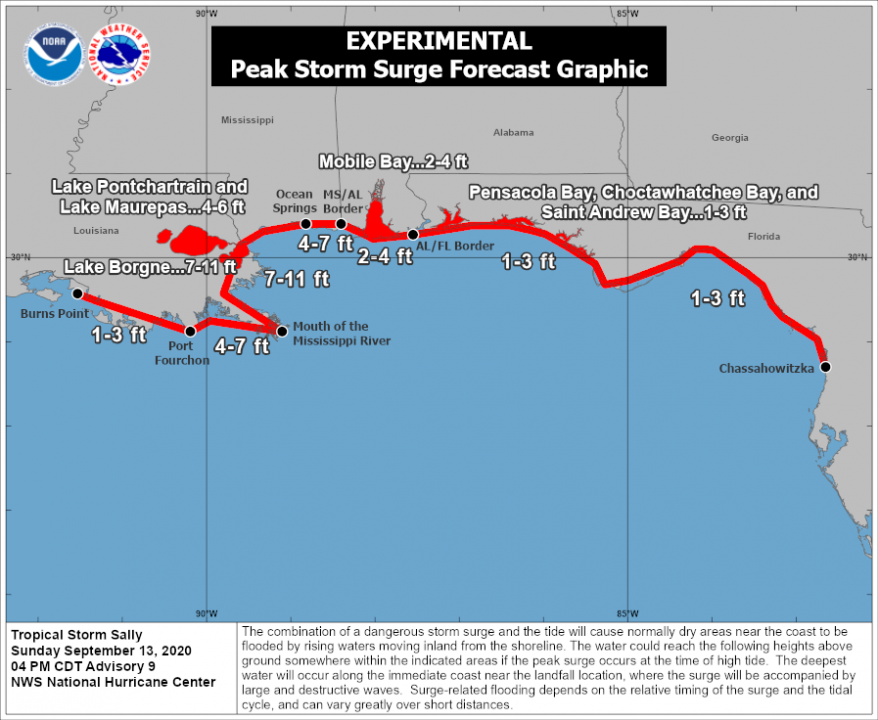
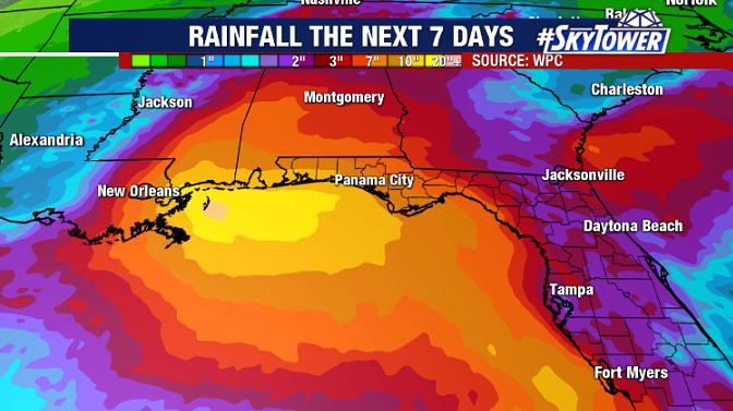
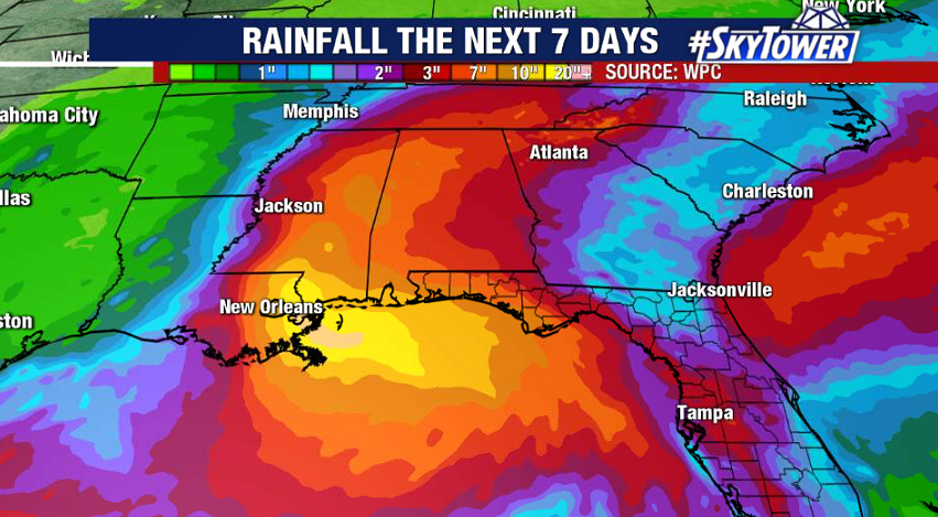
On top of this, while water is being pushed in, they’ll be a ton of rain coming down. 8-16″ rainfall totals can be expected, but isolated amounts up to two feet will be possible. Heavy rain will then spread inland across Mississippi, Alabama, north Georgia, Tennessee, and western North Carolina.

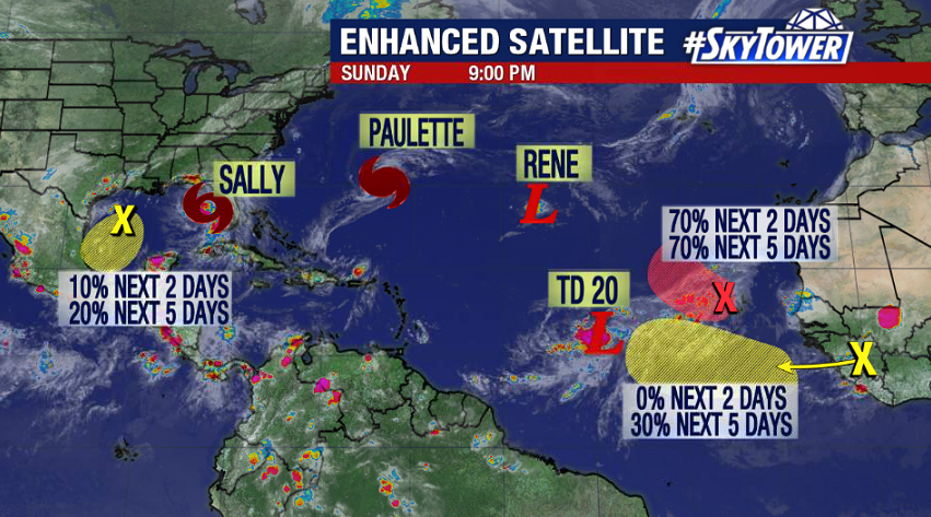
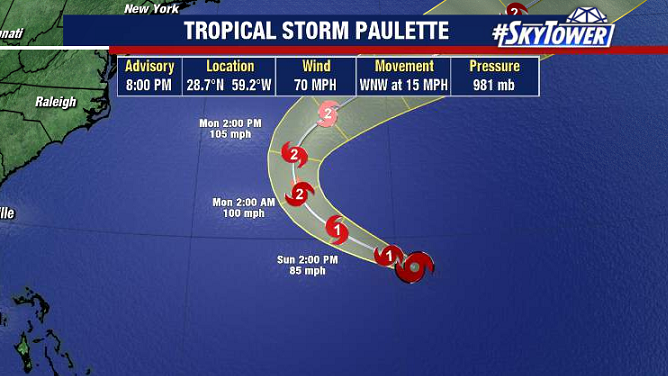
Elsewhere in the Atlantic we have Paulette, Rene, and Tropical Depression 20. Paulette will impact Bermuda as a Category 2 storm late tonight. Rene will fizzle out. And TD 20 should become Teddy and strengthen into a major hurricane later this week. As of now, it appears it will stay out to sea.

Tropical Storm Sally Expected To Strengthen; Headed For Northern Gulf Coast

As of 8pm Saturday evening, the center of Tropical Storm Sally was located about 40 miles west of Naples.

It has been producing some nasty squalls across SW Florida and the Keys today, and will now track northwest across the Gulf toward the northern Gulf Coast.

A hurricane watch is in effect from Grand Isle, LA to the AL/FL border. Folks in these areas need to be paying close attention to this storm as we fine tune the track and intensity forecast.

The environment is pretty favorable for steady strengthening aside from pockets of moderate wind shear. There is certainly no lack of warm water, with sea-surface temperature running 85-90°. This should become a hurricane as it nears the coast Monday night/Tuesday morning.

Wind and surge issues are likely near the coast, with peak surge upwards of 6 feet near and just east of where the center comes ashore.

The most far-reaching impact will be heavy rainfall and flooding. As the storm’s forward speed slows and it merges with a front over the Southeast, some areas could receive more than a foot of rain through the middle of the week.

It’s busy all across the Atlantic right now, but other than Sally, the only other storm expected to impact any land areas in the near future is Paulette – which is likely to become a significant hurricane and pass very near or directly over Bermuda late Sunday night.