Watching The Western Gulf Over The Next Few Days

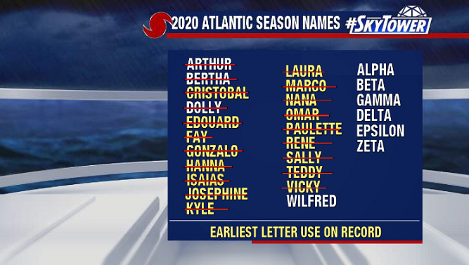
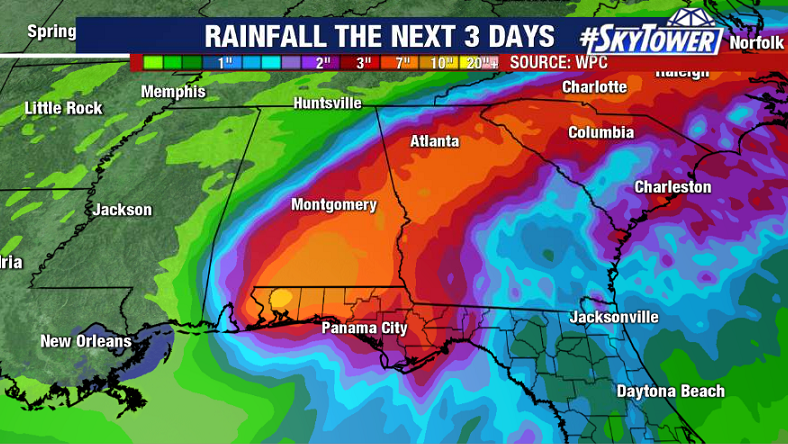
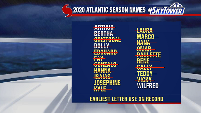
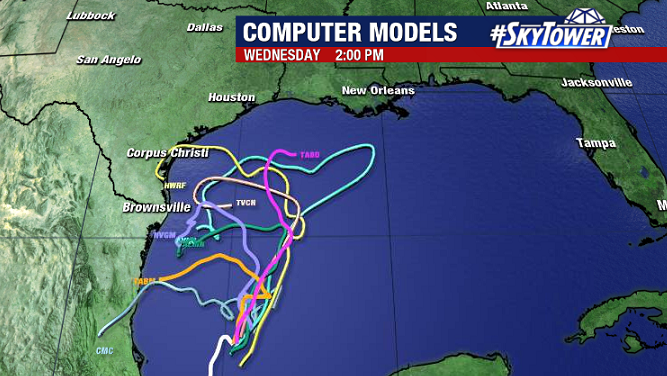
Just one name left on the 2020 list, and it looks like it will end up going to a disturbance in the western Gulf. This will be hanging out in the same general area, slowly drifting north, through the weekend. Wind shear should continue to lessen, and a tropical depression or Tropical Storm ‘Wilfred’ is likely to form in the next day or two.

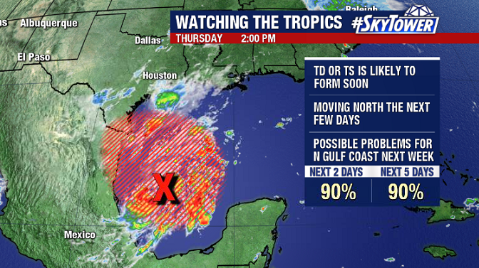
For folks along the northern Gulf Coast, this will be one to keep a close eye on next week. The timing of a trough digging into the middle of the country will be the key here as far what direction this ultimately will take. A lot of questions to be answered, so be sure to check back for updates on ‘Invest 90L’.

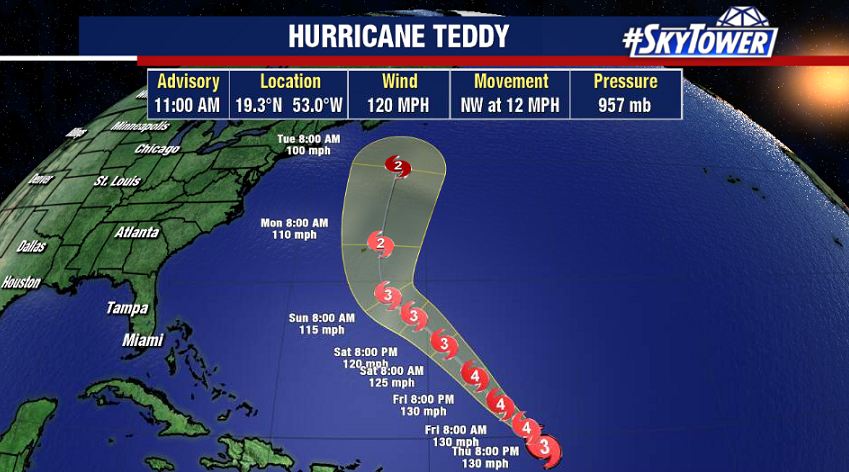
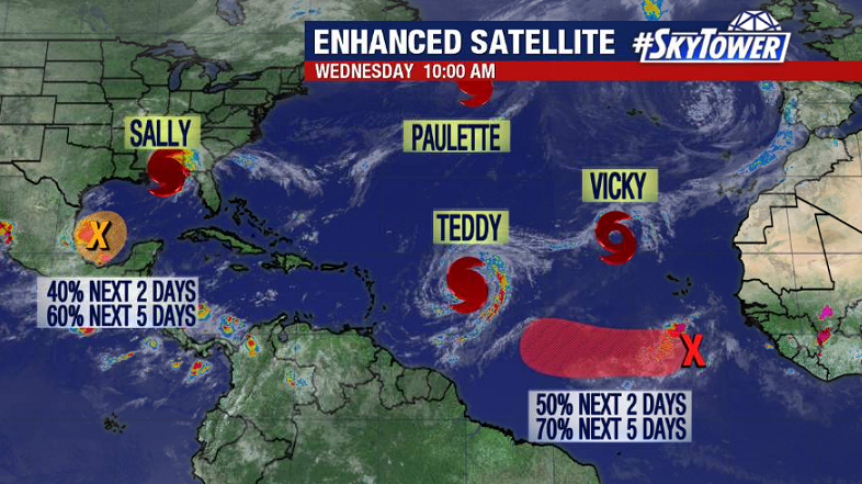
‘Teddy’ is now a major hurricane with winds of 120 mph. It will continue heading northwest toward the island of Bermuda through the weekend.

Sally Finally Makes Landfall; Immense Flooding Continues

Hurricane Sally underwent some strengthening in the hours leading up to landfall and officially came ashore near Gulf Shores, AL just before 5AM CDT as a category 2 with winds of 105 mph.

While the winds have obviously created some issues, the flooding from both storm surge and heavy rainfall has been disastrous. Many areas across Northwest Florida are continuing to get hammered with heavy rain this morning.

So far, radar estimates indicate that isolated spots have picked up close to 3 feet of rain. This swath of heavy rain will spread north today up through Alabama and into Georgia. In addition to freshwater flooding in many of these areas, tornadoes will also be possible.

The flurry of activity across the Atlantic continues. Teddy will be intensifying as it moves north-northwest. It’s likely to become a major hurricane, and potentially impact Bermuda late in the weekend or early next week.

Only one name remains on the list for the 2020 season – Wilfred. Following the formation that storm, we’ll be moving on to the Greek alphabet for the first time since 2005.