Tropical Storm Beta Set To Soak Parts of Texas and Louisiana

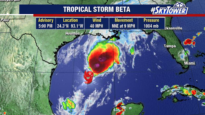
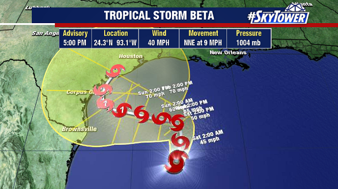
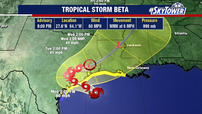
As of 7pm CDT Sunday evening, Beta was located about 120 miles south-southeast of Galveston, TX. It’s still creeping along at 6 mph, and forward motion will remain very slow over the next few day as the storm moves over South Texas.

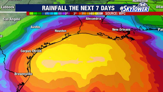
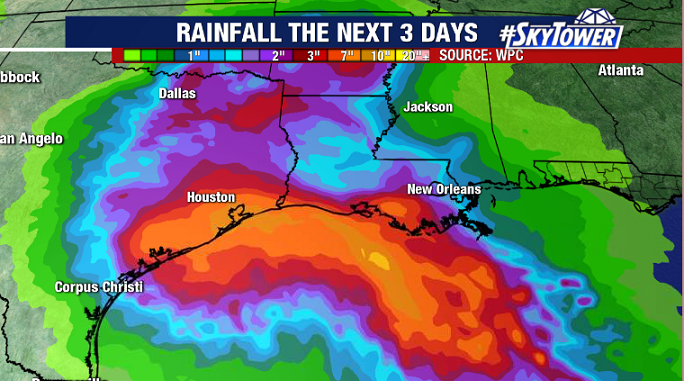
Herein lies the biggest problem, as persistent rainfall will be present over many of the same areas during the first half of the week leading to the potential for widespread freshwater flooding. Isolated spots could see up to 18″ over the next 3 days.

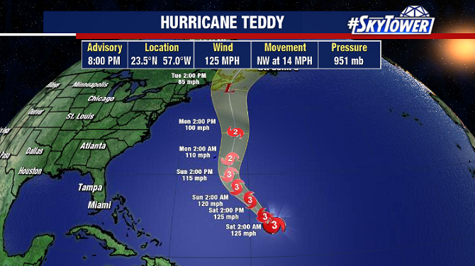
Beta will become the 9th named storm to make landfall in the continental U.S. this season. This will tie the record from 1916. The 2020 season continues to break records left and right.

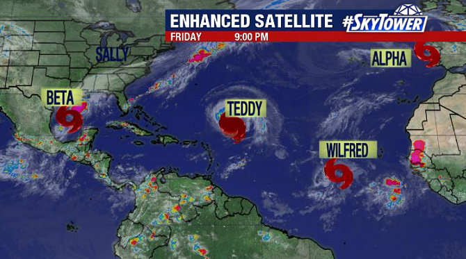
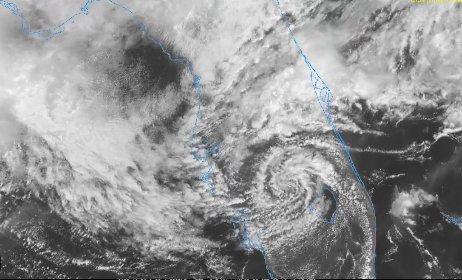
Finally, an interesting swirl popped up over central Florida today. This was an area of low pressure that formed along a stationary front. This is headed into the Gulf tonight, and obviously that draws the attention of Gulf Coast residents this time of year. Ultimately though, it looks like this will simply get ingested into the broad circulation of Beta to the west.

Generally speaking, it looks like things will quiet down a bit for the rest of the month. Remember though, October can always be a dangerous time of season with ‘homegrown’ tropical development leaving minimal time for preparation. Stay prepared.

A Flurry Of Activity In The Atlantic As We Head Into The Weekend

In the span of six hours on Friday afternoon, three new named storms formed in the Atlantic – Wilfred, Alpha, and Beta. The only other time on record that three named storms formed in a single calendar day was August 15, 1893. And yes, we are now into the Greek Alphabet with 23 named storms so far – fast approaching the record of 27 (2005).

Wilfred is in the middle of the central Atlantic and shouldn’t be a concern for anyone. Subtropical Storm Alpha will be short-lived, as it has already made landfall in Portugal. The only storm currently that will be a threat to the U.S. is Tropical Storm Beta in the western Gulf.

Beta will be slow-moving, meandering its way toward the Texas through the weekend. Southwesterly shear has the circulation a bit elongated right now, but this shear should start to relax, and the storm should slowly become better organized over the next few days.

A blocking ridge over the central U.S. is likely to keep the storm in the vicinity of South Texas for at least a couple days early next week before the next trough scoops it up. With this being the case, heavy rainfall looks to be the biggest potential threat right now. We’ll keep you updated over the weekend.

Not to be forgotten, Hurricane Teddy is category 4 storm with max winds of 125 mph. It should gradually weaken as it passes Bermuda and heads toward the Canadian Maritimes early next week.