
A disturbance in the western Caribbean that we’ve been keeping an eye on the last few days is certainly looking better organized as we head into the weekend. A broad area of low pressure has formed near the Cayman Islands, and has been producing a large area of disorganized showers and storms. This is the hot spot for tropical development in October and needs to be watched closely as we go through the weekend.
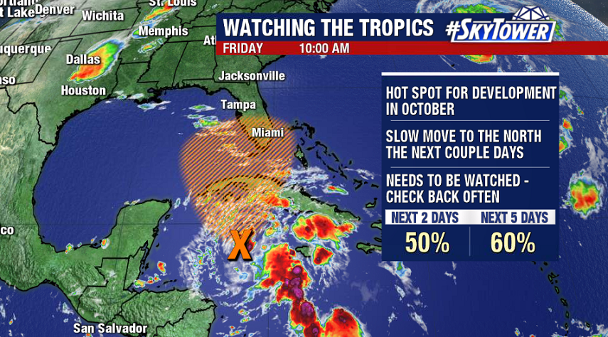
A tropical depression seems likely to form over the next couple of days as this slowly drifts in a general northward direction. There has been decent model consensus the last few days with this moving over western Cuba before turning northeast toward South Florida and the Bahamas early next week, however some recent runs are hinting at the possibility of a further west track into the eastern Gulf – which would obviously lead to more widespread impacts across Florida.
For now, just remember that it’s still hurricane season and we’re not done yet. Stay prepared as always. Let’s see how things evolve over the next day or so, and go from there. When/if a storm actually forms, the track and any potential impacts will become more clear. We’ll keep you posted.


