‘Eta’ was nearly a hurricane as of 10pm EST Sunday evening. The center of the storm is currently located about 200 miles east of the Nicaragua/Honduras border. Given the very warm water in this part of the Caribbean and the very limited wind shear present, the storm should have no problem continuing to strengthen up until the point landfall late Monday night – possibly becoming a major hurricane.
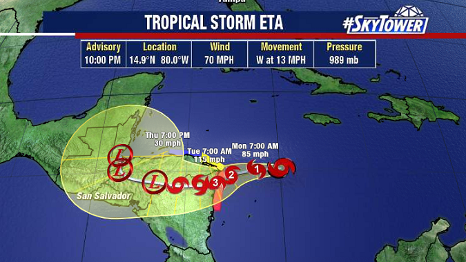
Damaging winds, and storm surge as high 10-15 feet can be expected close to the where the storm ends up making landfall. The biggest, and farthest reaching impact however, is going to be torrential rain and subsequent threat for landslides. As the storm slows over land, as much as 3 feet of rain could fall in some locations.
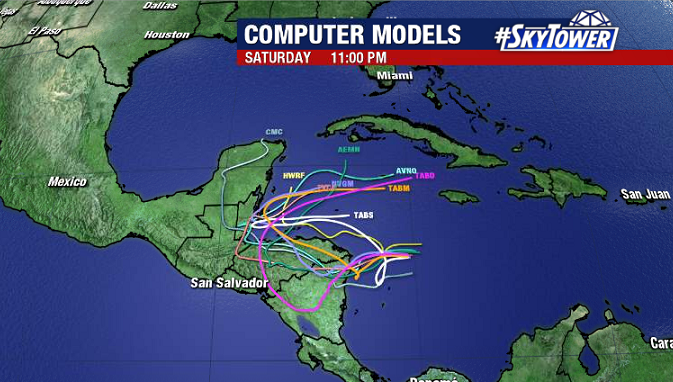
Some model guidance suggests that either the storm itself or its remnants will re-emerge over the northwestern Caribbean by next weekend. Such a scenario brings with it a lot of uncertainty, and for now is just something to keep an eye through the week.