30th Named Storm Of The 2020 Season Forms In Caribbean Sea

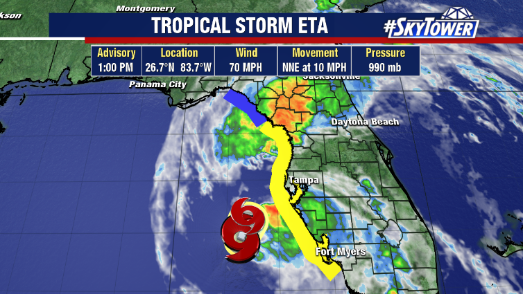
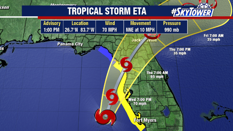
Tropical Storm Iota – the 30th named storm of the Atlantic hurricane season – has formed in the Caribbean Sea Friday afternoon. This has formed in nearly the same spot as Tropical Storm Eta. Eta went on to make landfall as a category 4 hurricane in Central America, leading to devastating flooding across Nicaragua and Honduras. Unfortunately, it may be a similar outcome with Iota, leading to additional life-threatening flooding.

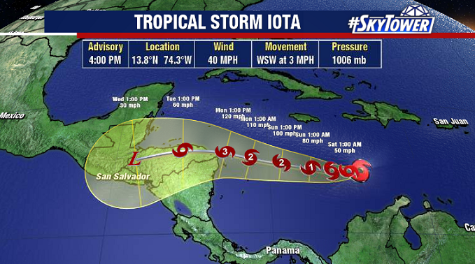
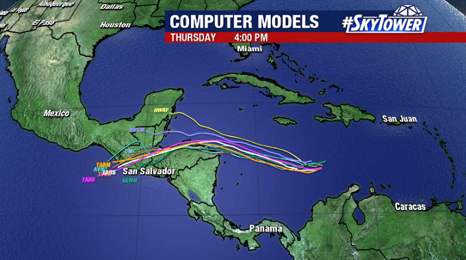
The ingredients are in place for steady strengthening of this storm as it moves toward Central America through the weekend. Deep tropical moisture, light wind shear, and very warm water should allow this to become the thirteenth hurricane of the season (only 2005 had more – 15). It’s possible that it reaches major hurricane status prior to landfall. For interests in Central America, this bears close watching.

Conditions Deteriorating Along Florida’s West Coast As Eta Approaches

Eta continues to scrape up Florida’s west coast this afternoon and conditions continue to go downhill. Numerous tornado warnings have been issued already today and more are likely as rain bands swing through.

Dry air and shear will continue to weaken the storm, but a significant decrease in intensity isn’t expected until after the storm makes landfall. Expect some nasty rain bands to continue moving through, with the worst of the weather coming through this evening into the overnight hours. The highest winds will be along the coast, with gusts of 60+ mph possible.

Coastal flooding is expected, especially close to high tide tonight. Storm surge will be on the order 3-5 feet from Tampa Bay south to Boca Grande. With slightly lower levels up through the Nature Coast. Conditions will improve across the state on Thursday.