National Hurricane Center Releases 2021 Season Outlook; Low Near Bermuda Could Become First Named Storm Soon

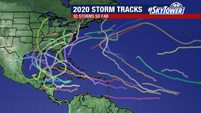
On Thursday, the National Hurricane Center released their outlook for the 2021 Atlantic hurricane season. No surprise, it’s expected to be another active year. While we’re not expecting a repeat of the historic 2020 season, there is a 60% chance of above normal tropical activity this year.

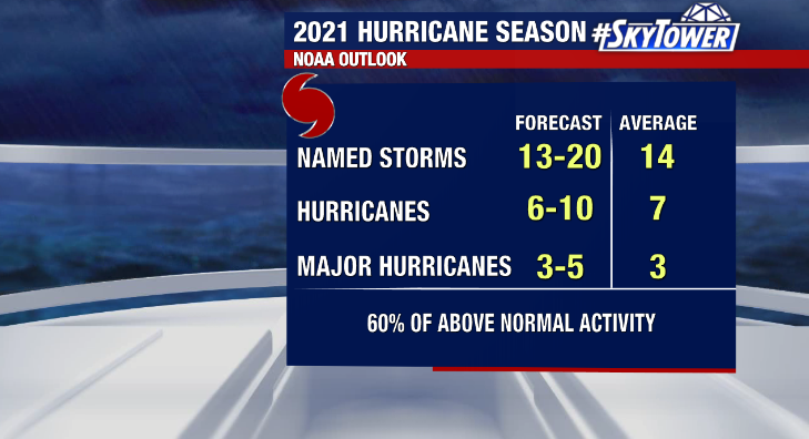
Contributing factors include warmer than normal sea-surface temperatures, weaker trade winds, and lower wind shear. A neutral phase of the El Nino Southern Oscillation is likely through the season, however it’s possible we transition transition back to a weak La Nina later in the year, which also aids in tropical development. Additionally, an enhanced African Monsoon season should lead to increased tropical development in the main development region of the Central Atlantic toward the peak of the season.

At the end of the day it’s to important to remember you should prepare for hurricane season in the exact same way every year regardless of what the seasonal outlook says. All it takes is one storm where you live to make it a bad year for you.

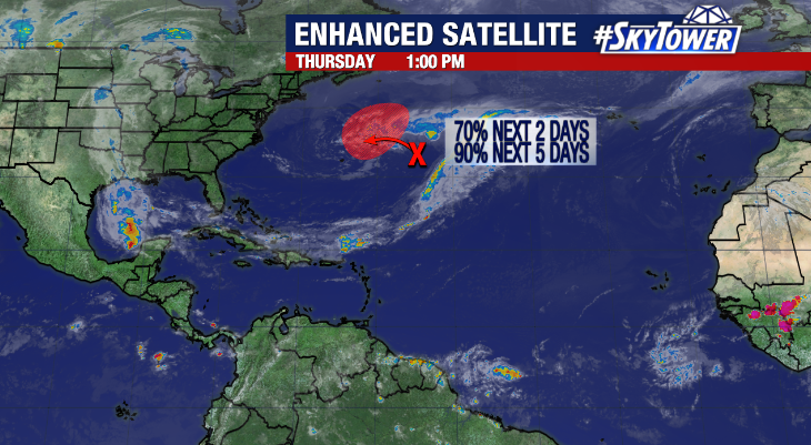
We are monitoring an area east of Bermuda at the moment for possible preseason development – a somewhat common occurrence in recent years. There is a high likelihood this develops into a subtropical system in the next day or two as it moves near Bermuda, before moving into a harsher environment late in the weekend into early next weekend. If a storm forms, it would get the name ‘Ana’. It will be no threat to the United States.

Historic 2020 Hurricane Season Officially Comes To An End

‘Extremely active’ – that was the expectation heading into the 2020 Atlantic hurricane season, and boy, oh boy, did that come to fruition. Records have fallen left and right this year, headlined by the following:

  • Most named storms in a single season – 30
  • Most U.S. named storm landfalls – 12

Remarkably, every single mile of U.S. Atlantic coastline was under a tropical watch/warning (tropical storm, hurricane, storm surge) at some point this year.

It was an especially rough season for the northern Gulf coast. A whopping eight named storms made landfall from the Texas coast to the AL/FL border! Louisiana was hit particularly hard, with five of those eight storms hitting the state – including three hurricanes. Hurricane Laura was by the far worst, making landfall in SW Louisiana as a Category 4, causing tremendous damage in southwest Louisiana. A wind gust of 133 mph was recorded in Lake Charles.

Hurricane Laura damage in Lake Charles, LA. Photo: FOX News

The back end of the hurricane was especially active. Four major hurricanes (Category 3+) formed this October/November: Delta, Epsilon, Eta and Iota. No other Atlantic hurricane season on record has had more than 2 major hurricane formations during the final two months of the season. Iota actually became the latest calendar year Category 5 hurricane on record as max sustained winds reached 160 mph on November 16.

Category 5 Hurricane Iota bearing down on Nicaragua just 2 weeks after Category 4 Hurricane Eta hit the country. Image: TropicalTidbits.com

So, the end of the season is officially here. While 97% of tropical activity occurs within the confines of hurricane season (June 1 – November 30). Storms do, and have formed at other times of the year. Rest assured though, it is incredibly rare to have a storm threaten the United States outside of the hurricane season.

Thank you for relying on all of us here at MyFoxHurricane.com throughout the year!