The National Hurricane Center is currently monitoring an area of low pressure off the coast of Florida, about 200 miles east of Daytona Beach. The area has a 60% chance of development over the next 2 days.
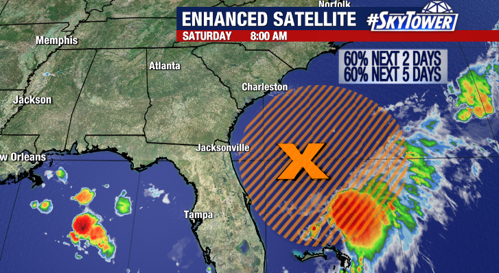
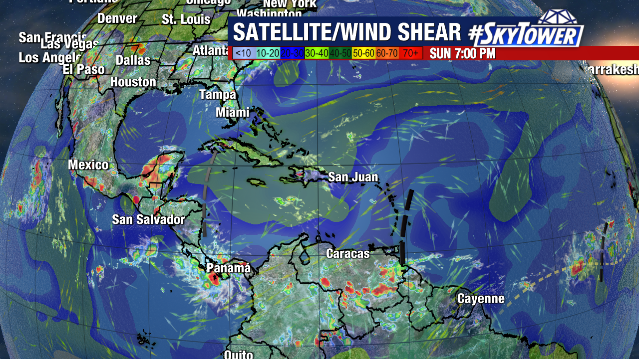
While the low is over relatively warm water, it is currently battling upper level wind shear which is keeping it rather disorganized with most of the convection south and east of the center as of Saturday morning.
Environmental conditions are expected to become more favorable for development and a tropical depression could form over the next day or so, according to the National Hurricane Center. A Hurricane Hunter aircraft could investigate the storm later today, if necessary. Should it develop into a named storm, it would be called ‘Fred’.
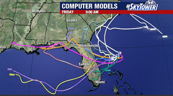
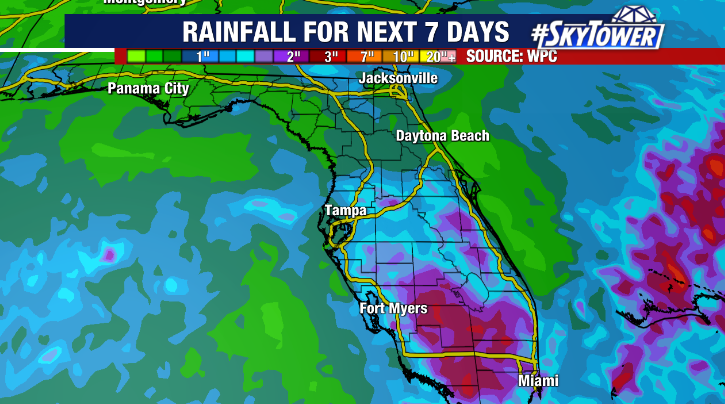
The low is expected to drift west over the state of Florida, emerging in the eastern Gulf early next week. As it does, it will turn our winds out of the south causing moisture to surge into the region. That will lead to higher rain chances for the first half of next week, especially across South Florida.