Tropical Storm Danielle Forms In The North Atlantic

We went a full 60 days with no named storms in the Atlantic – the 2nd longest streak on record since 1995! All good things must come to end and the streak is now over, as Tropical Storm Danielle formed Thursday morning in the North Atlantic.
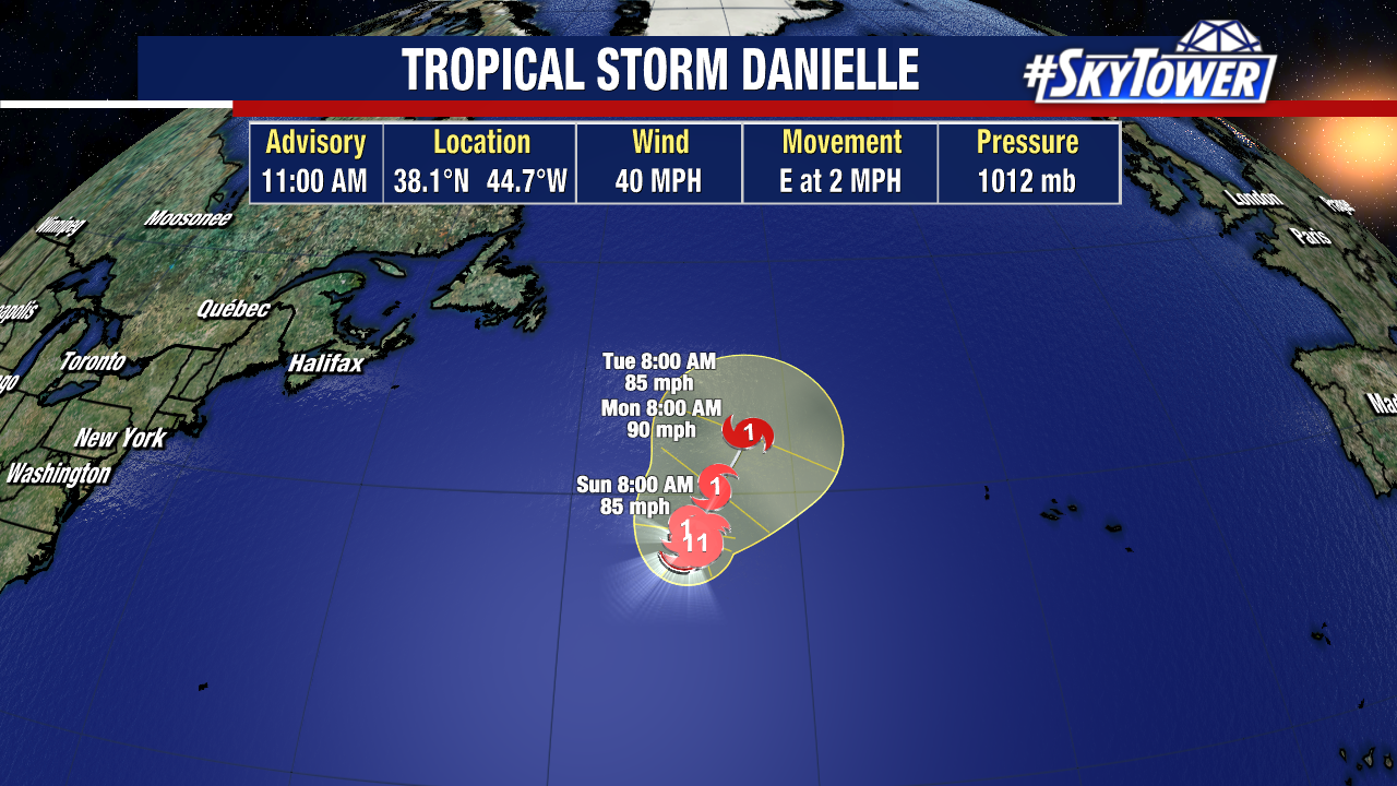
Danielle is likely to become a hurricane, but it won’t be a threat to the U.S. or really any land areas. At most, some leftover wind and rain could move into parts of western Europe late next week. This leaves us with Invest 91L in the Central Atlantic and a tropical wave behind it that just rolled off the coast of Africa that is unlikely to develop.
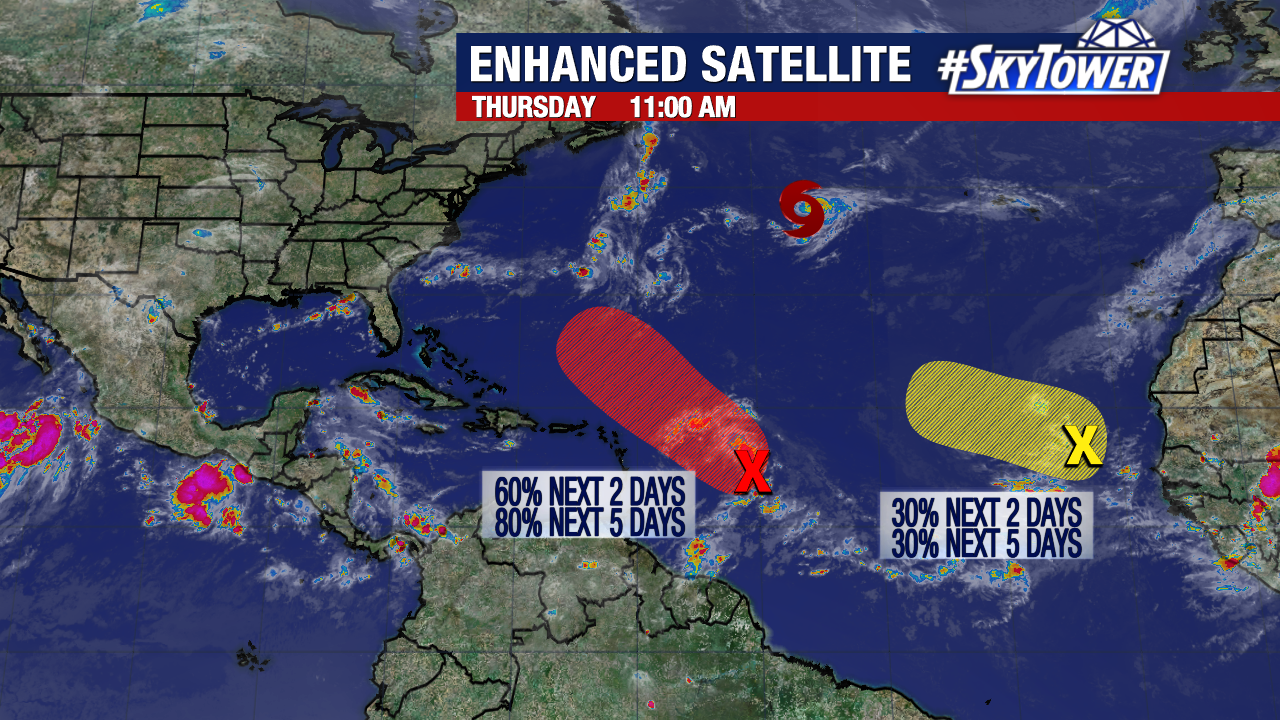
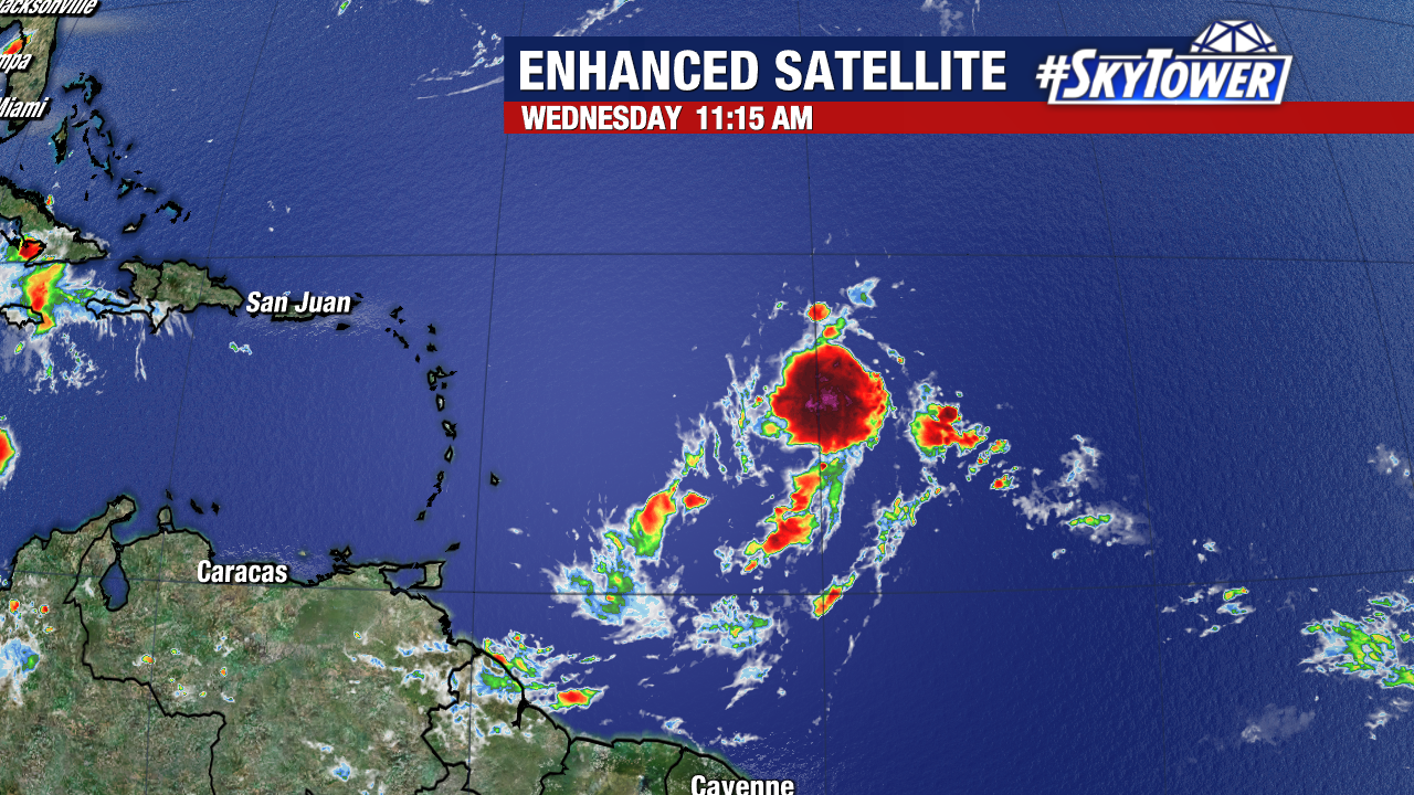
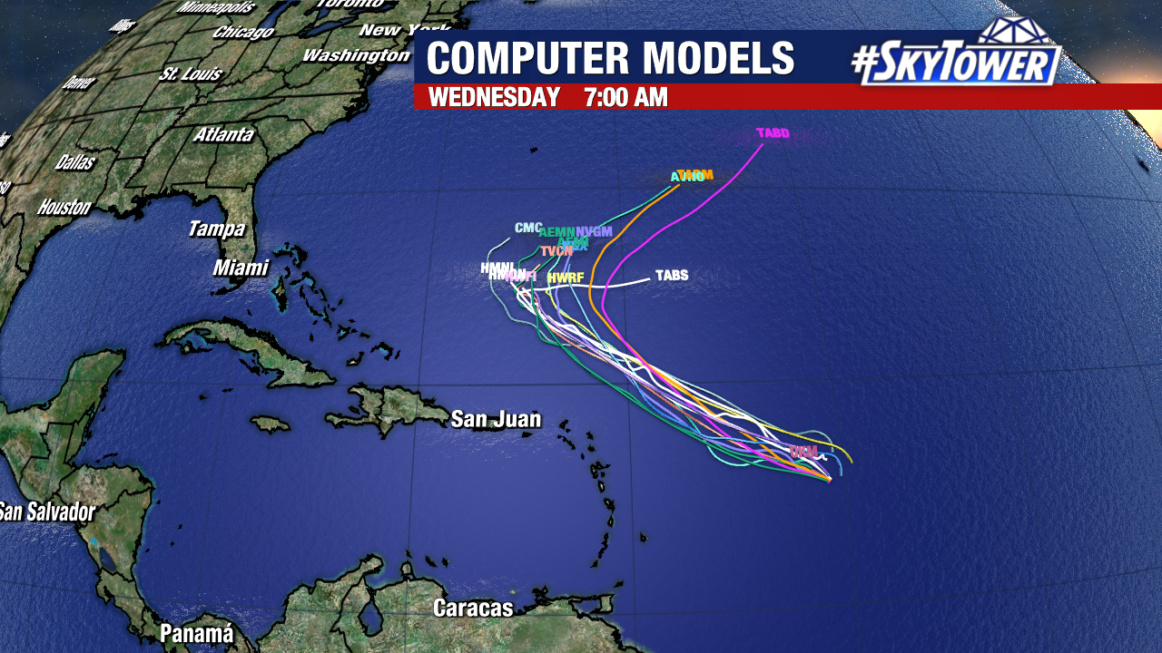
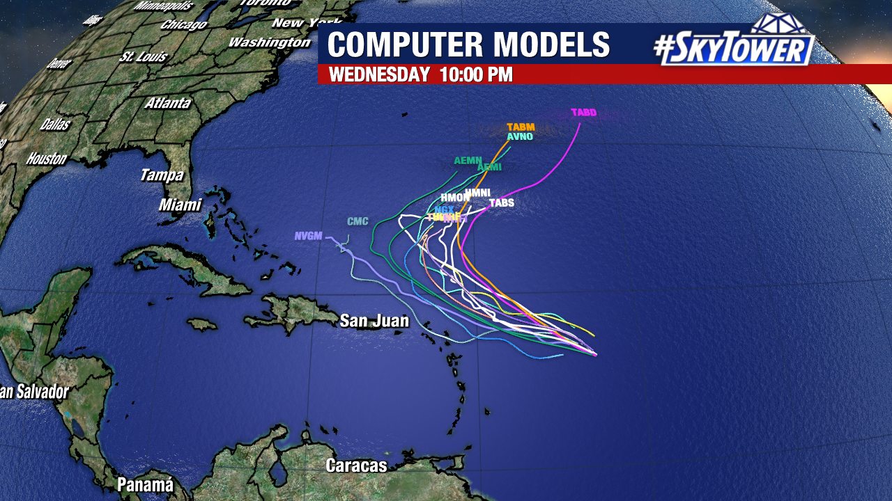
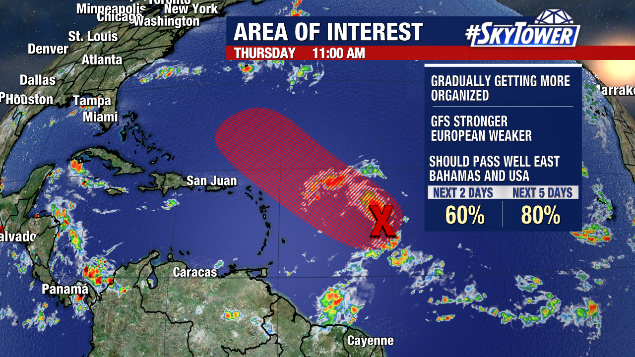
Some model guidance has backed off on the development of Invest 91L, while others have it turning into a hurricane early next week. It’s been gradually trying to get more organized, but the environment around it is only marginally conducive for development right now. The National Hurricane has development odds currently at 80% over the next 5 days. Regardless, this will stay north of the Lesser Antilles, and likely make a sharp right hand turn back out to sea next week – if it doesn’t completely dissipate beforehand.
Two Or Three Named Storms Possible In The Atlantic Over The Next Week Or So

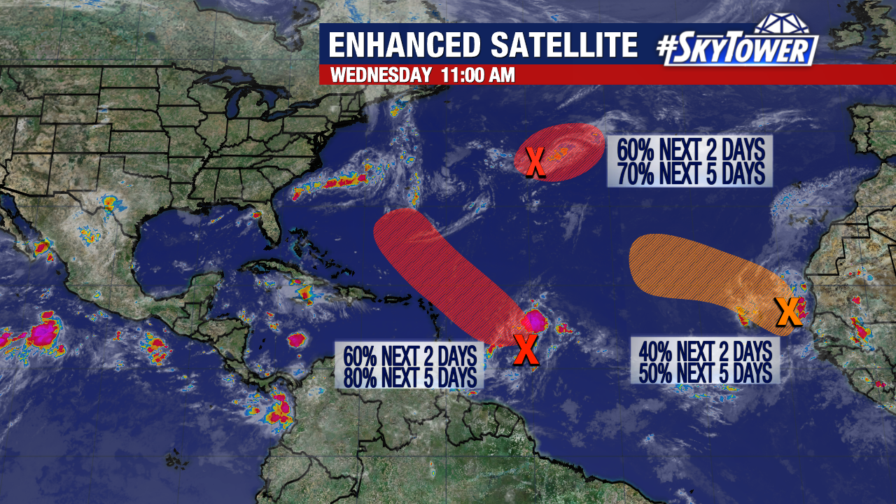
After an August which had no named storms in the Atlantic for just the third time on record, things are heating up as we head into September. There are currently 3 areas we’re watching for potential development, but the good news is that it doesn’t appear any of them will have an impact on the U.S… if any land areas at all.

Danielle, Earl, and Fiona are the next names on the list, and we may cross two or three of them off over the next week. We’ll start with the central Atlantic tropical wave that has had a lot of buzz around it in recent days. Environmental conditions aren’t exactly ideal for development right now, but it still has enough going for it that gradual organization should take place.

A tropical depression could form within the next couple days as this moves northwest. There is good model consensus this will stay north of the islands and begin its turn back out out to sea early next week.

The two other waves on the map right now have good chances of developing, but all indications right now are that they will simply be fish storms regardless of development.