Two Tropical Systems To Watch In The Atlantic

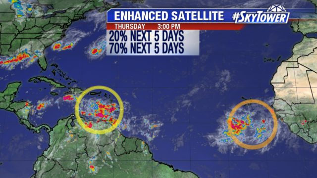
By next week, it’s possible that we’ll be tracking two named storms in Atlantic. On Friday afternoon, Invest 90L was located in southern Caribbean Sea, while Invest 99L was out in the open Atlantic, several hundred miles southwest of the Cabo Verde Islands.

atlantic-wide-2d-ir-enhanced

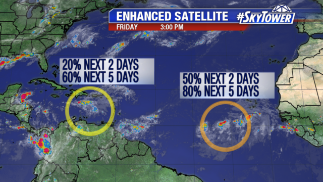
Invest 90L is battling quite a bit of wind shear in the short term and is currently nothing more than a disorganized area of showers & storms. However, environmental conditions should become more favorable for development as it emerges near the Yucatan Peninsula early next week. There is growing model support that we may have a tropical storm or hurricane in the Bay of Campeche by the middle of next week, which could then make a run at eastern Mexico or southern Texas.

Invest 99L certainly bears watching as well. It is in a pretty good environment for further development, but is taking its sweet time getting organized. If it can get its act together, it should take advantage of an increasingly favorable environment over the next few days as it moves west-northwest toward the northeastern Caribbean. Beyond that, it is still too early to speculate whether or not it will have any U.S. impacts.

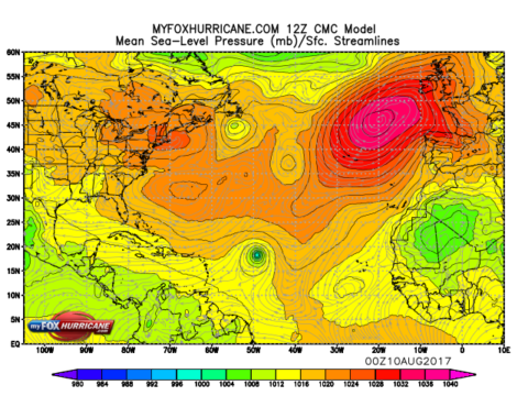
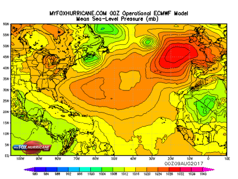
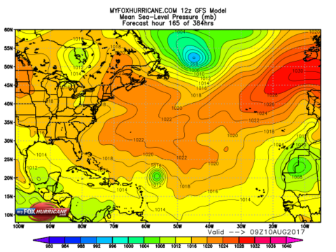
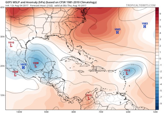
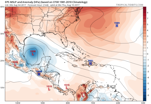
Below is the 12Z GFS Ensemble MSLP and the 0Z Euro Ensemble MSLP valid for next Wednesday evening. Images courtesy of Tropical Tidbits.

gfs-ens_mslpa_watl_23 ecmwf-ens_mslpa_watl_7

Time is certainly on our side, as we’ll have several days to keep an eye on both of these systems.

Two New Disturbances To Watch In The Atlantic

And just like that, we have two new areas to watch in the Atlantic basin. The first is a tropical wave in the southern Caribbean Sea just west of the Lesser Antilles (Invest 90L). Conditions over the Caribbean Sea should become a little more favorable over the weekend and into next week as this system moves west-northwest 15-20 mph. Overall, the National Hurricane Center (NHC) is currently only giving this a 20% chance of development over the next 5 days.

The second area we’re keeping an eye on is a rather robust wave (Invest 99L) that came off the coast of Africa over the last 24 hours . It’s combating some moderate wind shear and marginally warm sea-surface temperatures at the moment, but conditions will become more favorable for development as this moves off to the west-northwest over the next several days. The NHC is now giving it a 70% chance of development.

atlantic-wide-2d-ir-enhanced

As is usually the case when we’re talking about anything a couple thousand miles away, it’s way early to speculate about any impacts. Any model solutions a week or more away really can’t be trusted, especially with tropical systems. To give you an idea, latest runs of the GFS and CMC really ramp up this storm fast over the Central Atlantic, while the ECMWF has absolutely nothing. So for now. we watch and wait.

cmc_atl_mslp_53

ecmwf_atl_mslp_7 gfs_atl_slp_56