Franklin Exits the Yucatan-Headed for East Mexico; Still Watching Invest 99L

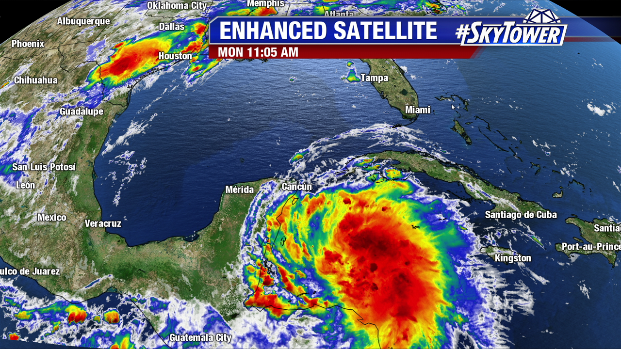
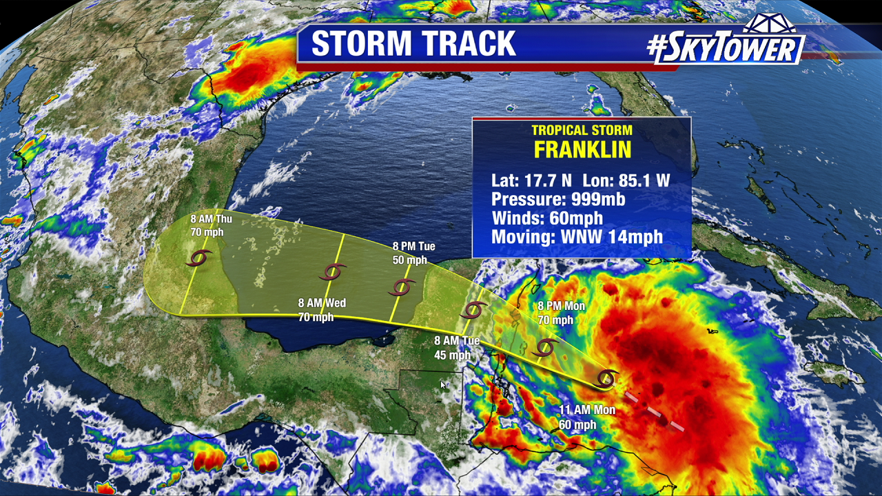
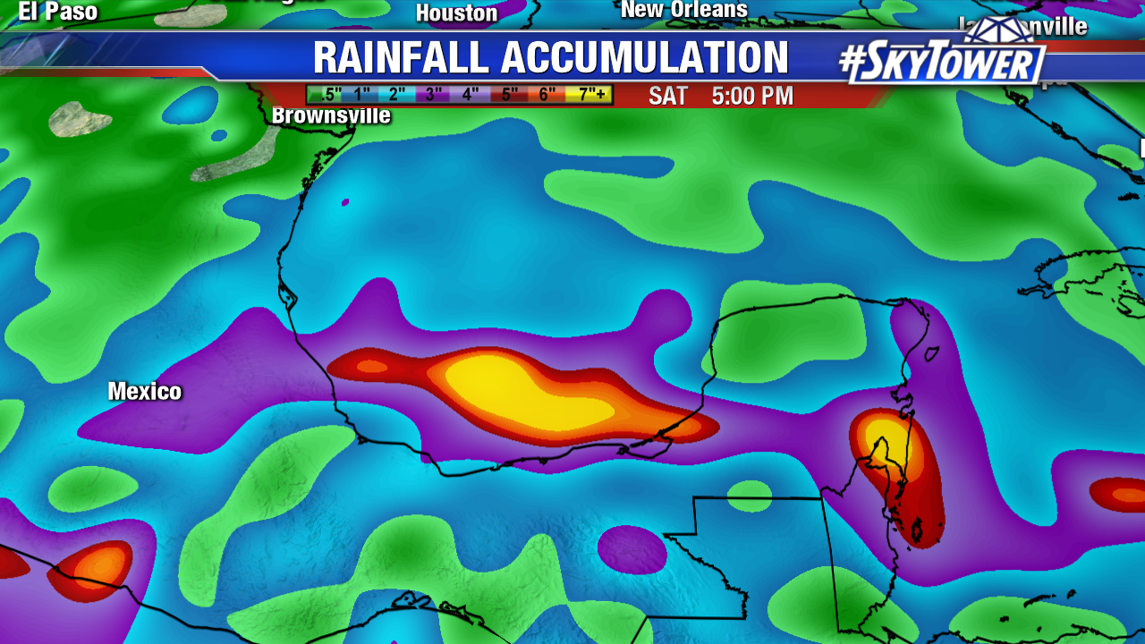
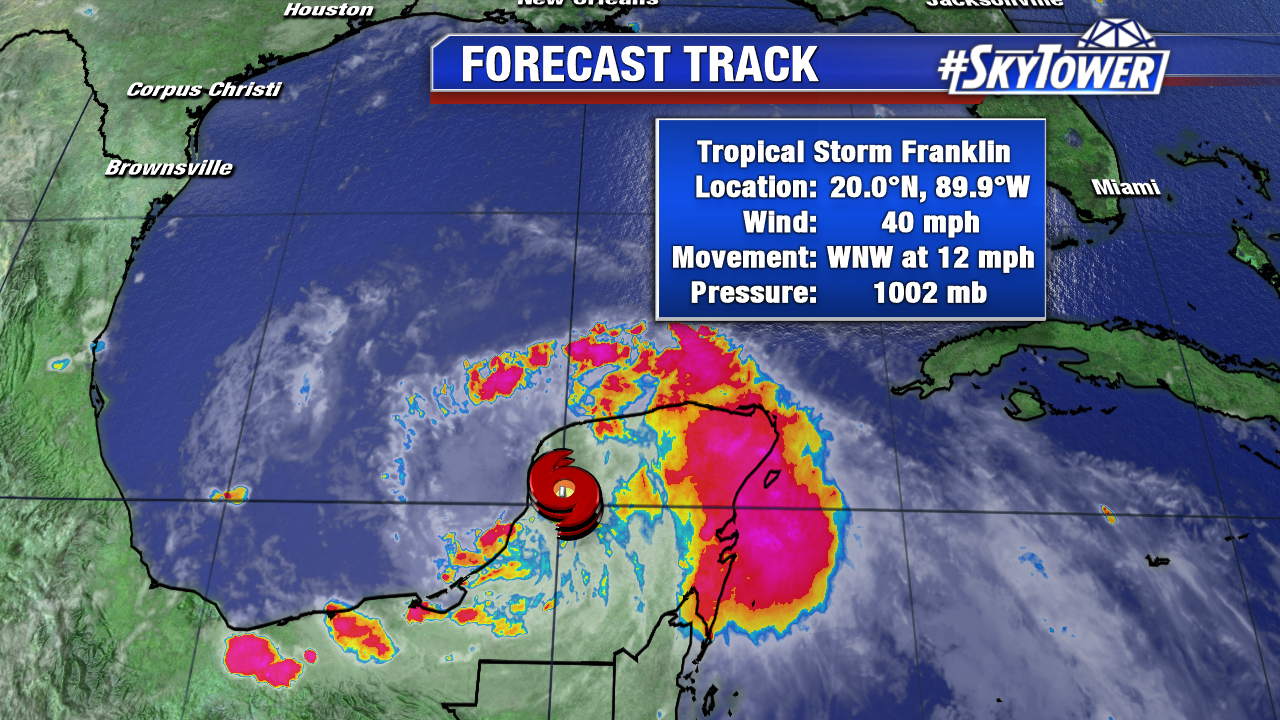
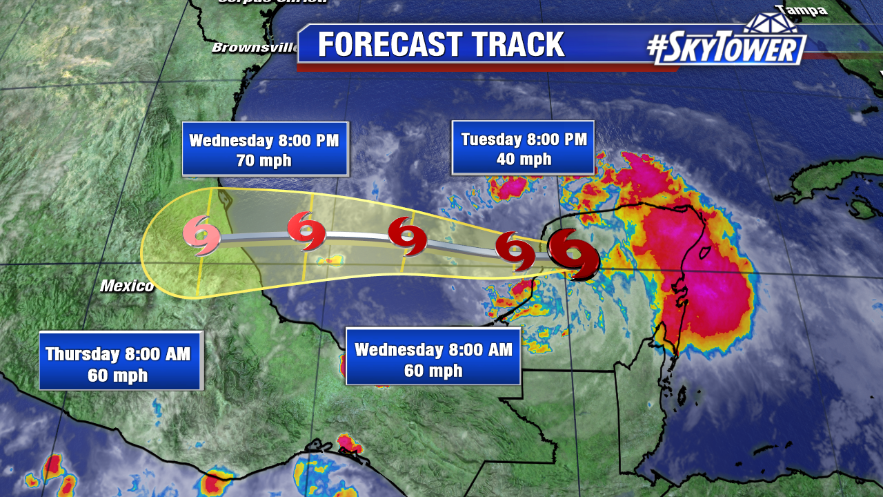
Tropical Storm Franklin made landfall late Monday night on the east coast of the Yucatan Peninsula with 60 mph. As of 2 PM Tuesday max sustained winds are down to 40 mph. While it has weakened over land since then, deep moisture still fuels torrential rains. 4-8 inches of rainfall, with isolated amounts near a foot are possible through Wednesday. Franklin will recharge over the southern Gulf of Mexico Tuesday night and early Wednesday. It will get close to hurricane strength before wind shear ramps up. A second landfall is likely by early Thursday in mountainous east Mexico. Mudslides and flash flooding are possible in this region. Up to 15 inches of rain is possible through late work week. Below is the 11 AM official track from the National Hurricane Center.

fiona-png2

fiona

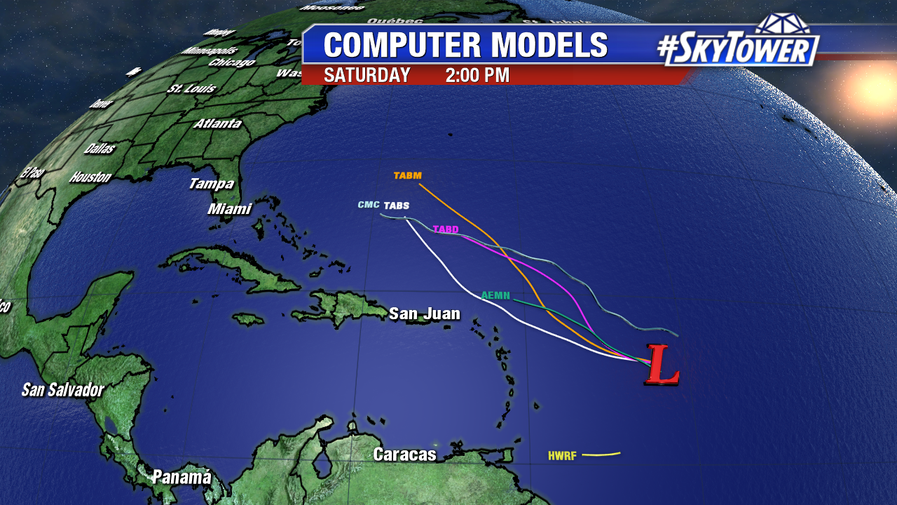
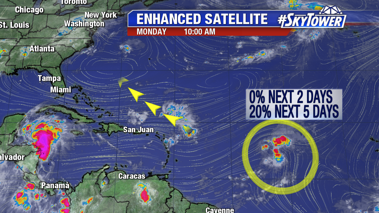
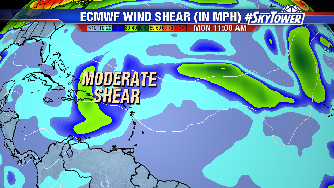
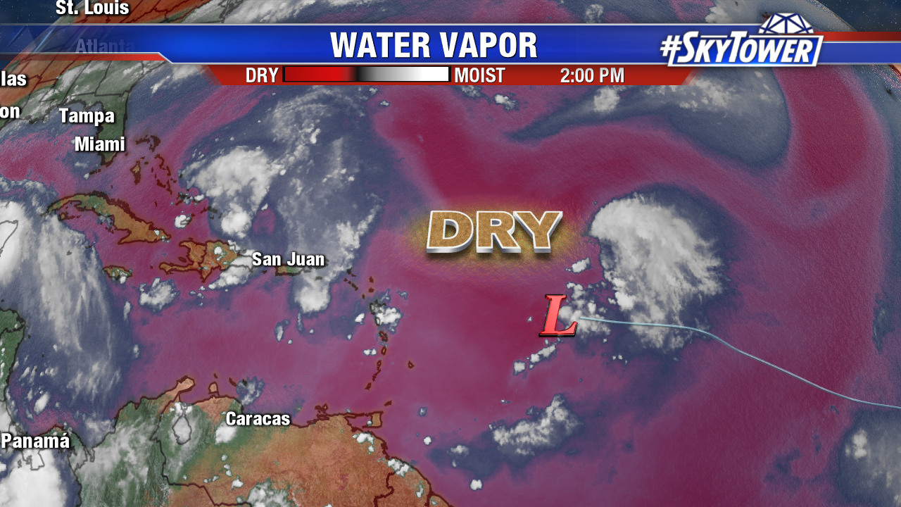
As mentioned the past few days, Invest 99L struggles east of the Lesser Antilles with dry air and increased upper level winds. Tropical cyclone development is highly unlikely over the next few days as the weak area of low pressure moves west-northwest at about 15 mph.

water-vapor-floater-png2

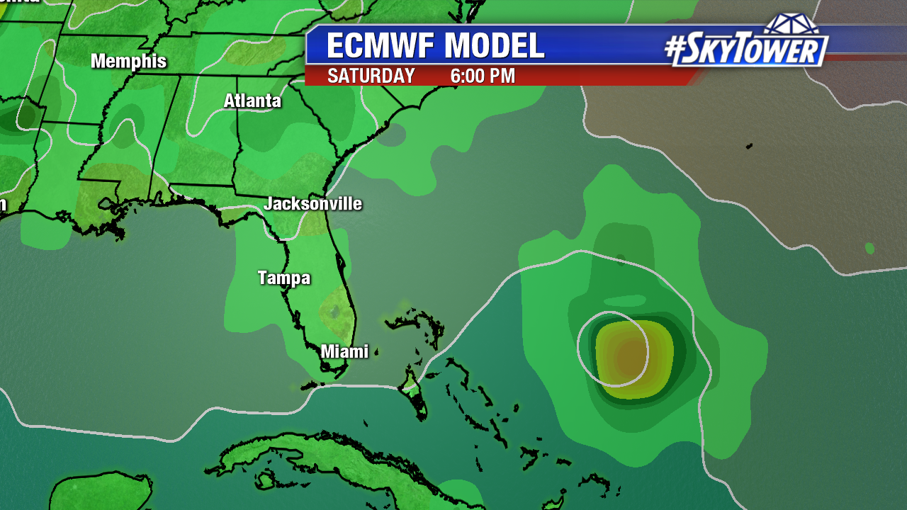
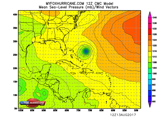
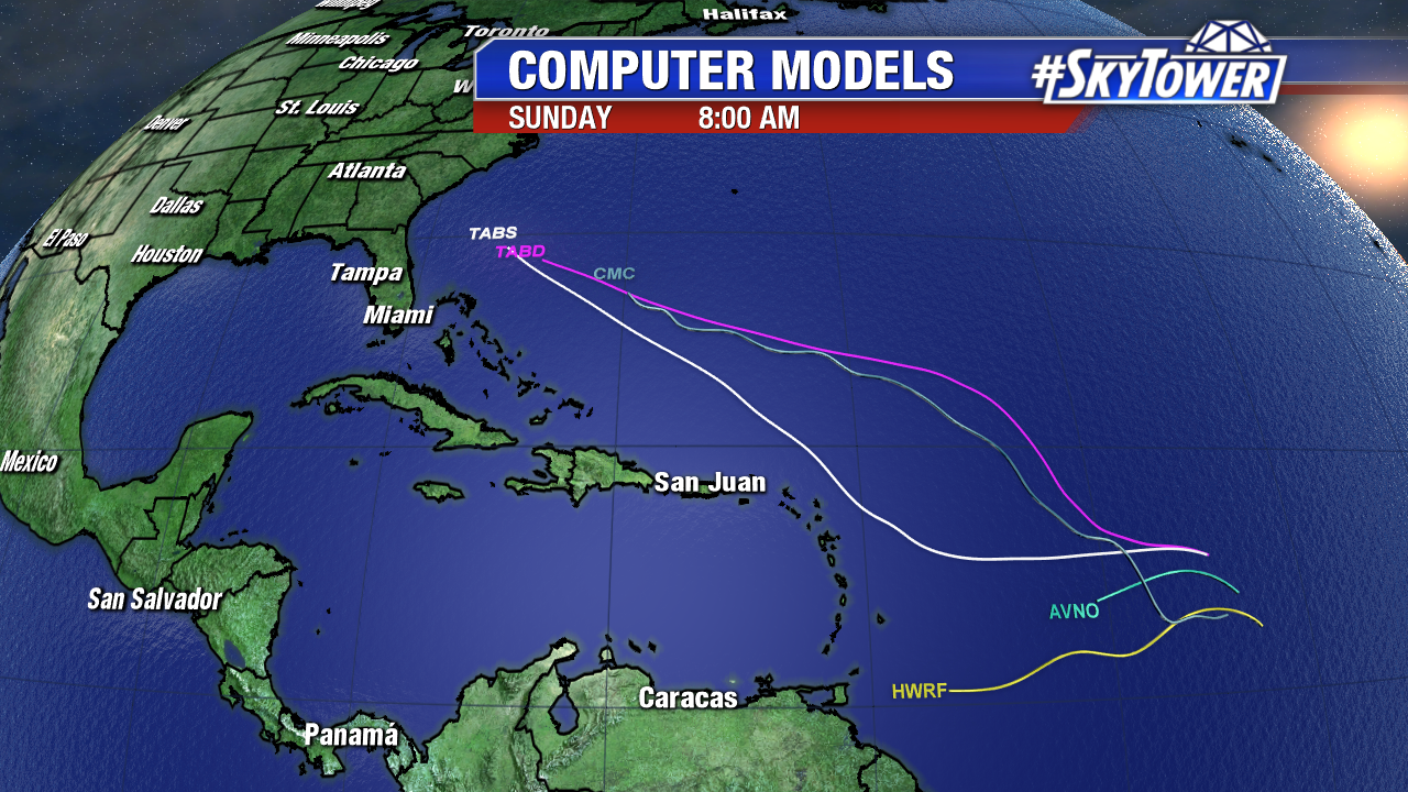
By Friday or the weekend the disturbance moves over the warm waters east of the Bahamas. The past 3 runs of the ECMWF suggest Gert will develop and strengthen during this time, possibly as a hurricane, by late in the weekend east of the Southeast U.S.. A developing trough could keep possible future Gert just off the East coast, but it’s too early to say for sure. The CMC is also on board. Meanwhile the GFS. It’s a wait and see situation late in the week.

invest-90l-models

ecmwf-msl-and-precip-rate

cmc_carib_mslp_41

Strengthening Franklin Headed for the Yucatan Then the Bay of Campeche

The 6th named storm of the 2017 Atlantic Hurricane Season, Franklin, gradually strengthens Monday. As of 11 AM max sustained winds are at 60 mph and it heads west-northwest at 14 mph. The storm develops better outflow and thrives off of warm Western Caribbean waters in the mid to upper 80s. Upper level winds favor further intensification before landfall late Monday night and early Tuesday in the Yucatan peninsula.  While the 11 AM National Hurricane Center forecast keeps Franklin below hurricane strength, it could become the first hurricane of the season. Hurricane Reconnaissance Aircraft will investigate Monday afternoon and get a better grasp on the strength of the storm. The graphic below shows the incredible GOES 16 enhanced satellite. This data is preliminary/non-operational.

franklin

Franklin will emerge in the Bay of Campeche Tuesday night and likely strengthen (possibly rapidly) to near hurricane strength before landfall in mountainous East Mexico early Thursday. It is no threat to the U.S..

franlin-2

Franklin brings tropical storm conditions and the threat for flash flooding to Belize and the Yucatan through early work week. 3 to 6 inches, with isolated amounts of 12 inches, are possible through Wednesday. That heavy rain threat shifts to East Mexico mid to late work week.

gfs-precip-acc

It doesn’t look promising for Invest 99L the next 5 days as it moves west-northwest at 15 mph. Upper level winds are on the rise and stay unfavorable for tropical cyclone development over the next few days.  Dry African air will also hinder development.

floater-ir-enhanced

gfs-wind-shear-with-text

By late in the week conditions are a bit more ripe for tropical depression development near the warm waters near the Bahamas. We will keep an eye on it.

invest-93l-models