Invest 99L Organizes Southeast of the Bahamas; Will Stay Out to Sea

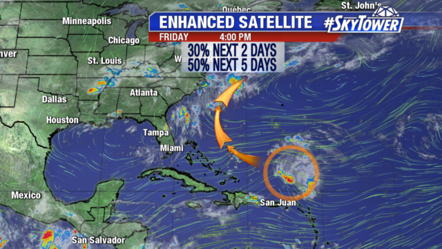
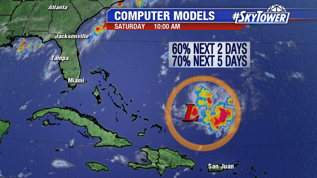
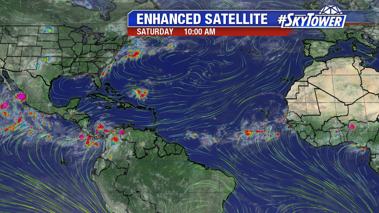
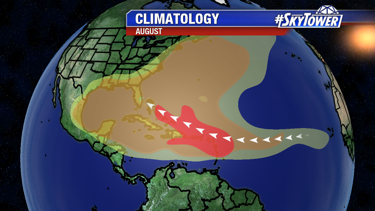
Invest 99L shows signs of life early Saturday. Wind shear in the vicinity has dropped and the area of low pressure organizes some east of Turks and Caicos and the Bahamas. Convection increases over warm Atlantic waters, but there is still some dry air in its path. Invest 99L has a high chance of becoming a tropical depression over the next couple of days. If it reaches tropical storm strength it will become Gert.

invest-90l-models-png1

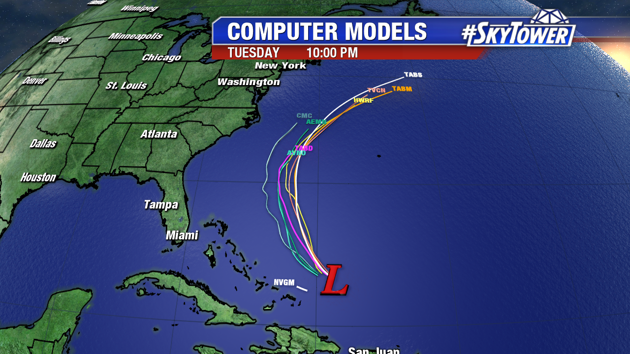
A northwest/northerly track is expected through early Monday. A trough will safely guide it east of the U.S. early this work week. Swells and an increase in rip currents are possible at some East coast beaches early in the week.

invest-90l-models-png23

Elsewhere the Atlantic is quiet overall. A new tropical wave coming off of Africa is worth watching. There is some model support for development. This is the time of year that low pressure can spin up quickly. All eyes are on the ITCZ in the coming weeks. This is where the strongest storms of the season often originate in August and September.

atlantic-wide-2d-ir-enhanced

climatology-august

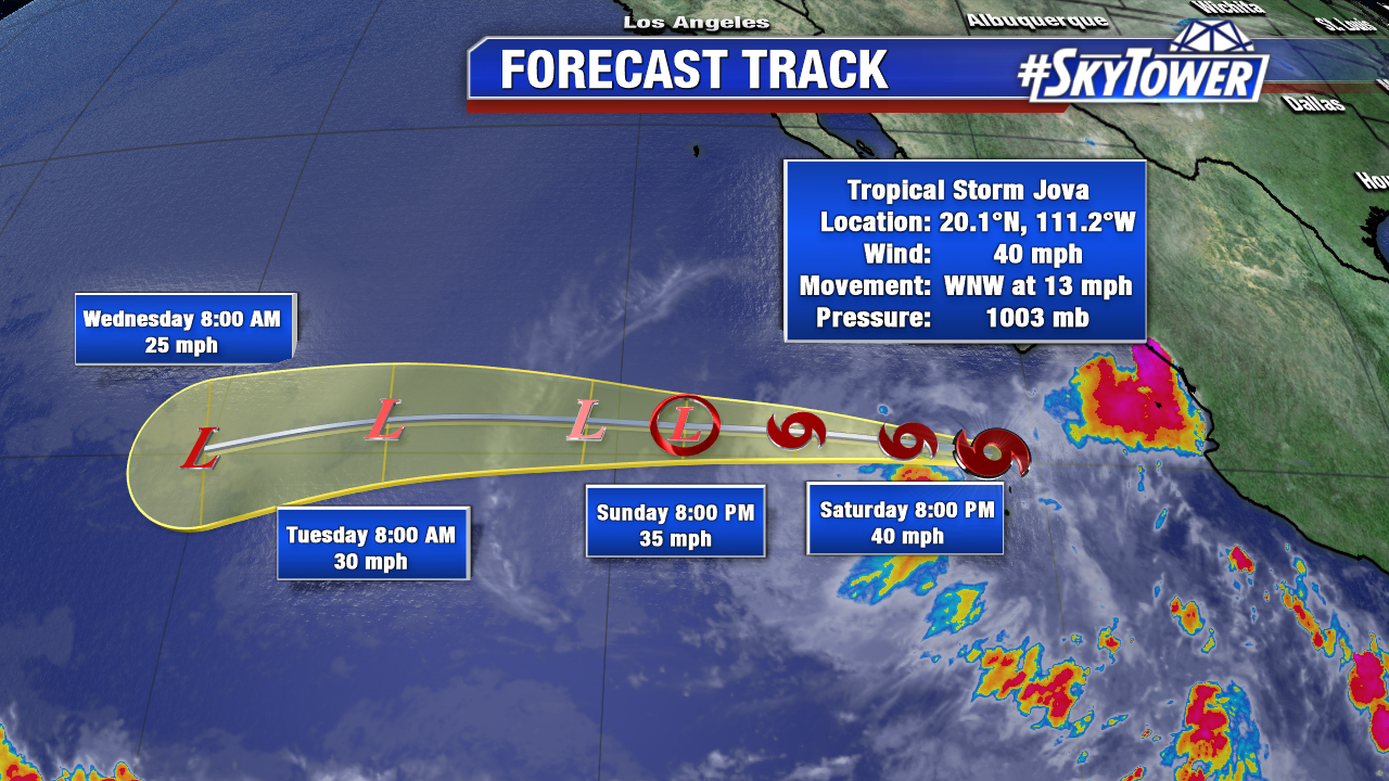
Some of the remnants of Franklin crossed over into the East Pacific Basin Friday and became Tropical Storm Jova. It will stay a minimal tropical storm and dissipate due to a combination of drier air and cooler waters in a few days.

fiona-png3434


Invest 99L Drifting Closer To United States; Should Stay Offshore

We’ve had Invest 99L on the map for a while now as it has made its way across the Atlantic over the last week and a half or so. It’s a disturbance that refuses to give up, but has never been able to gain any ground due to an on & off battle with wind shear and dry air.

atlantic-wide-2d-ir-enhanced

On Friday afternoon, it was a couple hundred miles north of Puerto Rico. There have been flare-ups of convection at times, but still no indication of a closed circulation. Upper level winds are becoming a little more favorable for development as we head into the weekend, but it will still have to contend with some pockets of dry air. The National Hurricane Center currently has development odds at 50% over the next 5 days. However, our latest model runs still aren’t too excited about any development with system… keeping it an open wave through the rest of its journey.

Whether or not a tropical depression, or even Gert, forms; steering flow should keep this well offshore as it moves north and northeast up the eastern seaboard.