The Atlantic basin is lit up with storms and areas of interest, but it’s really just two that bear watching…
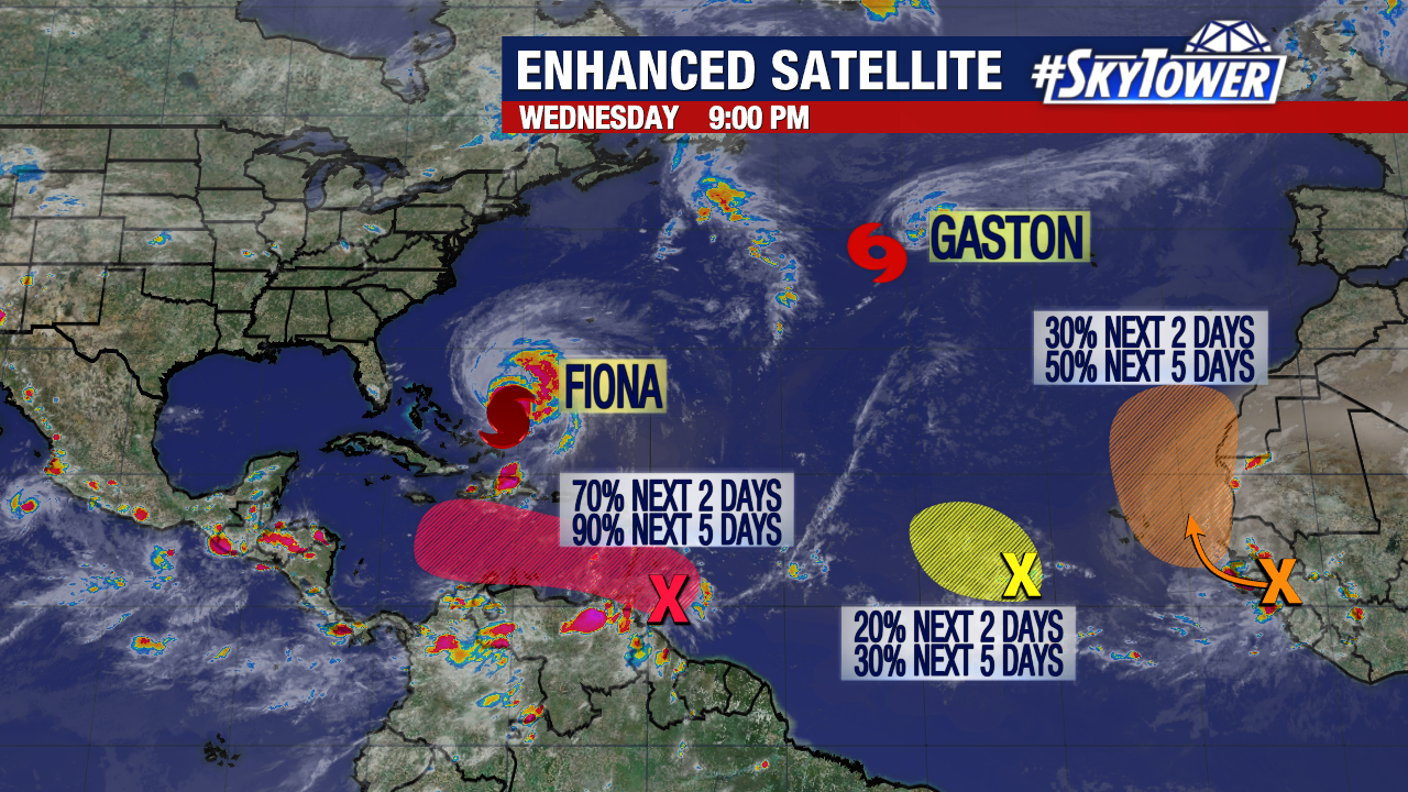
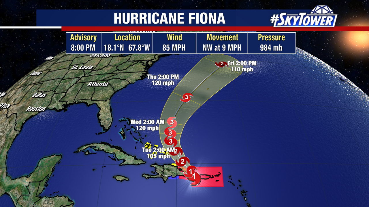
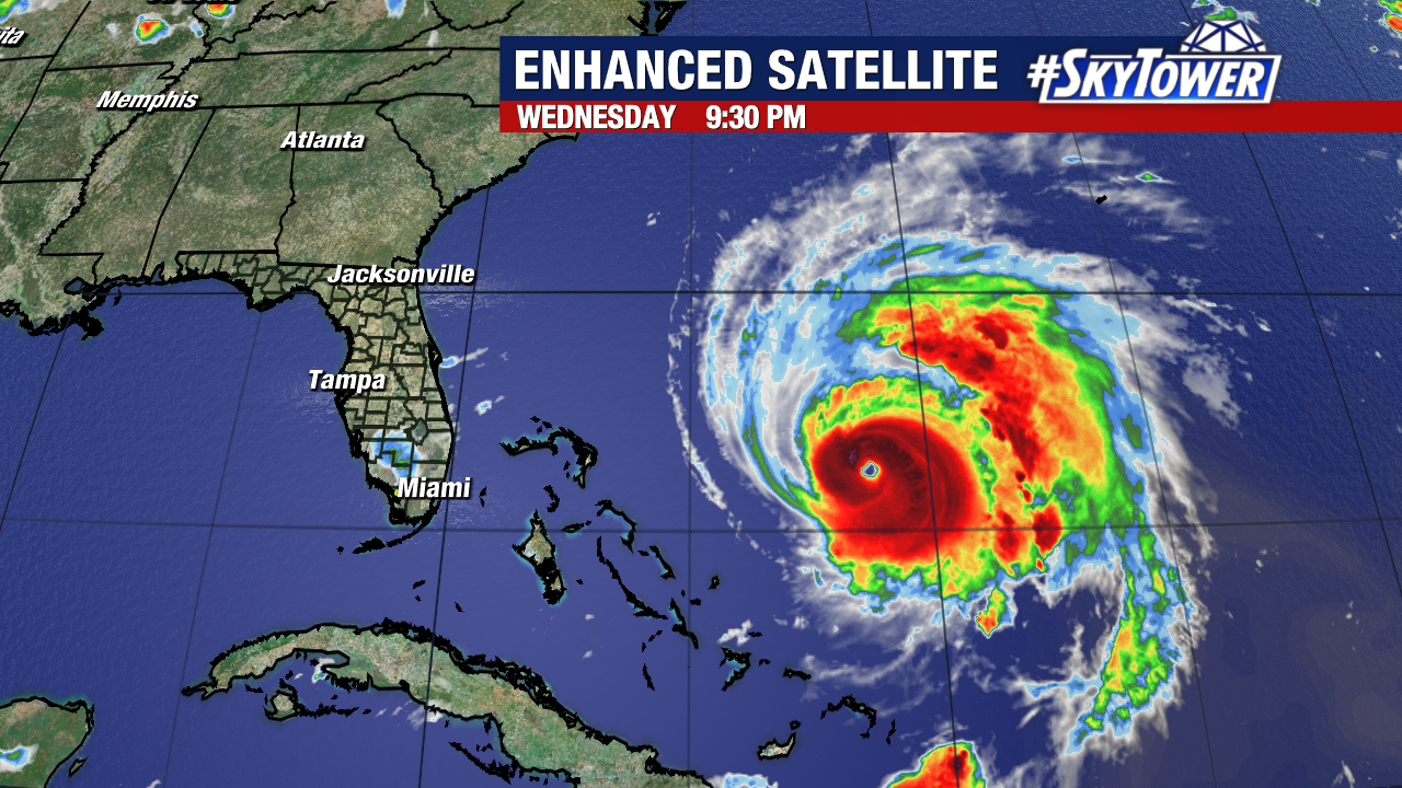
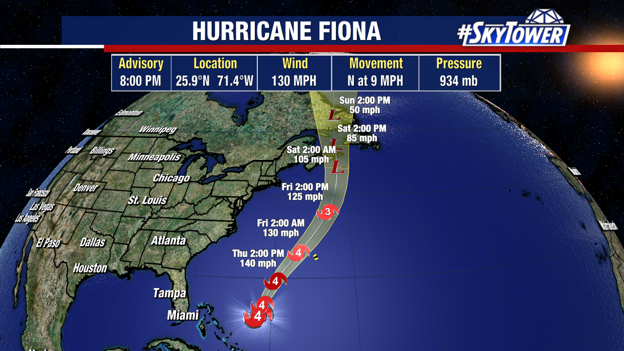
First up, Hurricane Fiona continues to intensify east of the Bahamas. As of 8pm Wednesday, it was a category 4 storm with max sustained winds of 130 mph.
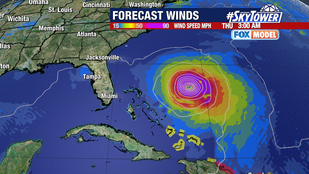
Little change in intensity is expected as it passes just to the west of Bermuda on Friday. It will lose tropical characteristics this weekend, but that doesn’t change the fact that it will bring hurricane-like conditions with wind gusts over 100 mph to parts of Nova Scotia and Newfoundland.
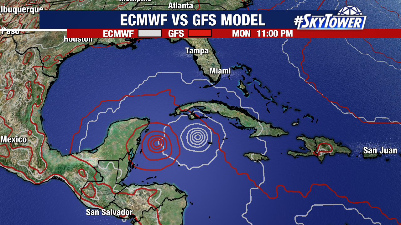
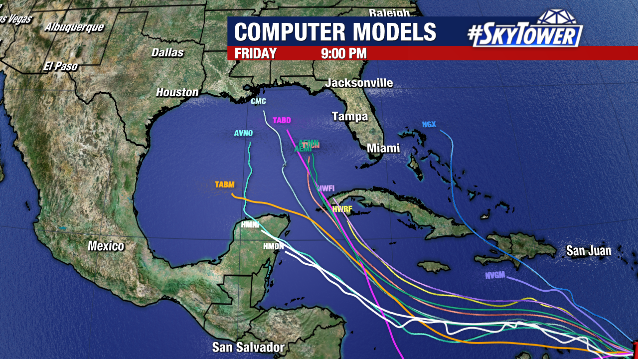
The area that will be an even larger talking point over the next several days is what is currently headed into the Caribbean Sea. It isn’t much to look at now, but this area of disturbed weather is likely to develop within the next couple of days. Further organization/strengthening is likely over the weekend as it moves toward the western Caribbean. There is fairly good model agreement that there will be a strong tropical storm or weak hurricane nearing the southern Gulf by early next week. Beyond that, questions remain as to where it will ultimately track. As things evolve, we’ll start to get some answers.
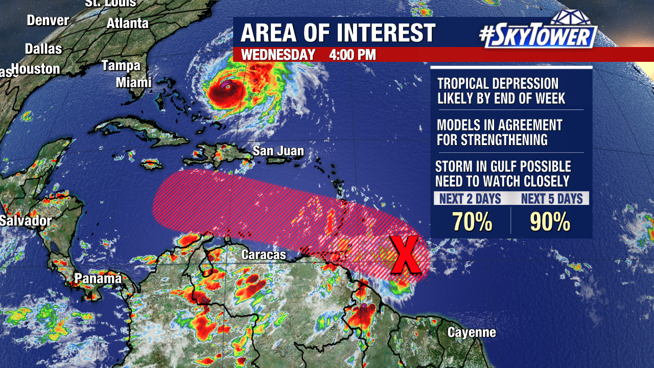
For now, there is a large realm of possibilities. Areas of the northern Gulf Coast to the Florida Keys need to be monitoring the progress of this system. We’ll keep you posted, with updates at least once a day here on MyFoxHurricane.com
