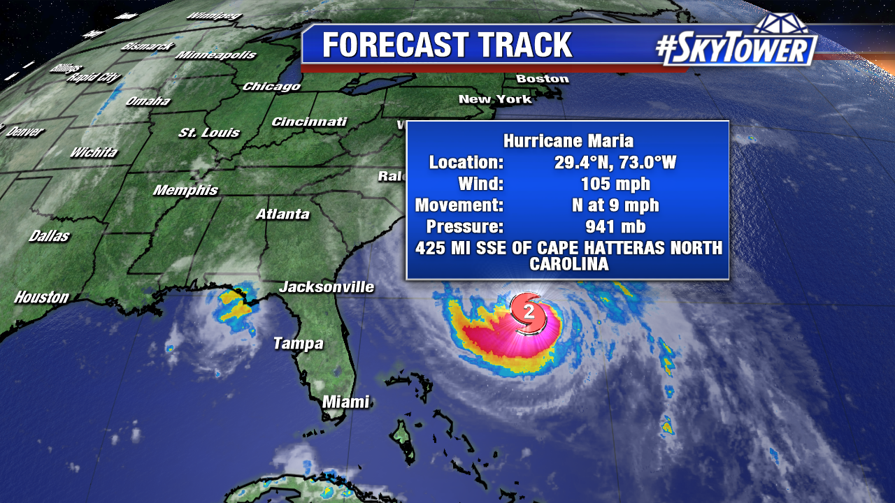
On Sunday evening, Hurricane Maria is still a category 2 storm with max winds over 100 mph. It will continue to slowly weaken over the next couple days as moves north into an increasingly unfavorable environment with higher wind shear.
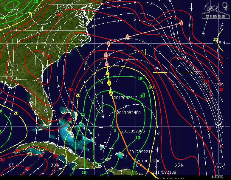
Image below (wind shear) courtesy University of Wisconsin/NOAA.
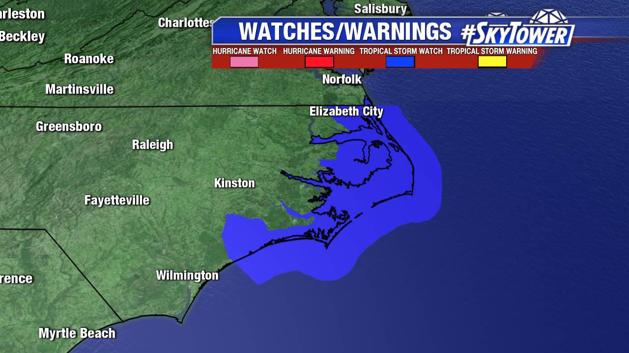
At this point, confidence is fairly high that Maria will ultimately get picked up and ushered out to sea mid-late week by a trough digging into the mid-Atlantic and northeast. That being said, the storm may pass within 100-200 miles of the Outer Banks of North Carolina before that happens and effects of the storm can be felt well away from the center. At the very least, high surf and gusty winds can be expected in the Outer Banks and a tropical storm watch has been issued for areas from Surf City northward to the North Carolina/Virginia border, including the Albemarle and Pamlico Sounds. A storm surge of 2-4 feet is possible from Cape Lookout to Duck including the sound side of the Outer Banks.
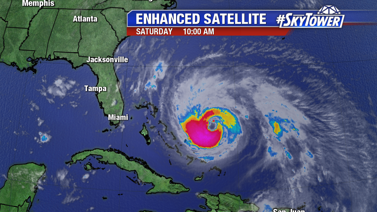
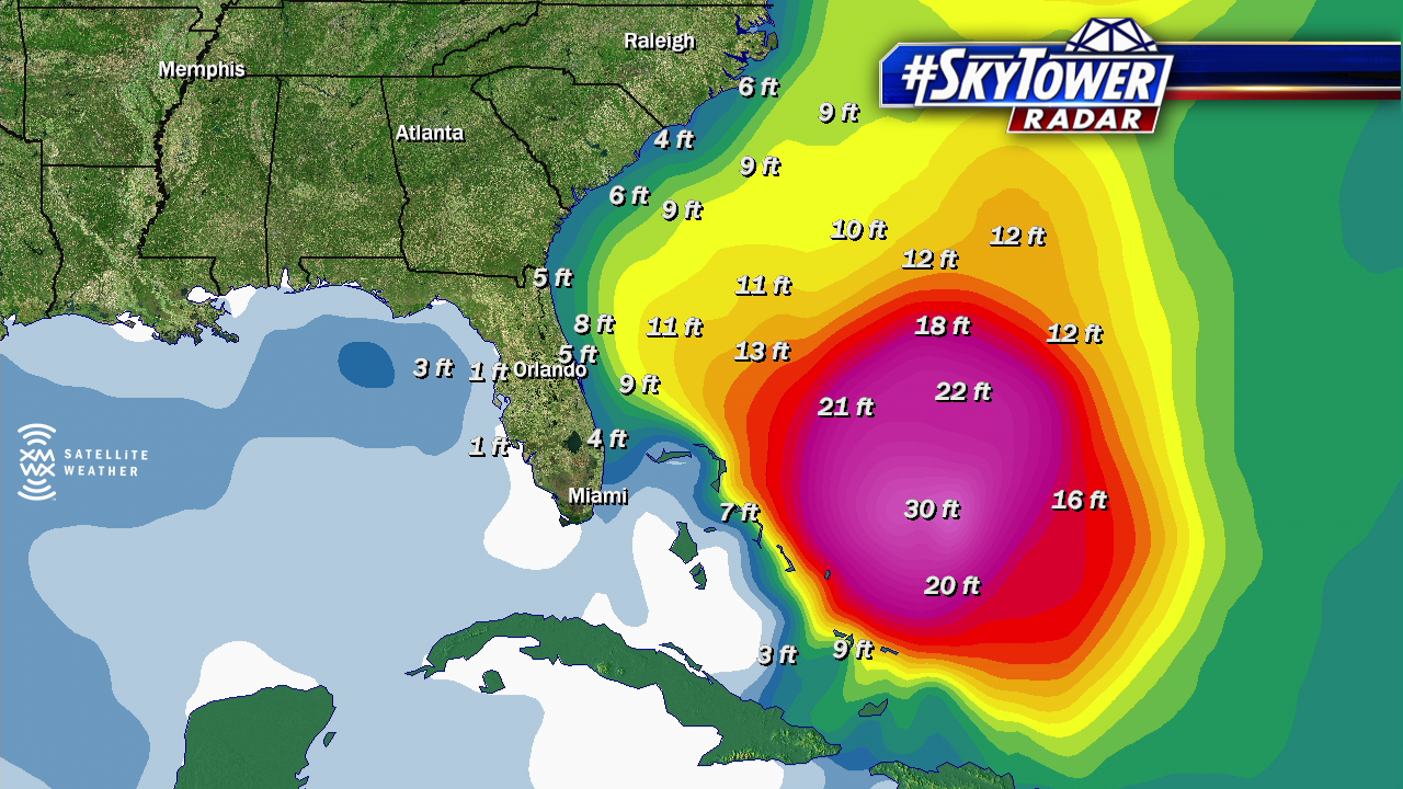
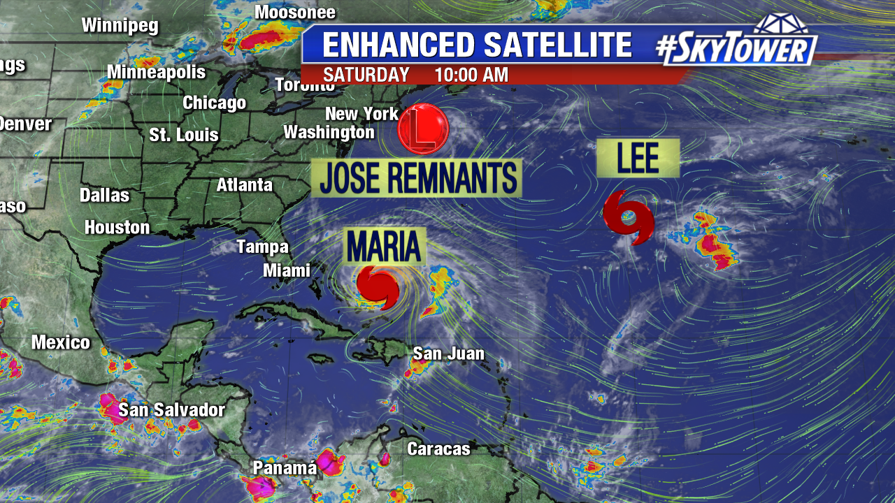
Hurricane Maria weakens some, but maintains major hurricane strength well east of Florida Saturday. The destructive storm with a large eye exits Turks and Caicos and will spend the next few days over warm Atlantic waters. Wind shear is on the rise, so Maria will weaken some in the coming days. Waves build up to 30 feet near Maria, but swells and rough surf already reach the east coast of Florida up through the Carolinas. The risk for rip currents remains high through at least mid work week.
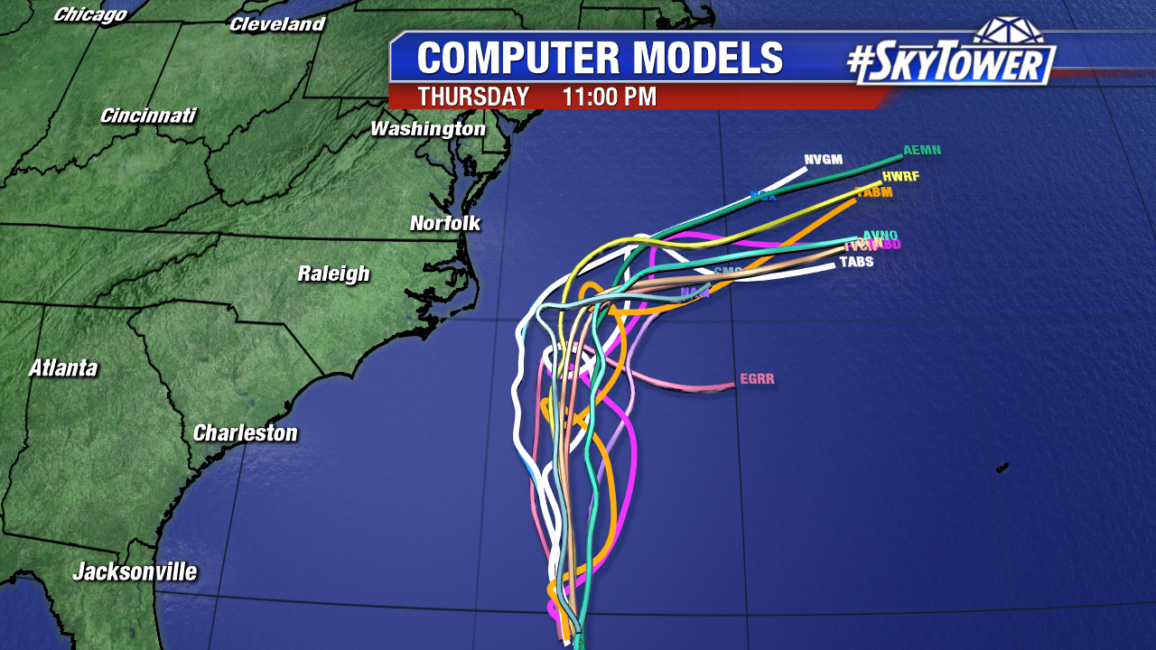
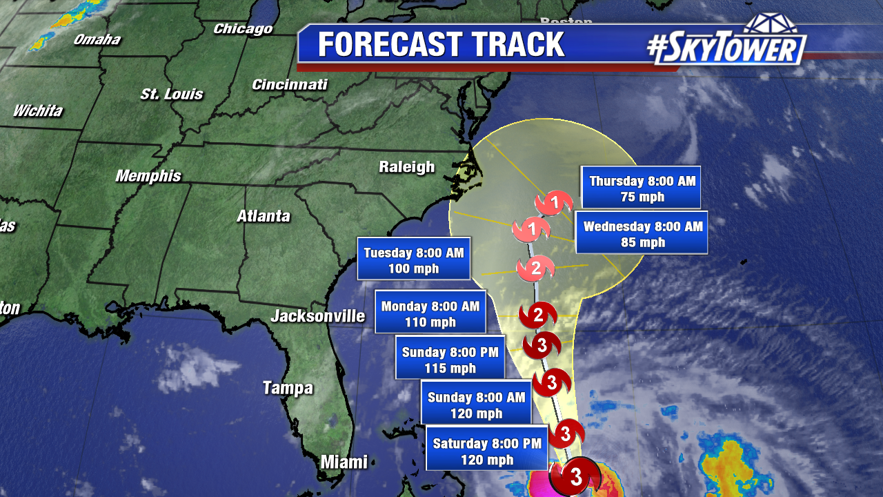
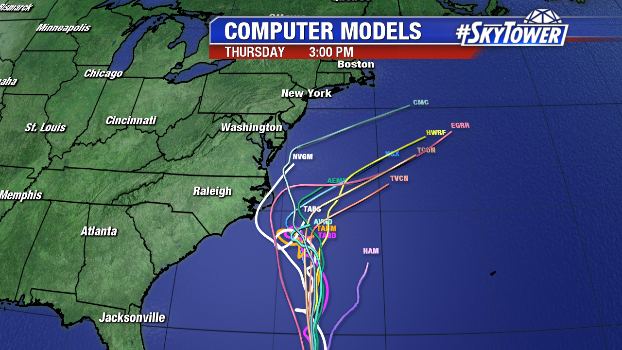
Here is the 11 AM forecast track from the NHC. Maria is a category 3 hurricane with 115 mph winds. It will head north-northwest through Monday and run into some hostile upper level winds. Maria may encounter some slight cooler waters mid work week off of the Mid Atlantic. However, a further west course closer to the Outer Banks puts Maria over the warm Gulf Stream. The Outer Banks of North Carolina are in the cone of uncertainty Wednesday and Thursday. This in line with a westward shift in some computer models early Saturday. Most models still keep Maria offshore. Interest in the Mid Atlantic region should also keep a watchful eye. Additional upper air soundings start Saturday afternoon and NOAA G-IV mission will assess the environment Sunday. This will help models gain better consensus on any possible U.S. impacts.
Tropical Storm Lee found new life late this work week. It is a tiny weak tropical storm Saturday morning. Lee may regain hurricane strength over the open central Atlantic this work week. It is no threat to land. Meanwhile the remnants of Jose churn off of New England. It is still breezy in coastal Massachusetts with rough surf from the Mid Atlantic up through the Northeast. Boating remains unfavorable through the work week as Maria lifts north over the western Atlantic.
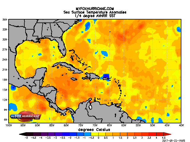
Fortunately, we enter a quiet 5-7 day stretch in the Atlantic Basin. Fronts are more active as we approach October. While this enhances upper level winds in the tropics, water temperatures are still quite water in the Gulf of Mexico and western Caribbean. Sea surface temperatures in the western Caribbean, parts of the Gulf of Mexico and even the western Atlantic are running .5-2° C above average. Fronts/troughs can guide tropical systems towards Florida/the U.S. These are areas we will watch for tropical cyclone formation in the weeks ahead.