Maria Ready To Race Out To Sea; Looking Ahead To October

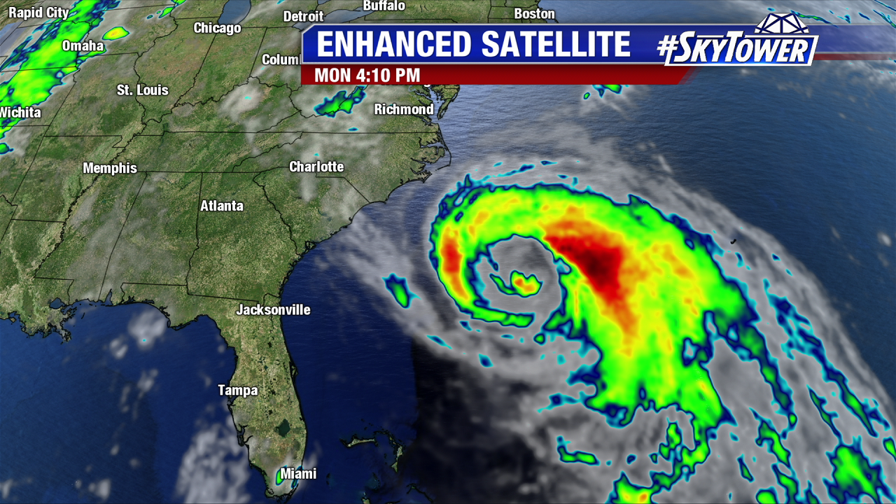
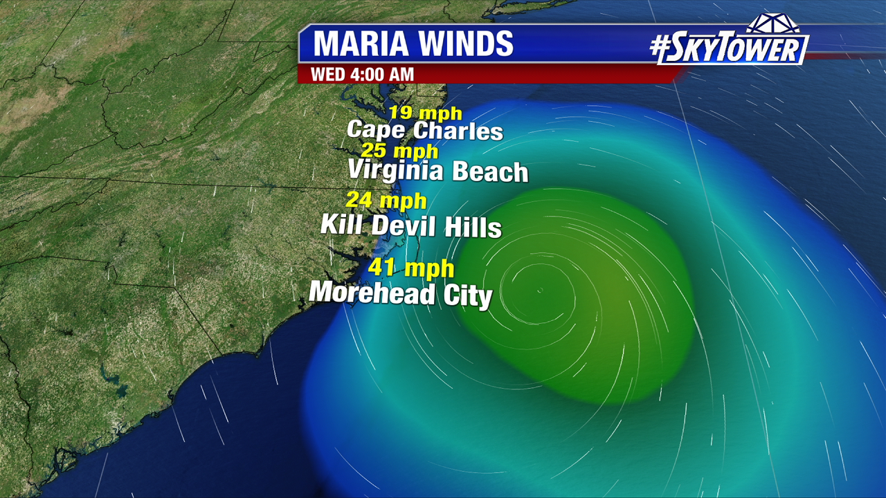
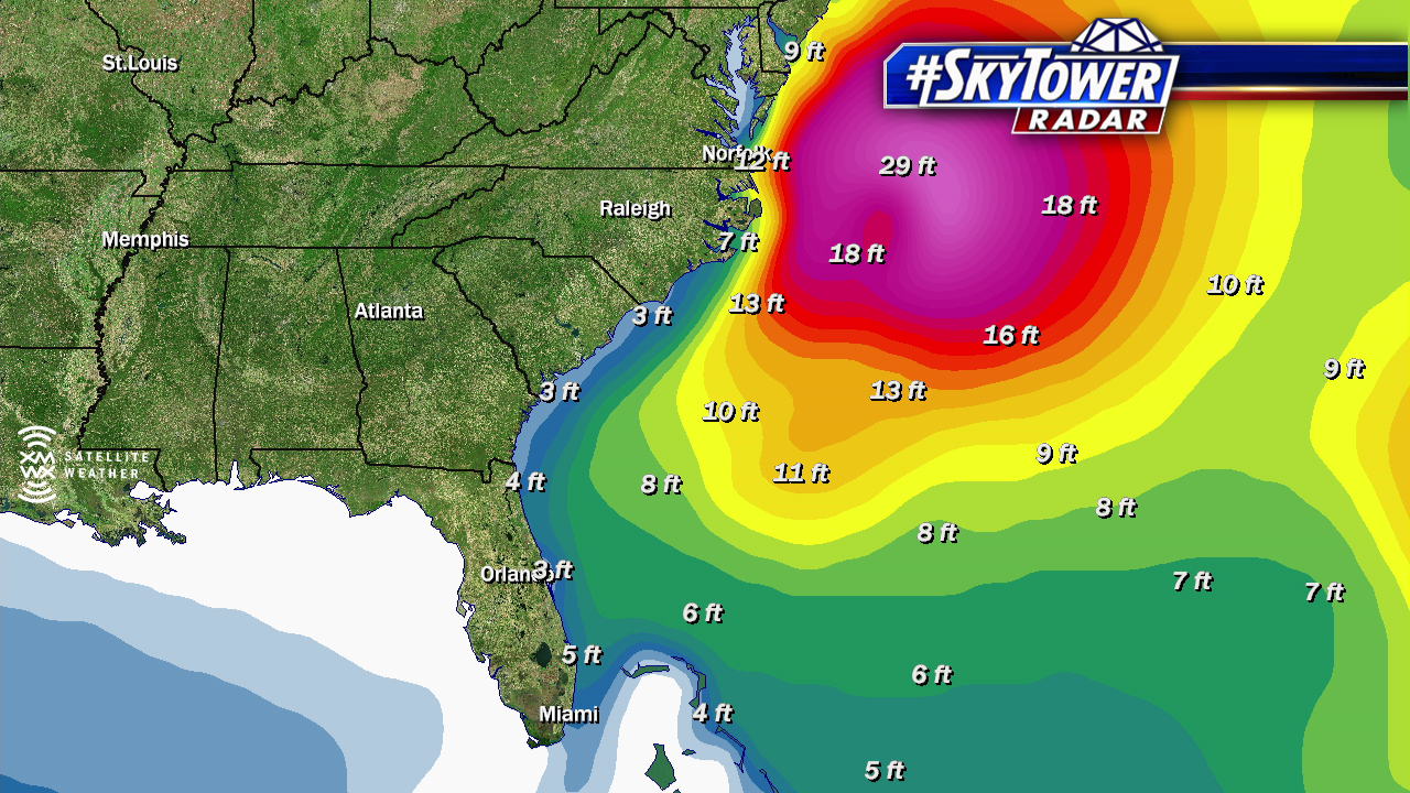
Overnight Tuesday into early Wednesday, Maria brought tropical storm conditions to the Outer Banks of North Carolina. The storm stayed about 150 miles offshore as it passed by, but large swells created dangerous rip currents and a storm surge of 2-4′, which in some cases resulted in minor coastal flooding.

peak-wind-gusts2 fastrac

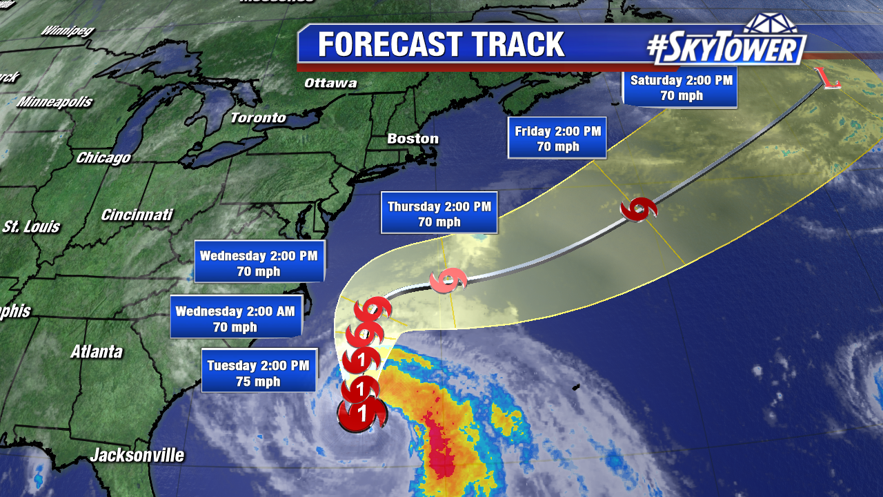
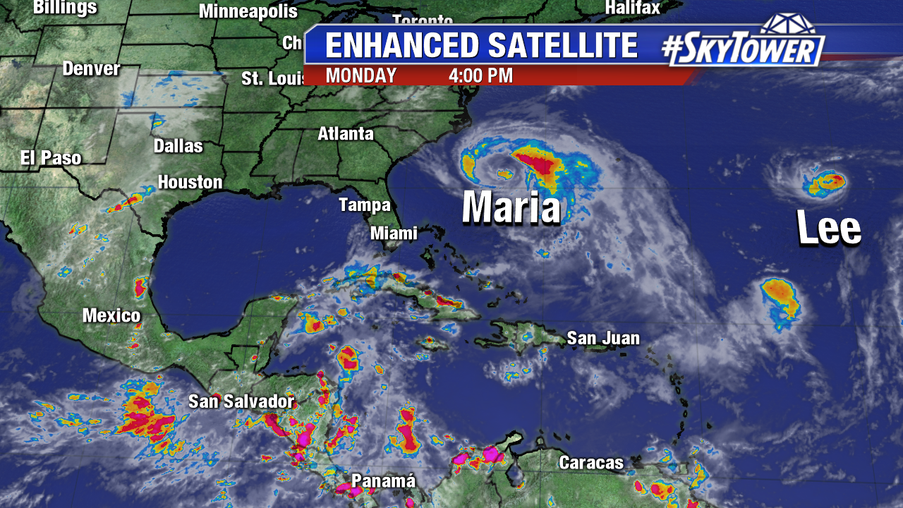
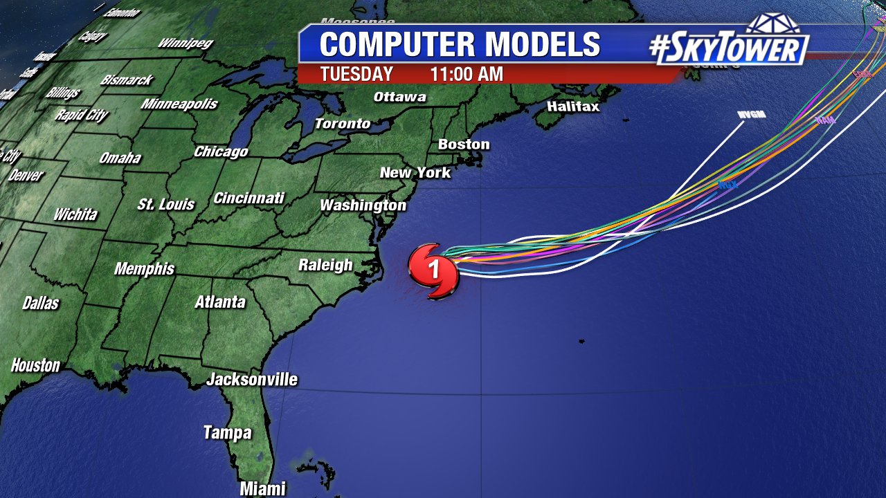
Maria is a category 1 hurricane with winds of 75 mph as of 11am Wednesday. Thanks to a trough digging into the northeast, Maria will take a sharp right hand turn over the next 24 hours and begin moving rapidly to the east-northeast, out to sea. Subsequently, conditions along the east coast will slowly be improving.

invest-90l-models

atlantic-wide-2d-ir-enhanced

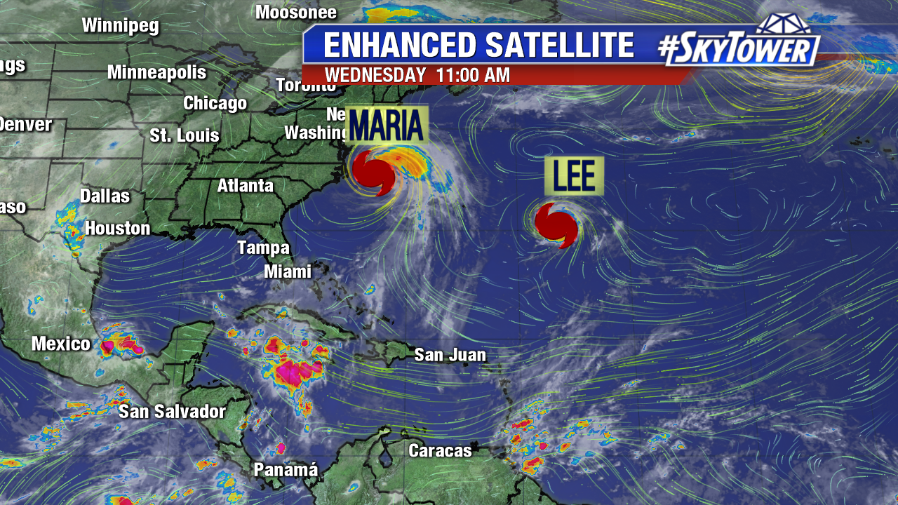
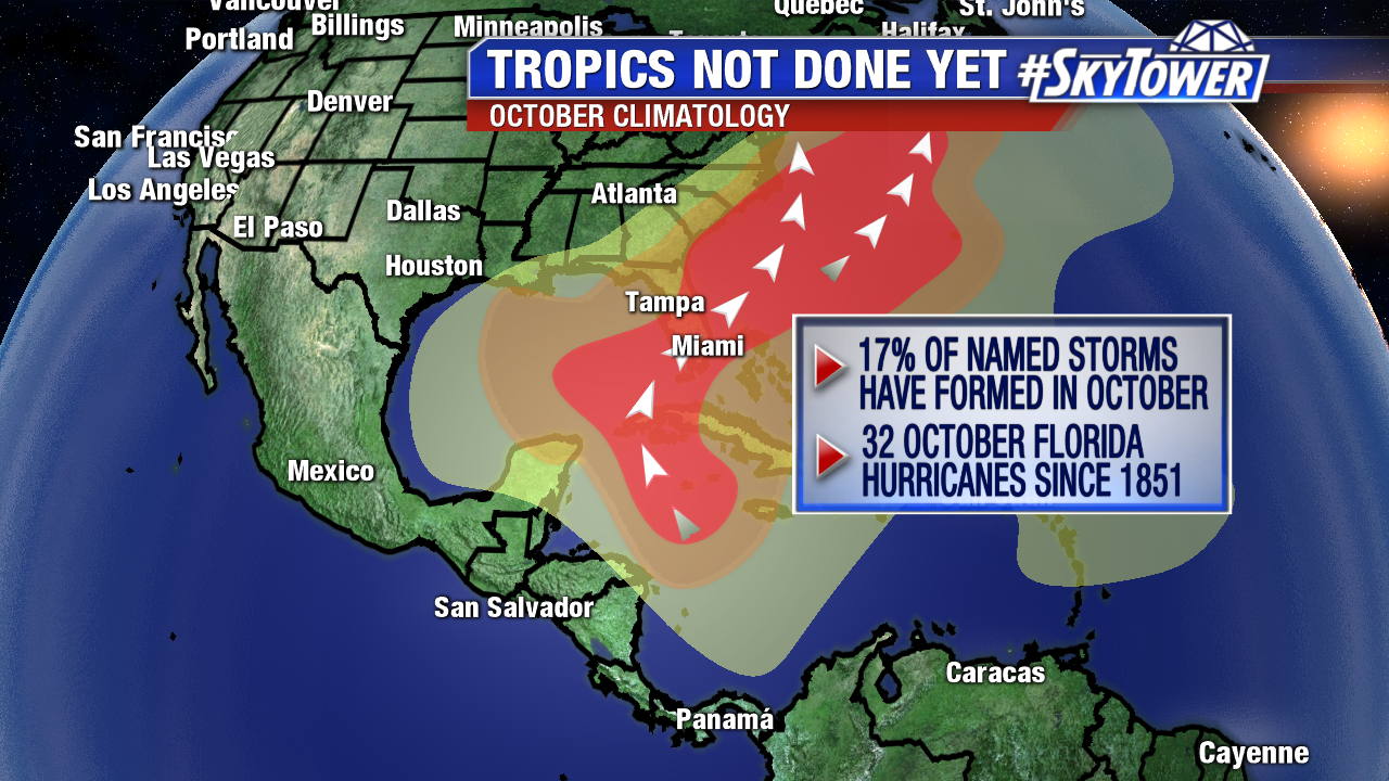
With Maria on its way out and Hurricane Lee bothering nobody but the fish in the open Atlantic, we finally have somewhat of a quiet period. That being said, it is still hurricane season and we’ll still be watching the tropics closely over the next month or so. Storms can and do often form during the month of October, before we see a sharp decline in activity in November. Unlike August and September, when we watch for tropical waves rolling off Africa, the month of October often favors more “homegrown” activity in the Caribbean and Gulf of Mexico. There have already been some hints in our long-range modeling of lowering pressure in the western Caribbean over the next couple of weeks. For now though, we enjoy the relative lull in activity and hope it stays with us the rest of the season.

climatology-october

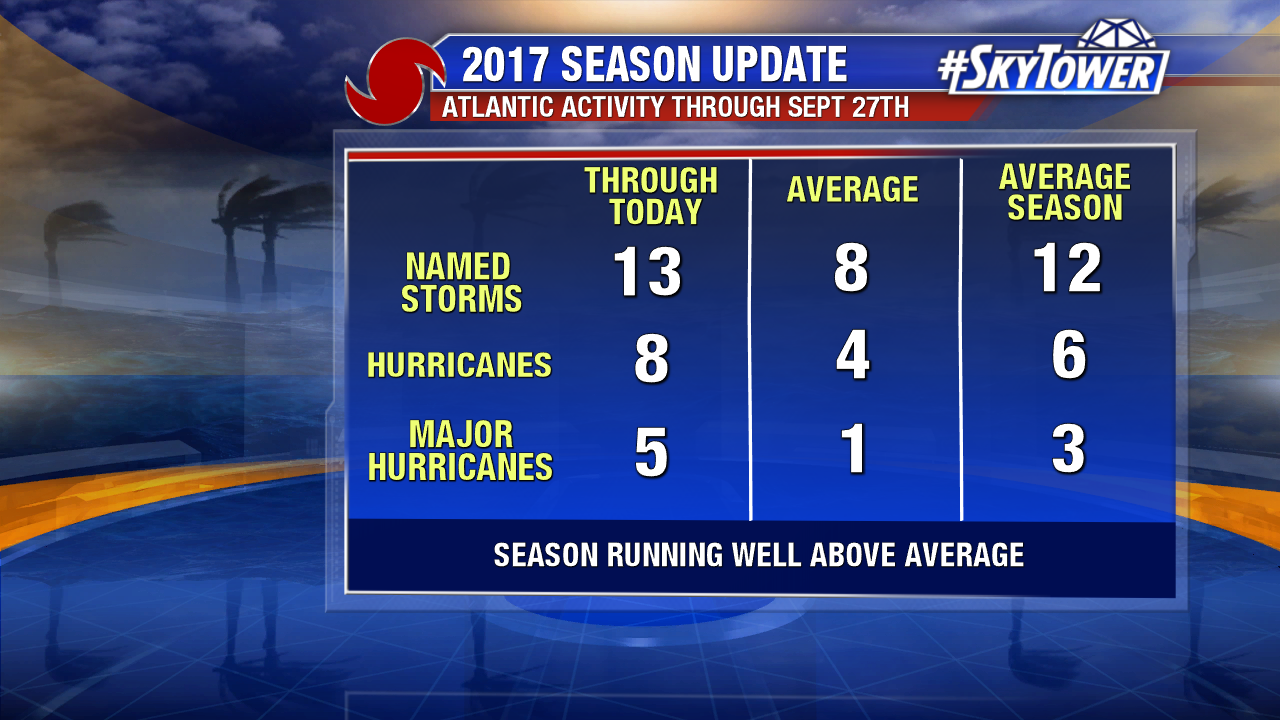
It has been an incredibly active season thus far with 13 named storms, 8 hurricanes, and 5 major hurricanes – already nearing or reaching the numbers put forth in many seasonal outlooks, with still two months left in the official hurricane season.

2017-season-update

Hurricane Maria Generates Swells Along East Coast; Tropical Storm Conditions in the Outer Banks Early Wednesday

Hurricane Maria hangs on Monday evening. The once major hurricane loses its symmetry and deep convection near its core. Maria combats stronger upper levels winds and taps into some cooler waters from upwelling from Jose. As of 5 PM it is a category 1 hurricane with 80 mph. It moves north at 7 mph. At this pace Maria will make its closest pass to the Outer Banks of North Carolina as a strong tropical storm early Wednesday. A strong upper level trough while guide Maria out to sea late in the work week. A Tropical Storm Warning is in effect for North of Duck to the North Carolina/Virginia border and North of Surf City to south of Cape Lookout. A Storm Surge Watch is in effect for Cape Lookout to Duck North Carolina. A mandatory evacuation was ordered from Ocracoke Island and Hatteras Island Monday afternoon.

maria1

gfs-wind-shear-with-text

Here is the 5 PM advisory. Notice the sharp northeast track after Wednesday. Maria will accelerate out to sea and lose tropical characteristics by Saturday.

4

While the center of Maria will pass well east of North Carolina, the tropical storm force wind field is quite large. Tropical storm force winds extend out 200 miles from its center. Sustained winds will approach low-end tropical storm force in the Outer Banks late Tuesday and early Wednesday. Below is the GFS wind speed forecast for early Wednesday morning. Higher gusts are likely. Outer bands will bring 1-2 inches of rain to the region, but this won’t be a big rainmaker.

maria2

Wave heights continue to build as Maria lifts northward in the western Atlantic. Dangerous swells reach the Mid Atlantic and even the Northeast Monday evening. Rough surf will continue through at least mid-week. This enhances the risk for rip currents and beach erosion. A 2-4 foot storm surge is possible from Cape Lookout to Duck North Carolina, including the sound side of the Outer Banks. Coastal flooding is possible starting Tuesday.

fastrac-png2

Elsewhere tiny hurricane Lee churns across the north central Atlantic. It weakens some at 5 PM. It is no threat to any land and will stay over the open Atlantic.

As October approaches, all eyes are on the western Caribbean and Gulf of Mexico. Long range models hint that pressure may lower in the western Caribbean during the first week of October. This is in line with climatology this time of year. Water temperatures are in the mid 80s. Our focus shifts to this region and away from the Main Development Region in the central Atlantic in the coming weeks.

floater-enhanced-satellite-3

maria3