Potential Development Late This Week, Main Impact More Rain

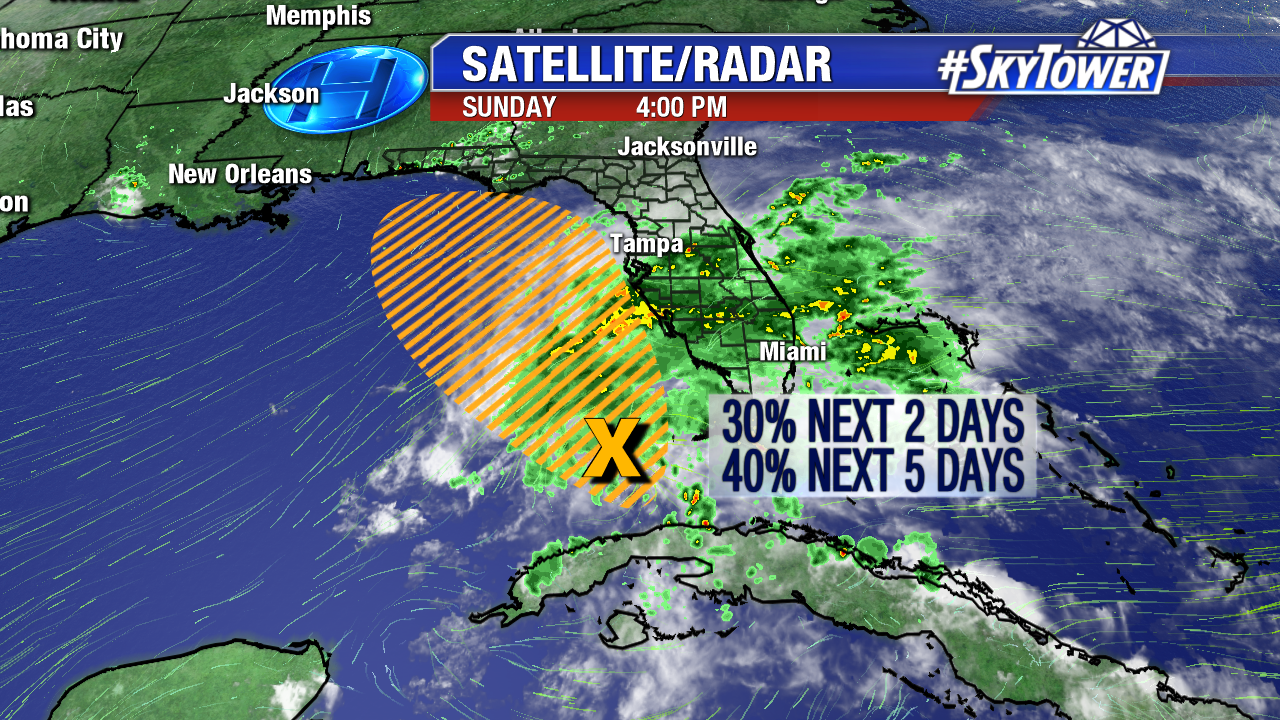
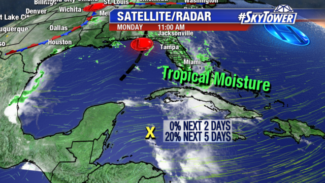
We are keeping an eye on a disturbance in the northwestern Caribbean. Right now it is disorganized and only has a 20% chance of tropical development over the next 5 days.

Models are not in good agreement on the path of this disturbance. The European model takes it north into the central Gulf and stalls it along the northern gulf coast. While the GFS tracks it east across southern Florida and then north along the east coast of the state. The biggest question is how much more rain we will get from the system.

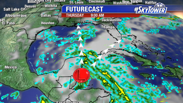
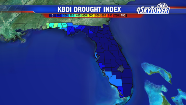
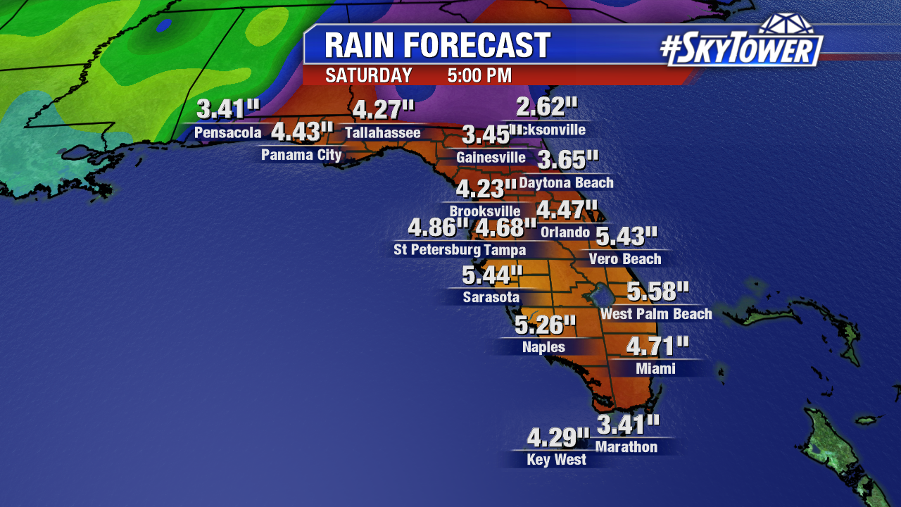
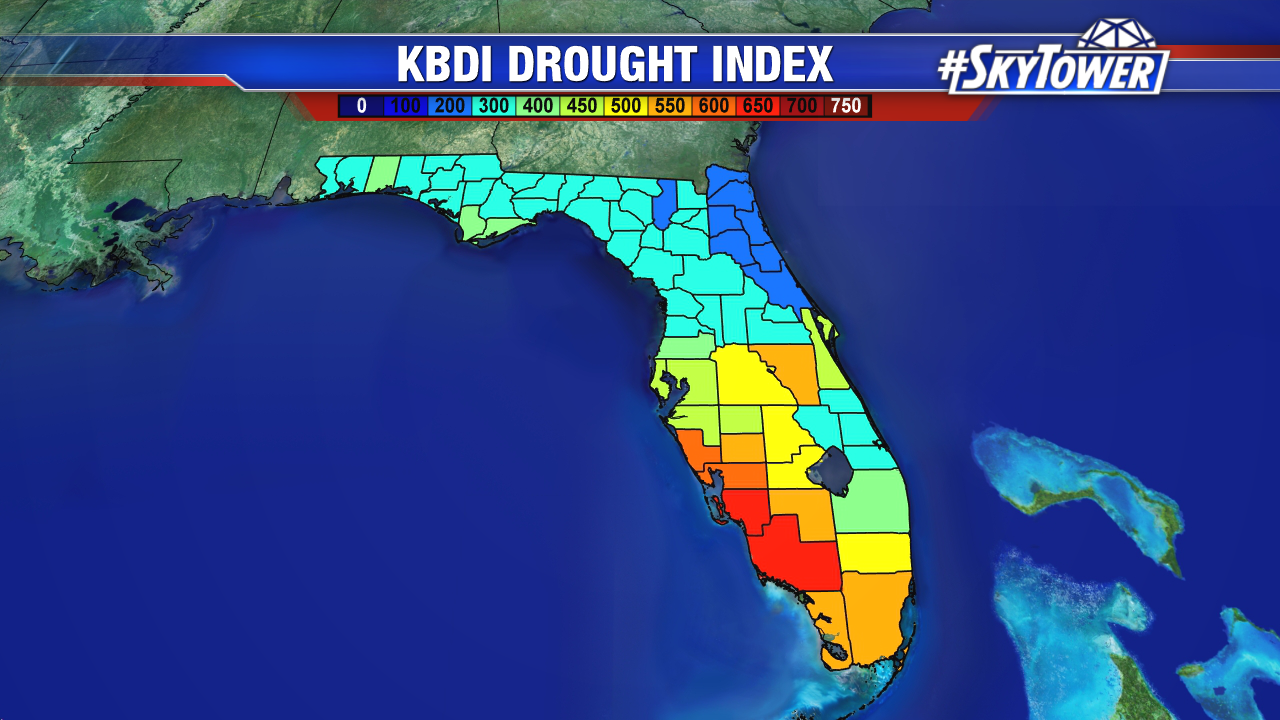
It is too early to tell what the strength and track of the system will be. But either way it means more rain for the state and a soggy Memorial Day weekend. Some areas have already picked up to 7-10″ of rain since Mother’s day, wiping out the drought for most of the state. Additional heavy rain over the next several days could lead to flooding on area rivers, as some are already at flood stage.

Regardless Of Development, Tropical Wave Set To Bring Heavy Rains To Florida This Week

On Sunday evening, a large area of showers and storms associated with a broad area of low pressure extended from Cuba up through Central Florida. As this area meanders northward through the eastern Gulf over the next few days it may start to take on some tropical characteristics. However, regardless of tropical development, the outcome is essentially going to be the same – heavy, but beneficial, rains across much of the state of Florida.

Below you’ll find rainfall totals through next Saturday from across the state. This is model output from Sunday afternoon’s Euro model. Don’t focus so much on the particular totals for each city, but rather the range. Expect a good 3-5″ across a lot of the state over the next week, with some isolated areas picking up even more.

This rainfall should wipe out a lot of the drought issues we’ve had in certain areas this Spring. Below you’ll find the KBDI Drought Index from Sunday, May 13. The higher the number, the drier it is.