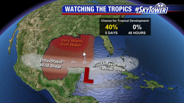
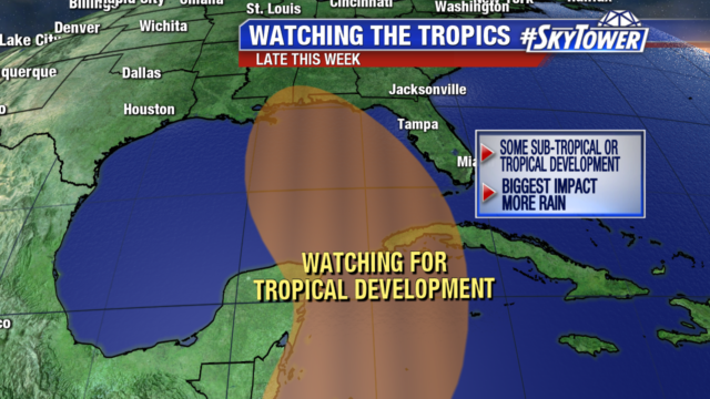
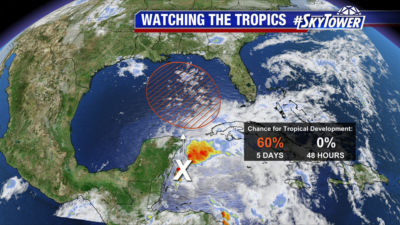
As of Wednesday morning, not much has changed with the disturbance (Invest 90L) in the far western Caribbean Sea. Very little development is expected over the next day or two thanks to strong upper-level winds and land interaction with the Yucatan Peninsula. However, conditions are expected to become a little more favorable for development as this system moves north into the central or eastern Gulf by late Friday/early Saturday. At that point, a tropical depression may form. The National Hurricane Center currently puts the chance for development at 60%.
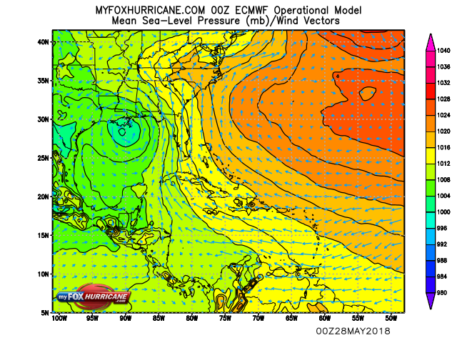
We’re still not seeing much model agreement as to how things will ultimately play out. The overnight Euro run continued to suggest a slow-moving, stronger system heading toward the central Gulf Coast.
00Z Euro valid for Sunday evening:
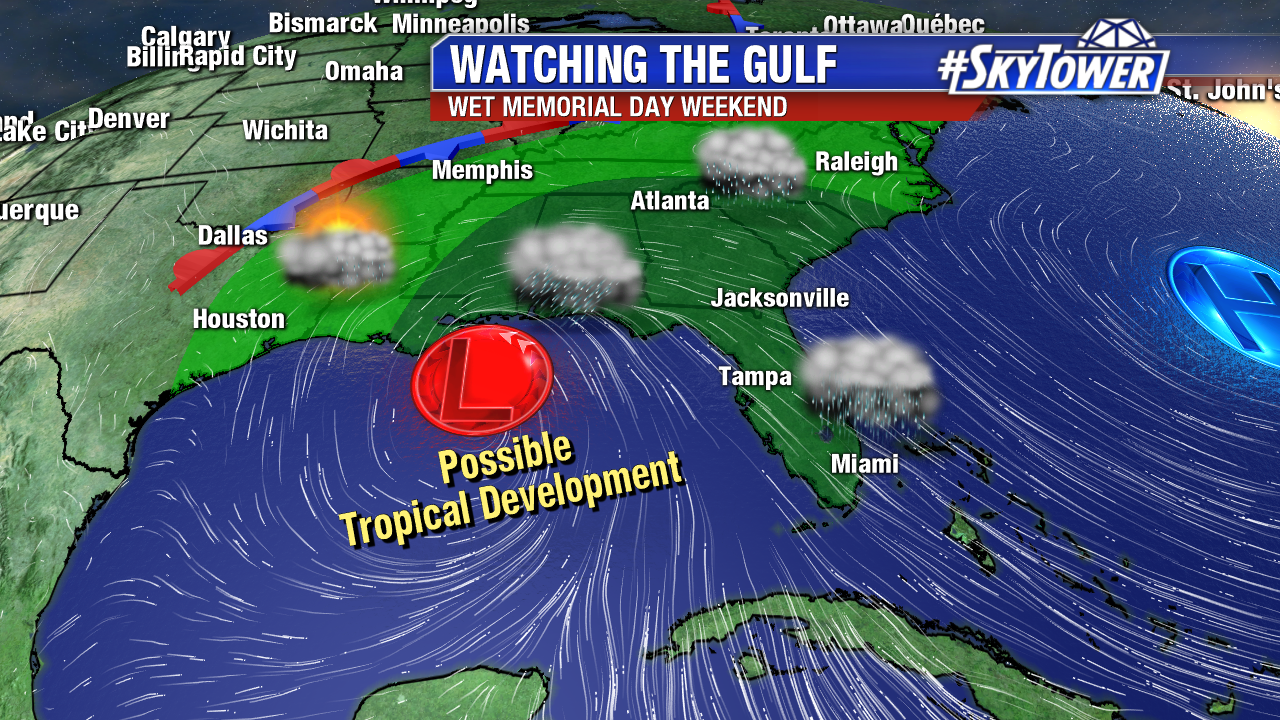
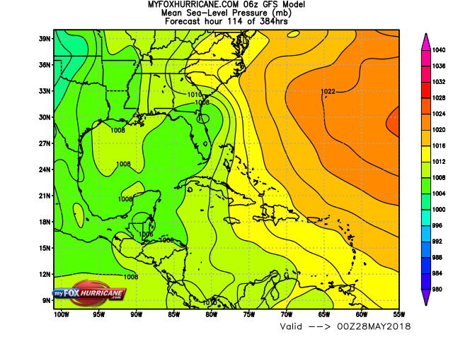
The GFS, however, essentially keeps this an open wave and takes the slug of moisture across central and south Florida. While the track, speed, and development of this system will determine who has the highest threat for heavy rainfall, the end result either way is going to be a wet Memorial Day Weekend for many folks along the Gulf Coast and across the Southeast.
06Z GFS valid for Sunday evening:
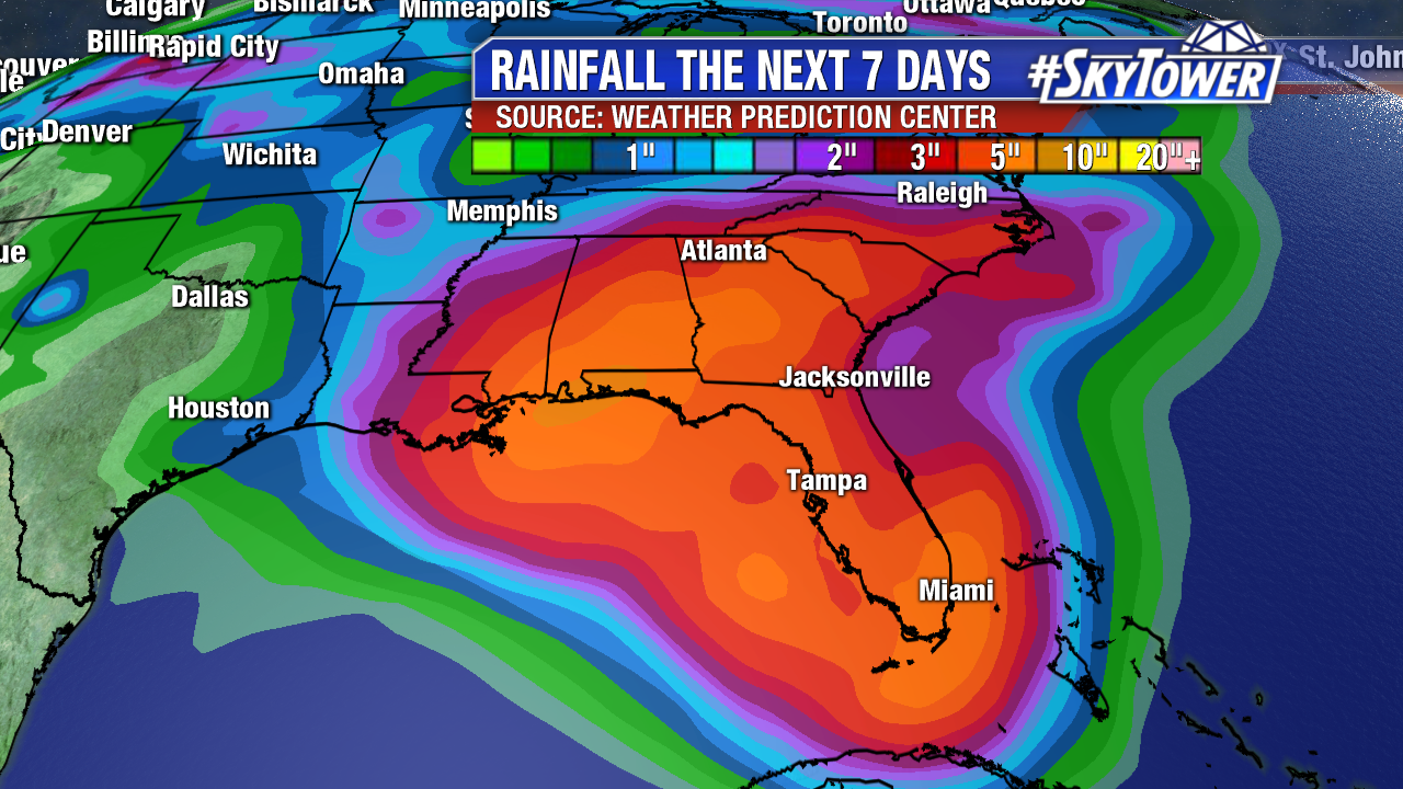
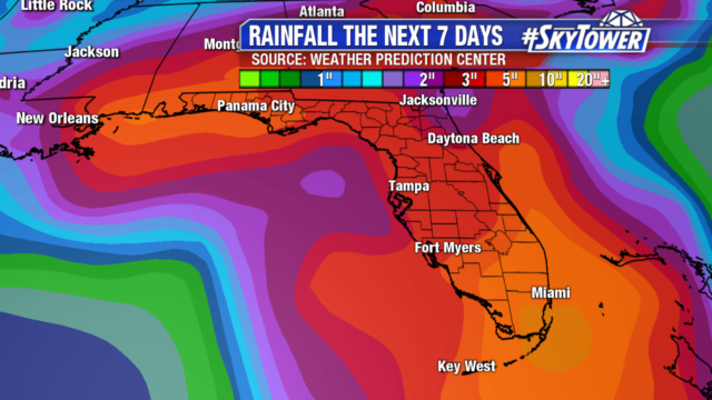
It’s a little too early to be pinpointing exact rainfall totals, but the latest precipitation forecast from the Weather Prediction Center (below) puts down several inches from New Orleans to Miami and up through the Carolinas through early next week. Depending on how things play out, these totals may be on the conservative side. Stay tuned as we iron out the details over the next couple days.