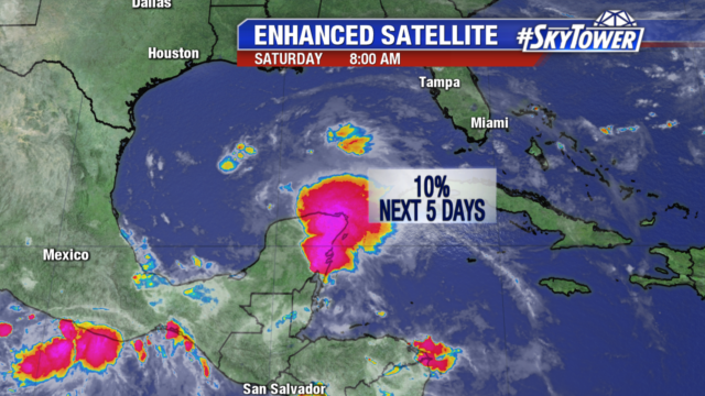
Invest 90L continues to bring heavy rain to the Yucatan Peninsula. The system has little chance of development over the next 5 days, only a 10% chance as the environment is unfavorable for organization.
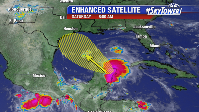
It will continue to move northwest as a cluster of rain and storms, headed toward the Texas and Louisiana coastlines.
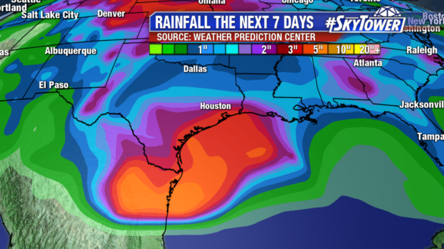
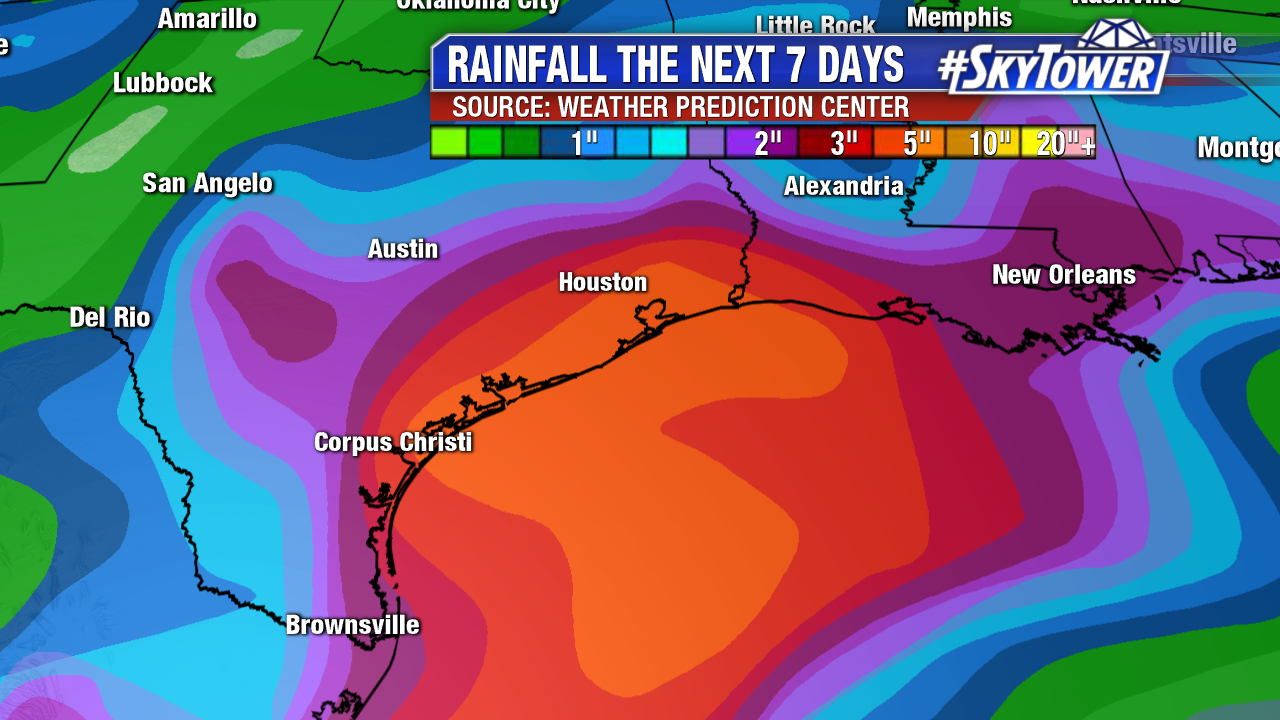
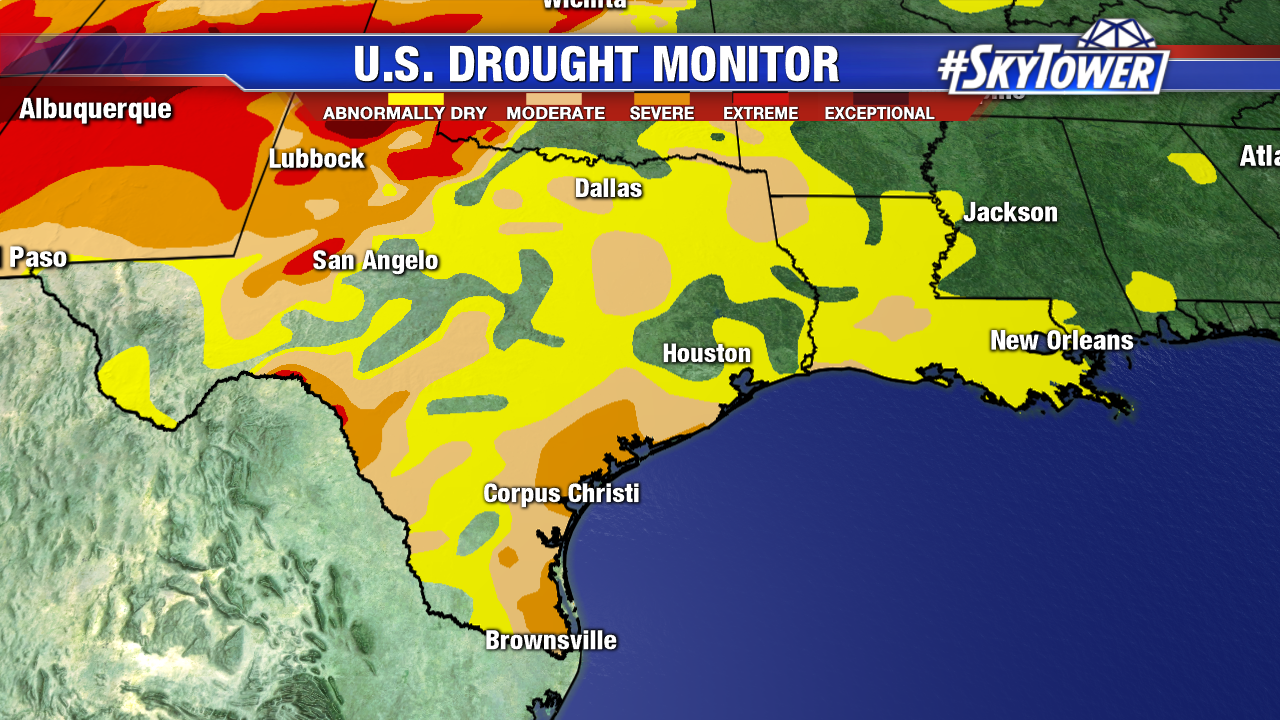
The disturbance will spread heavy rain along the Western Gulf Coast starting Sunday. Parts of Texas are in a moderate to severe drought, so the 2-4″ of rain will be welcome in the area.
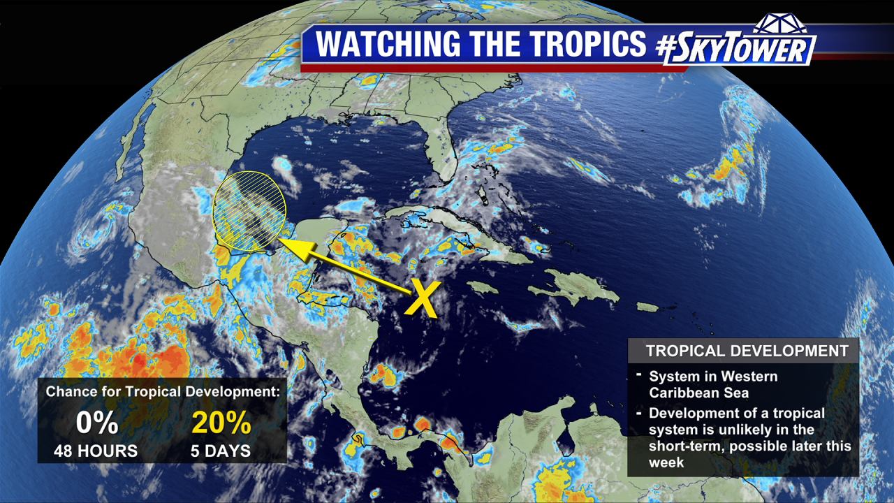
Still watching Invest 91L over the central Caribbean. As of Wednesday afternoon, the National Hurricane center still pegs the chance development at 20% over the next 5 days.
This disturbance continues to battle with pockets of dry air and high wind shear. As it moves west-northwest over the next few days, conditions may become a little more favorable for some weak development as it moves into the SW Gulf. However, model trends over the last few days have been to keep this an open wave as it approaches the western Gulf Coast this weekend. Regardless of development, beneficial rains will be heading into parts of Texas and Louisiana.
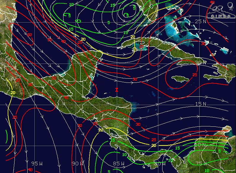
Above: Wind shear over the Caribbean and SW Gulf remains high for now. Courtesy – University of Wisconsin
The main impact here will be rounds of slow-moving heavy rain this weekend and into early next week. Widespread totals of 3-5″ with isolated amounts up to 8″ can be expected. Any rain across south Texas will be a welcome sight as much of the area is dealing with a moderate to severe drought.