Beryl Weakens to a Tropical Storm; Tropical Depression 3 Remains Off the East Coast

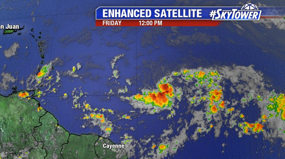
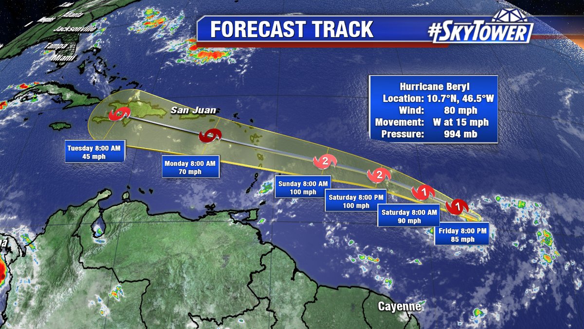
Beryl has now been downgraded to a Tropical Storm with 65 mph winds. Beryl’s tiny size has made it vulnerable to extreme fluctuations in intensity. An increase in low level shear and dry air have likely caused the sudden weakening.

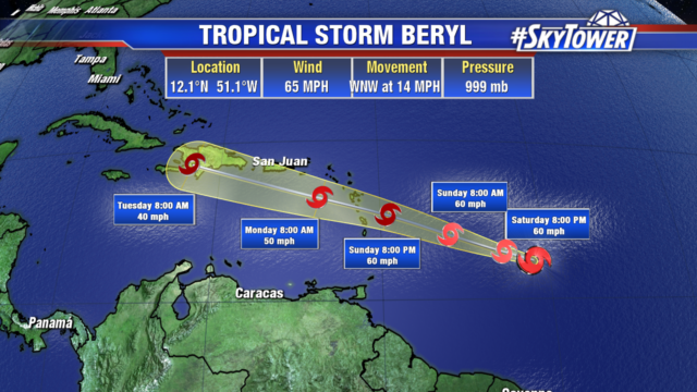
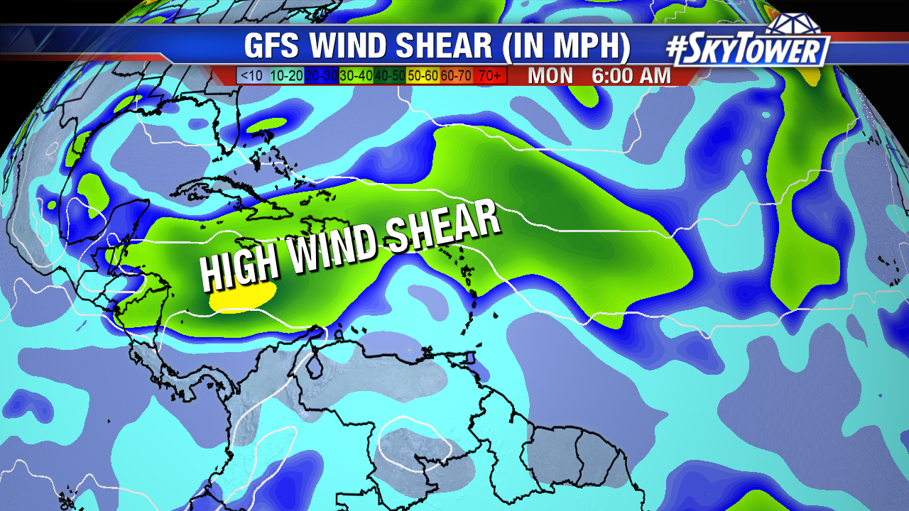
Beryl will continue heading northwest into an area of increased wind shear, lessening its chance of reorganization before moving into the Lesser Antilles Sunday night. The small cyclone will still bring heavy rain and gusty winds as it tracks over the islands. Tropical Storm Watches and Warnings are in effect for the area. After crossing the Lesser Antilles it will pass south of the Virgin Islands and Puerto Rico Monday into Monday night.

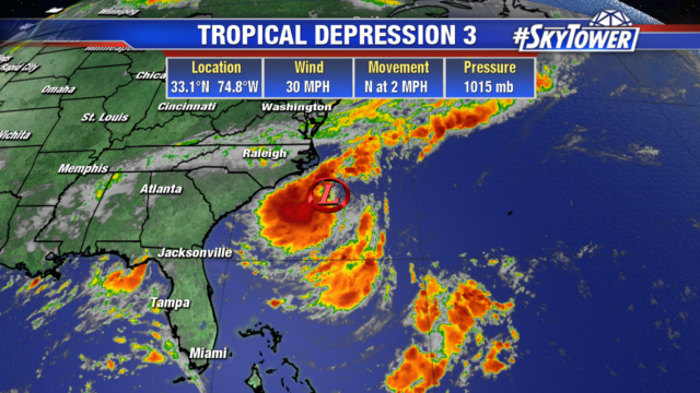
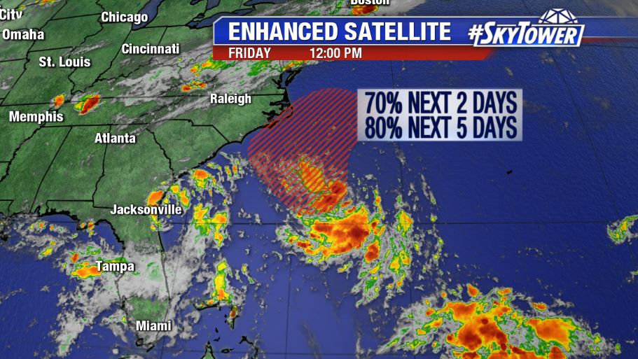
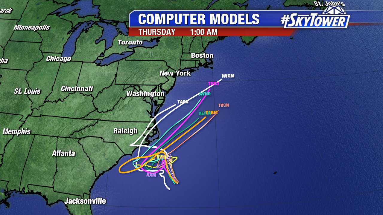
The system off the Carolina coastline remains a Tropical Depression but will likely strengthen into a Tropical storm late tonight into Sunday. Convection is a little better organized with winds still at 30 mph. It is sitting in area of low wind shear and warm waters. A reconnaissance aircraft will check the depression this morning for more information on its intensity.

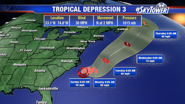
After meandering off the East coast for the next 2 to 3 days, it will finally head northeast beginning Tuesday. Southwesterly flow ahead of a trough moving off the coast will accelerate its movement next week, and keep it in the Atlantic. Increased swells generating dangerous surf and rip currents can be expected along the coast. Any Tropical Storm force winds will remain over the Atlantic, so no watches or warnings have been issued.

Hurricane Beryl Headed Toward Lesser Antilles This Weekend

As of 11am Friday, Beryl remains a category 1 hurricane with winds of 80 mph. It’s an incredibly small storm, with hurricane-force winds only extending out about 10 miles from the center and tropical storm-force winds extending out about 35 miles.

Beryl is a little more than 1000 miles east-southeast of the Lesser Antilles and will continue on a west-northwest track over the next 72 hours. Hurricane watches could go into effect for parts of the Lesser Antilles as early as Friday night. Current intensity forecast from the National Hurricane Center (NHC) has Beryl strengthening into a category 2 hurricane before moving into the Caribbean and weakening.

As Beryl enters the Caribbean it will begin to encounter high amounts of wind shear which should weaken the system dramatically, if not completely tear it apart. Still, interests in the northern Caribbean, such as Puerto Rico and the Dominican Republic, should monitor the progress of the storm closely. At the very least, some gusty winds and tropical downpours will impact those areas early next week. At this time, Beryl poses no threat to the United States mainland.

Elsewhere, in the Atlantic… Showers and thunderstorms are increasing in association with a well-defined area of low pressure a few hundred miles southeast of the North Carolina coast. NHC currently has the chance of tropical depression forming over the next 2 days at 70%. Should this become a tropical storm, it would get the name ‘Chris’. This disturbance will likely meander off the coast off the Carolinas for the next few days kicking up dangerous rip currents for beach-goers. Interests in these areas should monitor the progress of this unsettled area of weather closely.