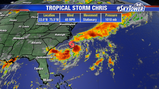
As of 5pm Sunday evening, Tropical Storm Chris was located about 180 miles SSE of Cape Hatteras, NC. Max sustained winds have increased to 50 mph. Steering currents will remain light for the next day or two, so very little storm motion is expected until late Tuesday. The storm should continue to intensify, likely becoming a hurricane at some point in the next 24-36 hours.

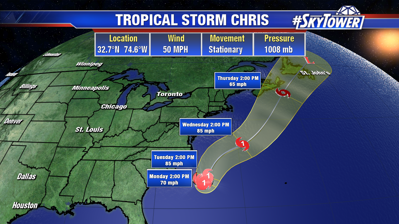
Thanks to a mid-level trough moving through the eastern U.S., Chris should start accelerating to the northeast by late Tuesday or early Wednesday. Although no landfall is expected on the U.S. mainland, the storm will still kick up high surf and dangerous rip currents for beach-goers along the East Coast.
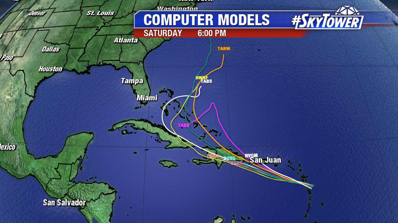
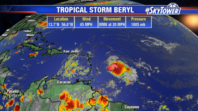
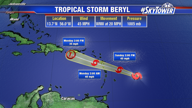
Great news for those in the Caribbean… Beryl continues to lose steam as it nears the Lesser Antilles. The storm no longer has an identifiable low-level center, as wind shear and dry air continue to take their toll. Beryl’s remnants are still producing tropical storm-force winds and heavy tropical downpours as they move into the central Lesser Antilles late Sunday night.
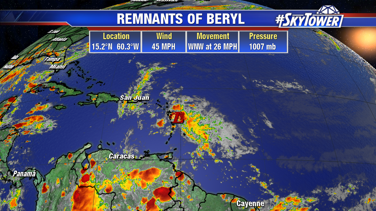
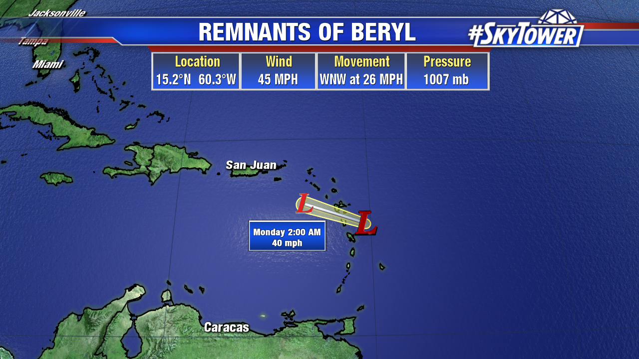
This area of disturbed weather will move through the northeastern Caribbean and into the southwestern Atlantic near the Bahamas over the next few days. It’s possible that Beryl’s remnants will regenerate into a tropical system at that point as conditions become more favorable for development. However, there isn’t a lot of model support for that type of outcome right now.