After a big burst of tropical activity over the last few weeks, things are a lot quieter now in Atlantic. That being said, we are keeping an eye on a large area of showers and storms sitting about 1000 miles east of the Windward Islands. The disorganized area is associated with a tropical wave that may organize a little over the next 48 hours.
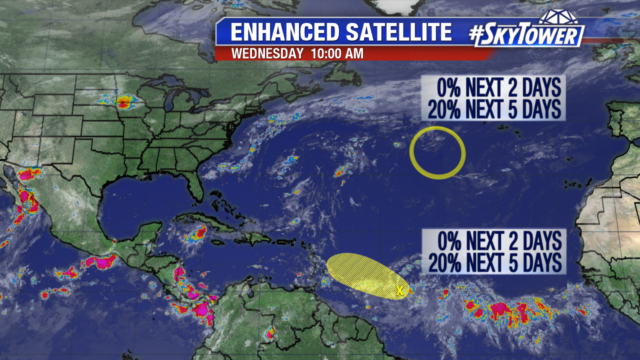
As it continues to move west though, it will encounter dry air and higher wind shear. There is only a 20% chance of development over the next 2 to 5 days.
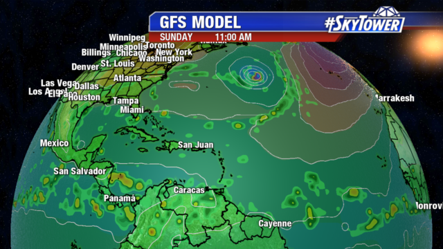
Looking ahead to the weekend, a non-tropical area of low pressure could develop between Bermuda and the Azores as a front moves off the east coast of the United States. This low will meander over the north Atlantic and could begin to take on some tropical characteristics. If a storm does develop here, it would likely stay out to sea, but it’s something we’ll be monitoring.
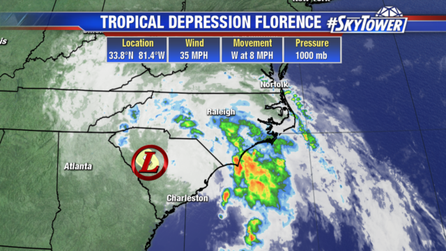
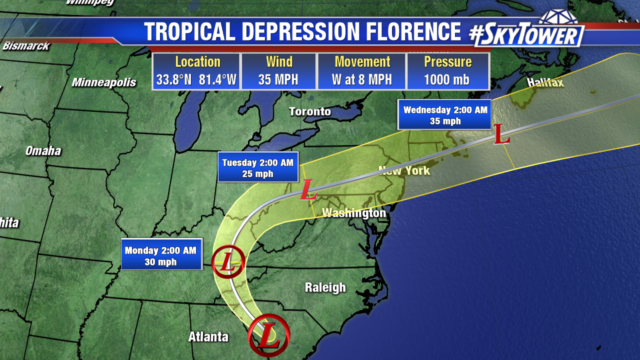
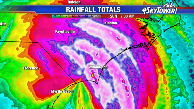
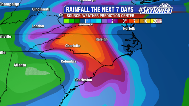
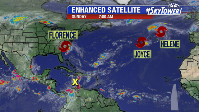
It has been days since Florence moved out of the Carolinas but widespread flooding and water rescues continue. The highest rainfall total in Southeast North Carolina was 35.93″ in Elizabethtown. The strongest wind gust of 105 mph occurred at Wilmington Airport. Northeast South Carolina was also hit hard. Loris, South Carolina picked up 23.63″ of rain and Cherry Grove Beach endured the strongest wind of 77 mph. There are 9 rivers in North Carolina forecast to have major or even recording flooding this week.