Hurricane Julia makes landfall in Nicaragua, bringing heavy rain across Central America

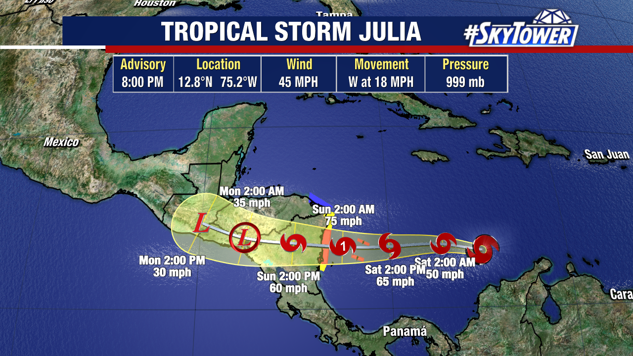
Hurricane Julia made landfall as a hurricane along the coast of Nicaragua early Sunday morning near Pearl Lagoon. The storm was strengthening at landfall due to favorable conditions but is expected to gradually weaken as it continues moving west across the country.  
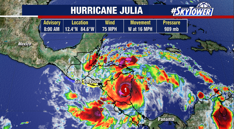
Julia will continue to produce heavy rain and a threat of flash flooding and mudslides across Central America, especially in areas of mountainous terrain. Despite land interaction, the fast movement of Julia will allow it to remain intact as a tropical storm when it emerges in the eastern Pacific Monday.

Julia will then brush the coast of El Salvador and Guatemala as it continues to weaken, dissipating by Tuesday.

While Julia is not a Florida concern, moisture remnants from the system may emerge in the Gulf of Mexico and get swept toward the state by a cold front arriving midweek, helping to boost rain chances.

Julia To Bring Heavy Rain To Central America This Weekend

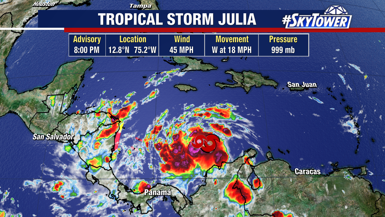
Tropical Storm Julia formed just north of Colombia early Friday. Wind shear has been keeping the storm from intensifying too much thus far, but that shear is expected to ease soon. With very warm waters ahead, strengthening is likely leading up to landfall along the coast of Nicaragua on Sunday morning.

While a storm surge of 2-4 feet is expected along the coast of Nicaragua north of the landfall point, it is the heavy rain that will bring the biggest problems. Isolated rainfall totals of up to 15″ will lead to life-threatening flash flooding and mudslides.

Land interaction will dissipate the storm over central America /southern Mexico early next week, but it’s possible the remnants end up in the southwestern Gulf thereafter and end up interacting with an arriving cold front. While the chances of redevelopment are slim, we’ll be keeping a close eye on it.