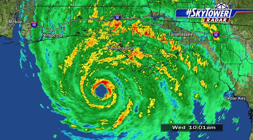
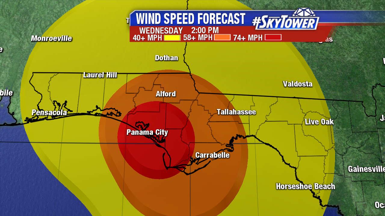
As of 10am Wednesday morning, Hurricane Michael was located about 60 miles southwest of Panama City, FL. Max sustained winds were at 145 mph with gusts to 165 mph.This is shaping up to be a catastrophic hurricane for the Florida Panhandle – the strongest storm on record to hit this part of Florida.
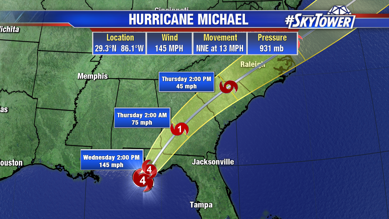
Landfall looks to take place at some point between 1-3pm EDT this afternoon near or just east of Panama City Beach. Hurricane force winds extend out about 45 miles from the center and tropical storm force winds extend out about 185 miles. Conditions are going downhill quickly this morning along the Panhandle coast with heavy rain bands and gusts to 45 mph.
Storm Surge:
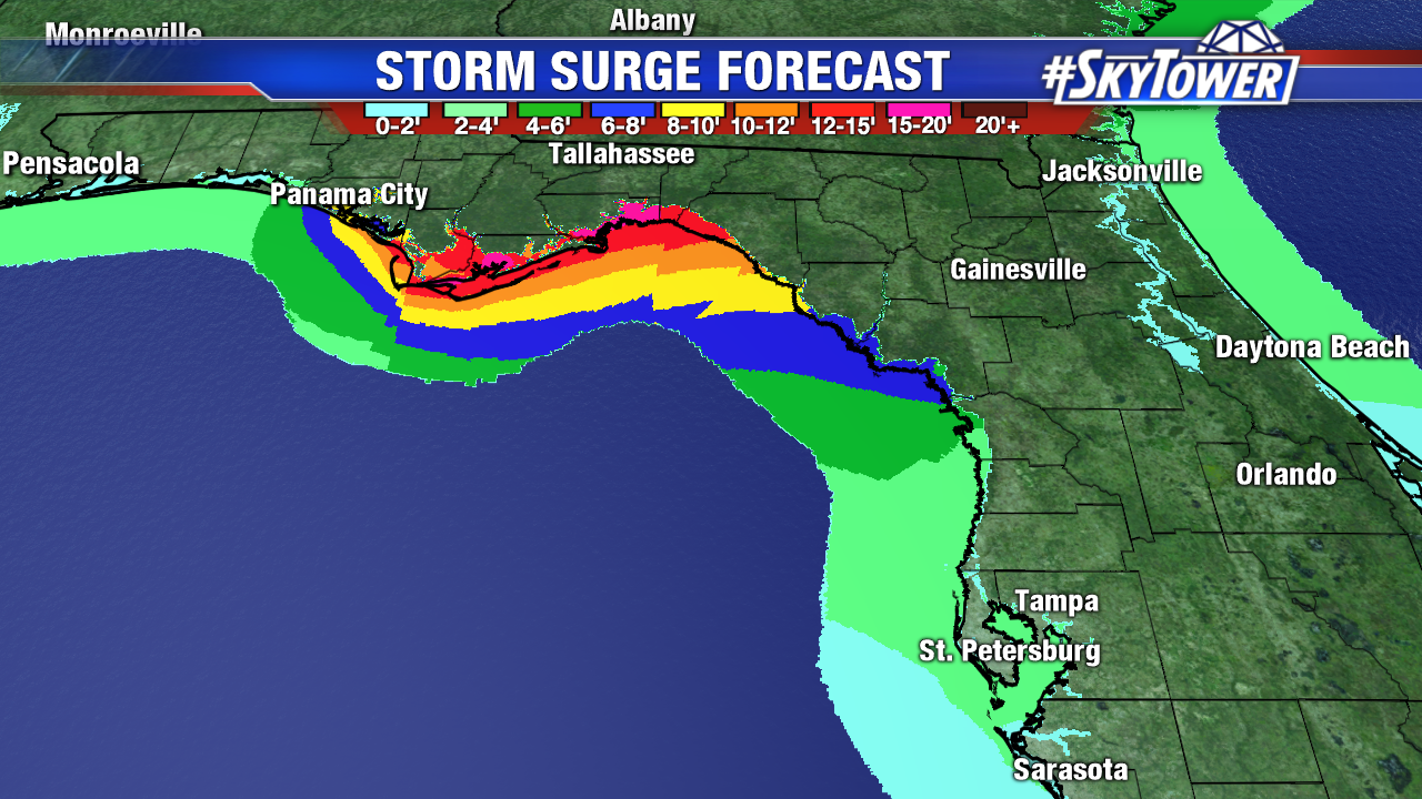
Tyndall AFB to Aucilla River… 9-14 feet
Okaloosa/Walton Co. line to Tyndall AFB… 6-9 feet
Aucilla River to Cedar Key… 6-9 feet
Cedar Key to Chassahowitzka… 4-6 feet
Chassahowitzka to Anna Maria Island… 2-4 feet
Wind:
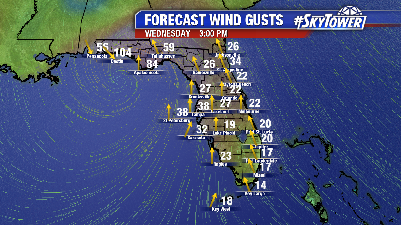
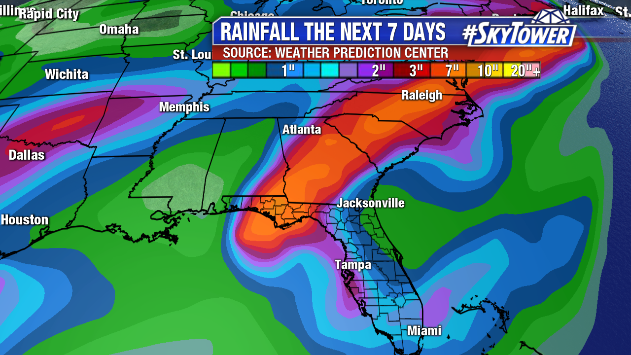
Rain: