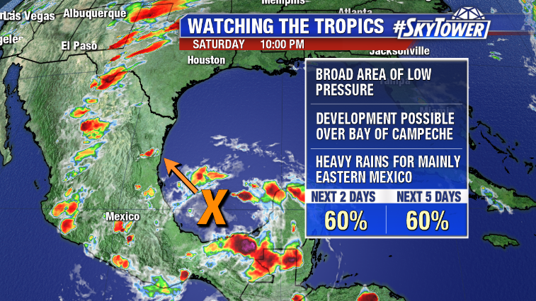
A couple blips on the radar so to speak in the young 2019 hurricane season. A short-lived Andrea back in mid-May, and a minimal threat in the western Gulf this past week that never materialized. So far, so good.
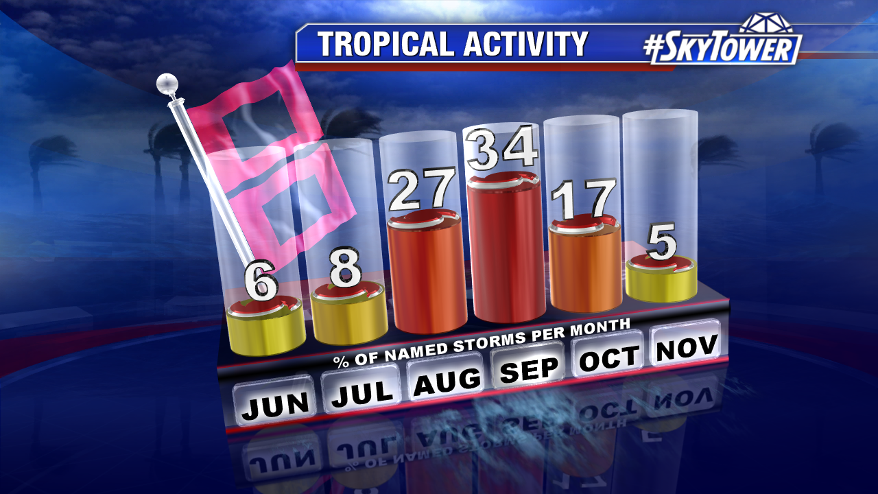
June is usually a quiet month for us. In fact, about half of all Junes since modern weather records began (1950) have not had any named storms form. Overall, June has accounted for only 6% of named storms on record.
Storms that do form early in the season are usually weaker, but there have been four June hurricanes to make landfall in the U.S. since 1950 – the most recent being Hurricane Bonnie in 1986. The takeaway? June hurricanes are rare, but not unprecedented. There’s a reason we want you to be prepared before the start of hurricane season.
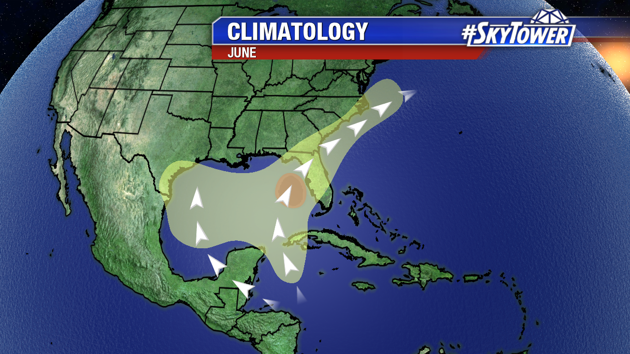
While things are quiet at the moment, below is a look at the regular June formation zones. As usual, we’ll be here with you all season long.