Disturbance Continues to Move Away from East Coast

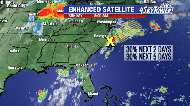
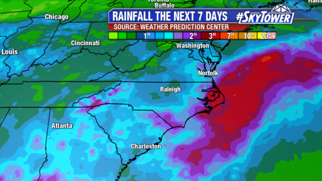
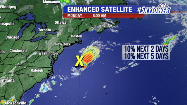
An area of low pressure brought heavy rain to the North Carolina coastline and Outer Banks over the weekend. It is now sitting several hundred miles south of Nantucket, Massachusetts in the Atlantic. Thunderstorm activity associated with the low has already decreased and will continue to do so as it moves northeast into cooler waters, so development is unlikely. It will no longer impact the East coast as it moves further into the Atlantic Ocean.

The rest of the tropics remain quiet under the influence of dry air and wind shear.

Continued Rain for North Carolina Coast, Minimal Development Chance

An area of low pressure has already brought heavy rain to the Carolina coastline and more is on the way. We have been watching the low since it moved through northern Florida. Organization today is unlikely due to its proximity to land and the window for organization is narrow. It is headed out into the warmer waters of the Atlantic tomorrow with a 30% chance of development. .After a day or so in warmer water it will encounter cooler water, limiting its chance of further strengthening.

Today several more inches of rain are possible in the Outer Banks and North Carolina’s coast with the risk of flash flooding. But that will be the only impact to the United States as it heads away from the East Coast early next week.