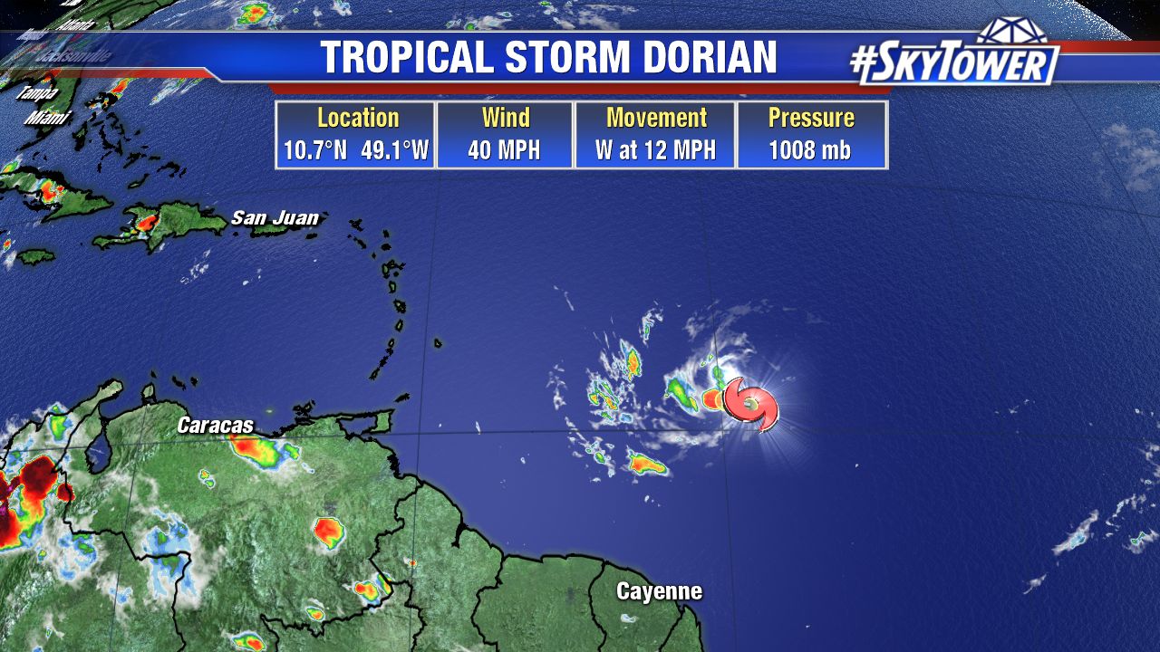
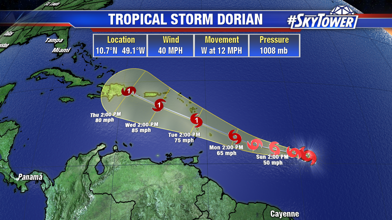
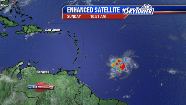
Tropical Storm Dorian is a compact cyclone maintaining 40 mph winds. It has become more organized since early this morning and is expected to slowly strengthen over the next few days. The track has once again shifted south and sped up a little..Dorian will likely arrive in the Windward Islands late Monday into early Tuesday. with winds nearing hurricane strength.
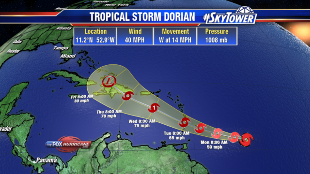
Warm water temperatures and lessening wind shear are helping combat the dry air the storm is experiencing.
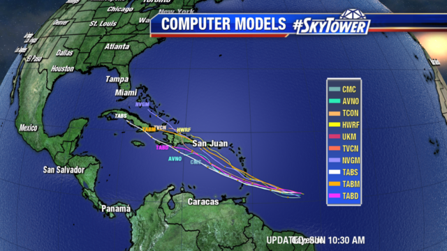
Models are in good agreement moving Dorian west-northwest into the Eastern Caribbean and then up towards Puerto Rico and Hispaniola. The intensity of the storm as it nears these islands is very dependent on land interaction and the amount of wind shear it encounters. It is too far out to determine the impacts in those areas. Interests in the northern and eastern Caribbean should monitor the progress of this storm very closely.
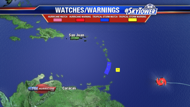
A Tropical Storm Warning has been issued for Barbados, and Tropical Storm Watches are in place for St. Lucia, St. Vincent and the Grenadines. These areas will begin to feel impacts from Dorian in the next 36 to 48 hours. Tropical Storm force winds extend out 25 miles from the center. Parts of the Lesser Antilles will see 2-4″ of rain with isolated totals to 6″ possible. Swells will also begin impacting these areas late Monday with life threatening surf & rip current conditions.
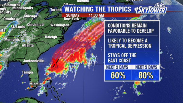
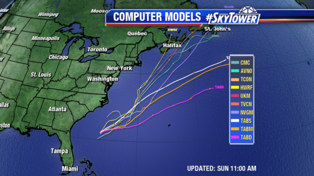
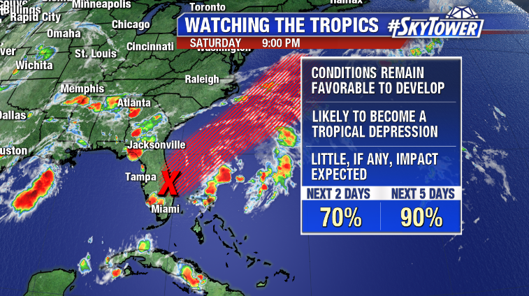
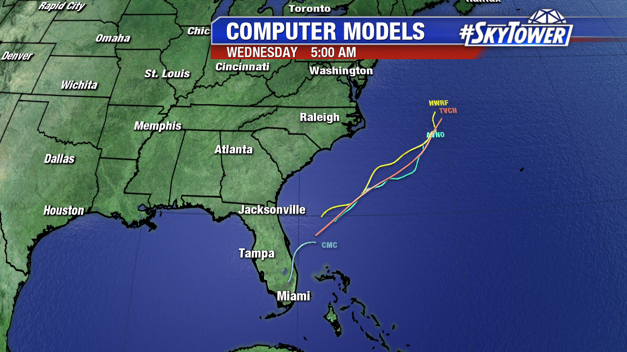
The trough of low pressure that has moved off Florida’s coast into the Atlantic is still likely to develop into a tropical or subtropical depression over the next few days. The path of the system will stay well off shore of the east coast as it heads northeast over the Atlantic Ocean. If necessary, an Air Force Reserve Hurricane Hunter will investigate the disturbance later today.