Dorian’s Track Shifts Closer to Puerto Rico

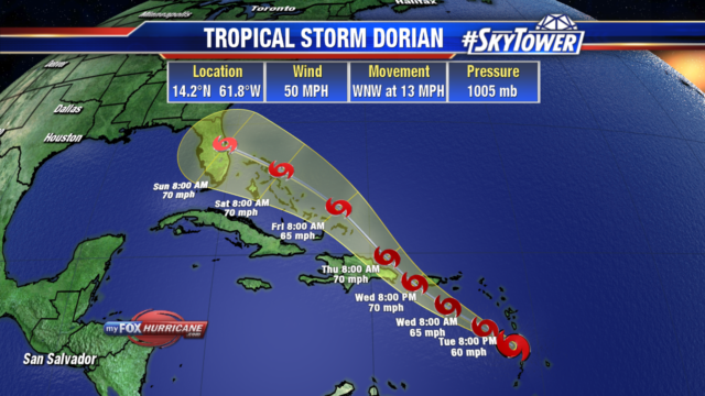
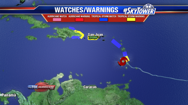
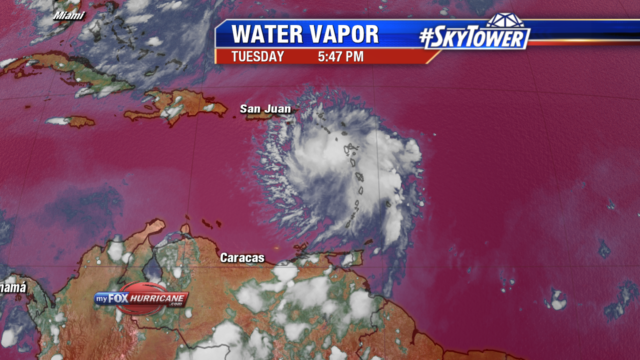
As of the 5pm update, Tropical Storm Dorian’s track has shifted a bit more to the northeast. This brings the storm through the northeastern Caribbean Sea tonight and then over or near western and central Puerto Rico on Wednesday. The center would pass just east of the Dominican Republic Wednesday night. Heading into Friday, Dorian would near the Turks and Caicos and then the Bahamas. It currently has 50 mph winds and is moving WNW at 13 mph. A shift more to the northwest is expected tonight.

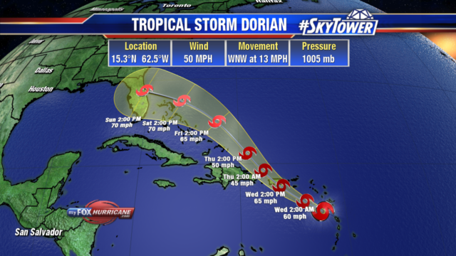
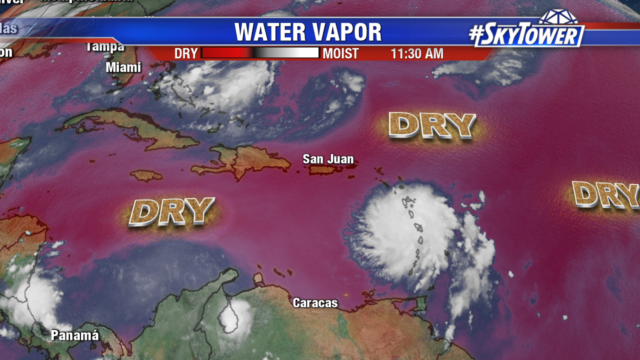
Dorian is expected to slowly strengthen as it nears Puerto Rico, nearing hurricane strength. Heavy rain of 4-6″ with locally 8″ totals could lead to flash flooding. The storm is currently battling dry air which is being pulled into mid levels, this is keeping the storm from quickly intensifying. After interacting with the higher elevations of Puerto Rico, it is expected to briefly weaken before conditions become favorable once again for restrengthening. It will be moving into more moisture, warmer water and lower wind shear as it nears the Bahamas.

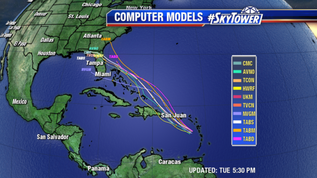
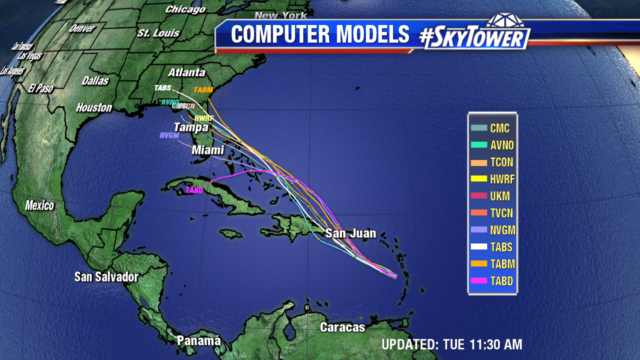
There is low confidence in the intensity forecast once it passes Puerto Rico as the models are showing a range of possibilities. A turn towards Florida’s east coast is looking more likely, but it is still several days out. The average margin of error with a 5 day forecast is over 200 miles. Even though the path and intensity could change, residents in the Turks and Caicos, Bahamas and Florida’s east coast should have a hurricane plan in place and monitor the storm closely.

Tropical Storm Dorian Headed Towards Hispaniola & Puerto Rico

All eyes are on Tropical Storm Dorian as it continues WNW headed towards Puerto Rico & Hispaniola. Dorian passed over St. Lucia earlier this morning with some disruption to its winds, but overall it is in better shape than this time yesterday.

Currently the storm has 50 mph winds and is moving WNW at 13 mph. The current track has the system moving right through the space between Puerto Rico & Hispaniola. Although there will be land interaction on this path, it won’t have the same weakening effect we would see if it passed over the higher terrain in the Dominican Republic. Staying over the water would give it a better chance of holding together before it moves into an area with even more moisture.

Dorian is currently surrounded by dry air, which is hindering any significant quick development. Hurricane Hunter found some of the dry is now working its way into the system.

Tropical Storm Warnings as well as Hurricane Watches are in effect for Puerto Rico and the Dominican Republic. Puerto Rico could begin seeing tropical storm or even hurricane conditions as early as tomorrow, the Dominican Republic by Wednesday night. These areas are looking at 4-6″ of rain with isolated amounts of 8″ which could lead to life threatening flash flooding. Dangerous swells are expected to begin on Wednesday.

It is too early to tell what impacts we will see in Tampa, we are in the wait and see period. The amount of land interaction Dorian encounters as it passes over the Greater Antilles will have significant effects on its strength. There is still wide model spread in the track moving into the weekend.

Tropical Depression 6 remains in the Atlantic with 35 mph winds. Little motion is expected today. It will begin to move north and then northeast on Wednesday. Its path will stay well off the East Coast through the rest of the week. It will likely become Tropical Storm Erin later today or Wednesday.