Dorian Continues To Strengthen; Exact Track Still Uncertain

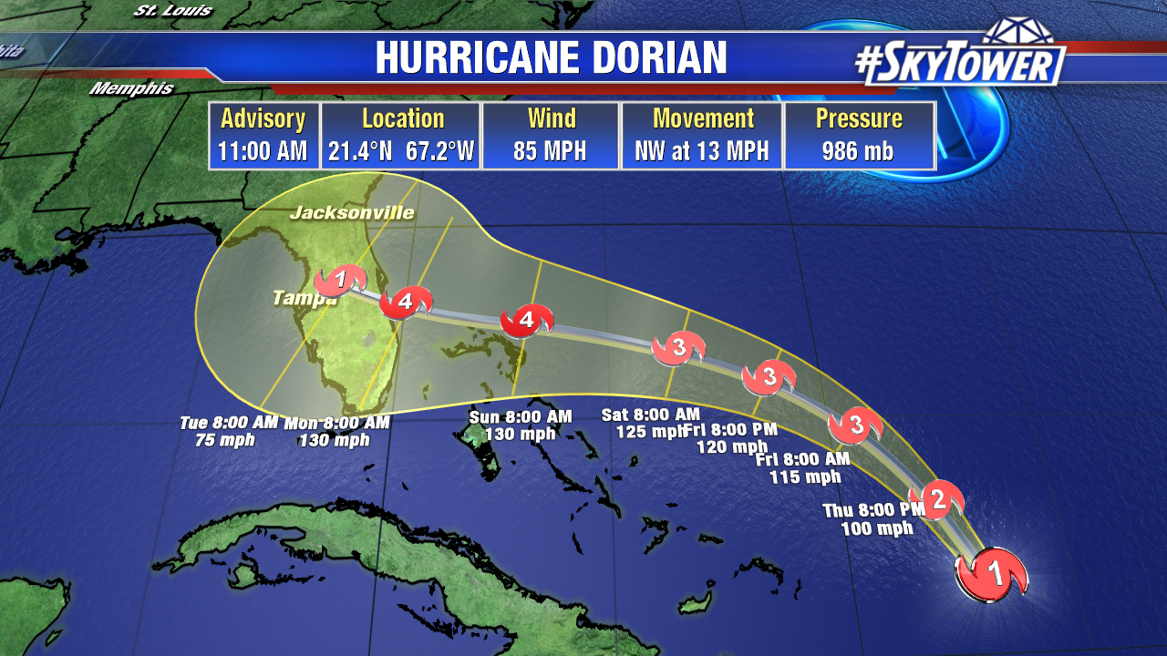
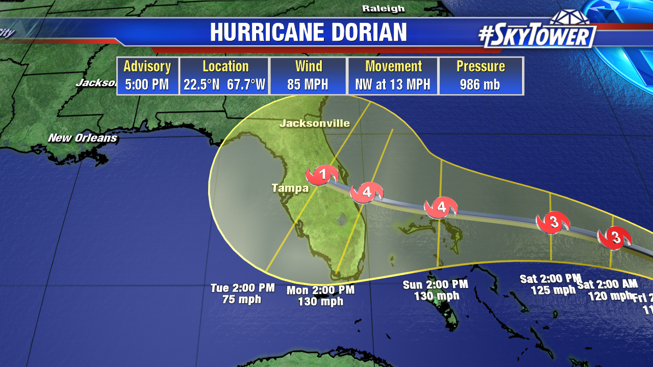
As of 5pm Thursday, max winds are sustained at 85 mph. The storm was moving northwest at 13 mph. Hurricane Dorian will be steadily strengthening going forward as it moves over very warm water, and takes advantage of low wind shear and a lack of dry air.

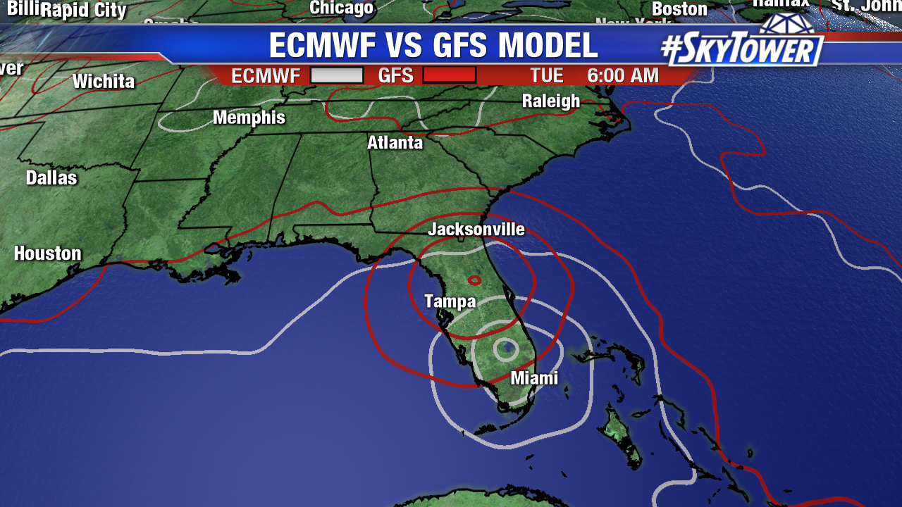
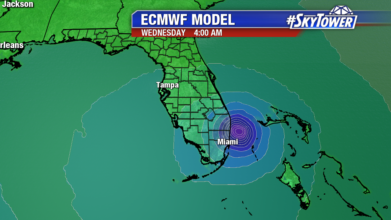
This afternoon’s model runs have unfortunately provided us with more questions than answers. In particular, the latest ECMWF run take the storm further south, slows it to a crawl with landfall in South Florida before riding up the East Coast of the state.

Forward speed is really a big factor. The slower Dorian moves toward Florida, the more likely it is to find a weakness in the ridge and turn north. If it moves faster, the ridge will likely keep it on a westerly track into Florida.

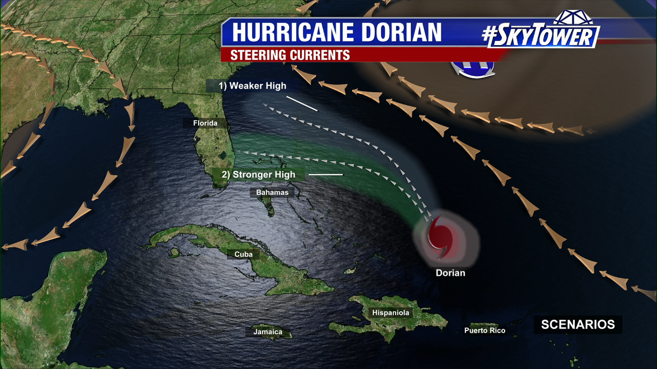
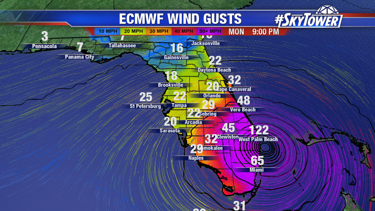
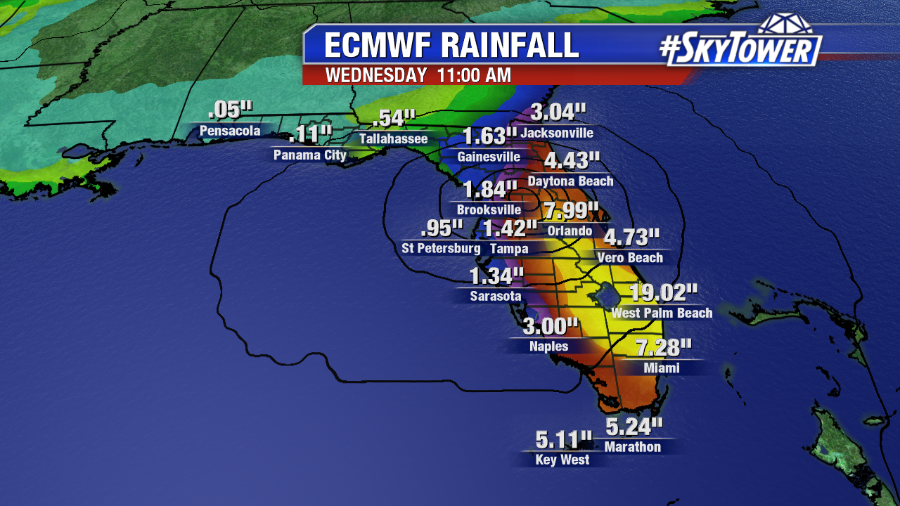
The one thing we have to understand here is that the atmosphere behaves like a fluid. There’s a lot of cause and effect, in regards to several different variables, that will ultimately decide where Dorian will end up and when. Until models get a better handle on things and more consensus on a particular solution, which should happen over the next 48 hours or so, we can’t nail down local impacts. Right now, especially along Florida’s East Coast, folks need to be preparing for the possibility of a major hurricane landfall some time early next week.

Dorian Strengthening; Sights Set On Florida

Dorian remains a healthy category 1 hurricane. Pressure continues to fall and wind speeds will be increasing going forward. As of 11am Thursday, the storm was located about 220 miles NNW of Puerto Rico. Movement to the NW will continue for roughly another 24 hours before Dorian takes a turn more to the west toward the Bahamas and Florida. The latest track from the National Hurricane Center has Dorian making landfall as a Category 4 hurricane on Florida’s East Coast.

While it’s still too early to nail down exactly where the storm will come ashore, models have certainly come into a little better agreement in the last 24 hours. Consensus right now seems to be a landfall somewhere between Cape Canaveral and West Palm Beach. Obviously, that’s still a fairly large spread, but it will shrink over time.

The exact track will determine who sees what, especially in regards to storm surge and the highest winds. For now, anyone along Florida’s East Coast should be preparing for a major hurricane making landfall. Inland threats will range from hurricane-force wind gusts, to freshwater flooding, to tornadoes. We will be able to pinpoint local impacts as Dorian draws closer in the coming days. Stay tuned.