Dorian Intensifying Rapidly; Track Near Florida Still Uncertain

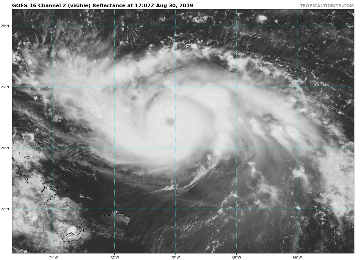
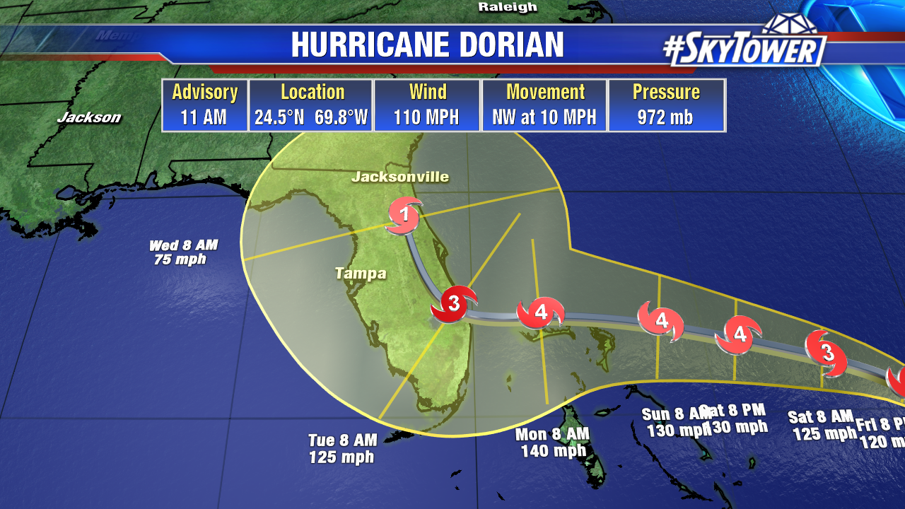
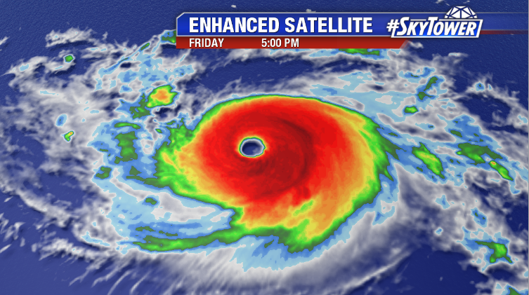
Hurricane Dorian is kicking it up a notch this evening. Latest satellite imagery is that of a very healthy category 3 hurricane, which looks to be well on its way to becoming a category 4 later this evening or overnight.

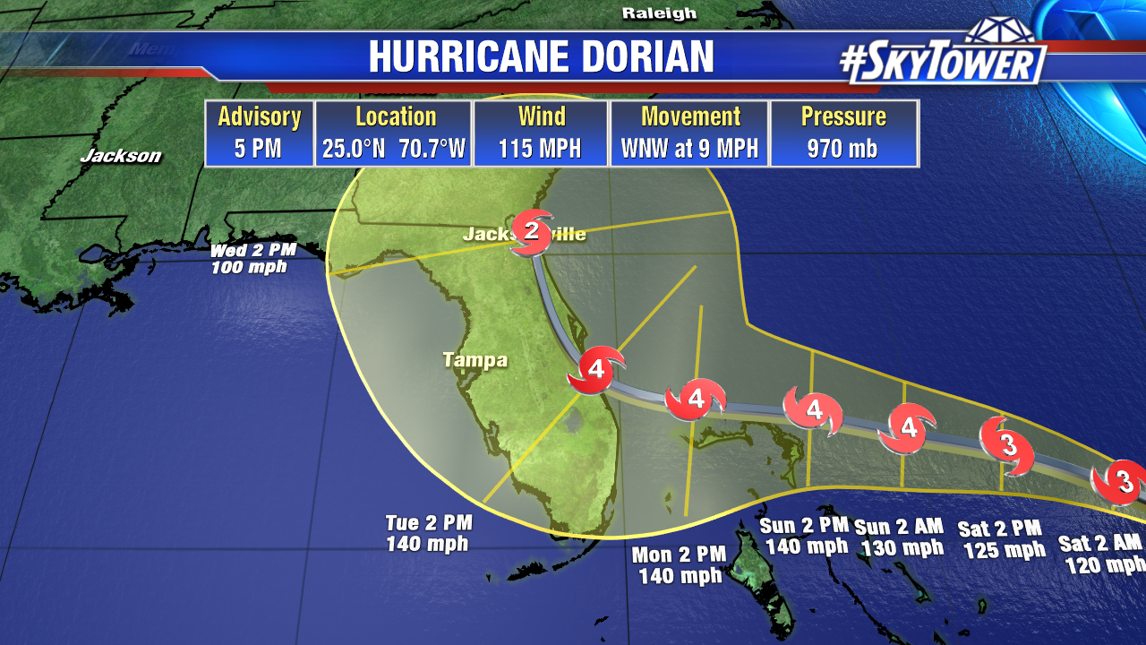
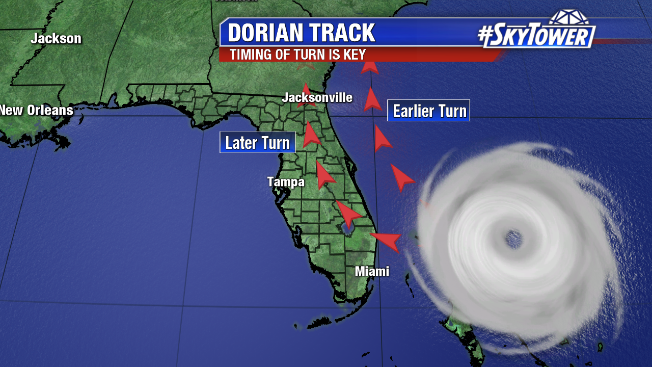
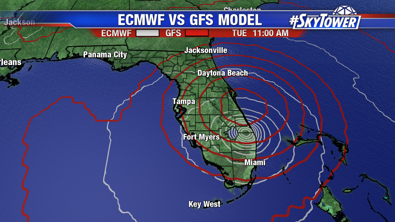
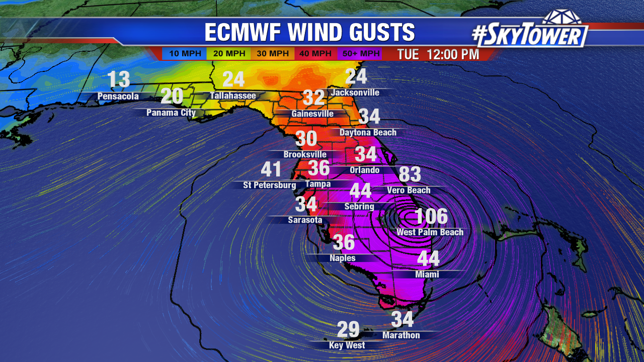
In the 5pm advisory, the National Hurricane Center nudged the track slightly to the east. This in response to afternoon model guidance, which suggested an even slower moving storm and an earlier turn to the north. The afternoon ECMWF model run in particular kept Dorian off of Florida’s East Coast altogether. The clustering of the majority of the ECMWF ensembles (51 versions of the same model) has noticeably shifted east as well.

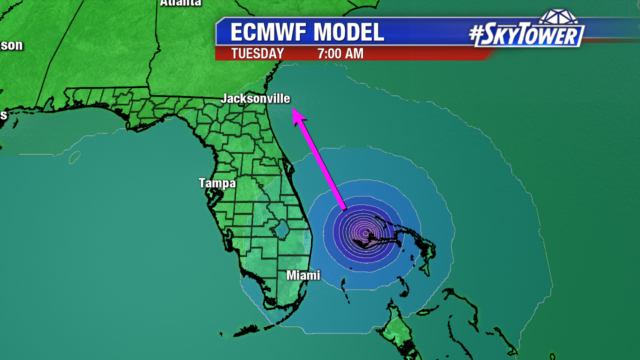
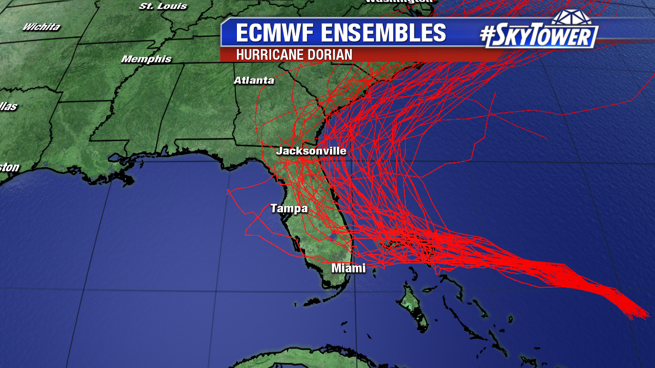
It’s one run of one model, but it’s a subtle trend that has become more apparent over the last day or two. By no means should we let our guard down, but it’s a promising sign that we’ll hope to continue in future model runs.

Model runs in the next 24 hours will be very telling. We’re optimistic at this point, but that optimism will only continue if we have more model consistency and consensus. Stay tuned, and stay prepared.

Dorian Will Become A Major Hurricane Later Today

As of the 11am advisory from the National Hurricane Center, Hurricane Dorian had winds max winds of 110 mph – nearly a category 3 storm. A small eye is now visible. Intensification should continue over the next few days.

Dorian should start take on more of a WNW motion through the weekend as it moves toward the Bahamas and Florida. Latest runs of the GFS and Euro are in much better agreement in regards to track, with landfall in South Florida on Tuesday somewhere between Vero Beach and West Palm Beach.

Keep in mind, while we have some agreement now, these are simply two singular model runs. The takeaway for now is that we expect a turn toward the Bahamas and Florida this weekend, followed by a turn to the north on Monday or Tuesday. That will end up being the difference between Dorian moving up I-95 and the storm staying offshore and paralleling the coast, and as a result a huge difference in regard to impacts.


We’ll be looking for continued agreement and consistency as we go forward, and when our confidence rises in that numerical guidance we can start talking about specific impacts. For now, as we’ve said that last couple days, all of Florida’s east coast needs to be preparing for a major hurricane.

Below: 00Z ECMWF model run valid at 12pm Tuesday.