Life-Threatening Hurricane Dorian Nearing Northwestern Bahamas

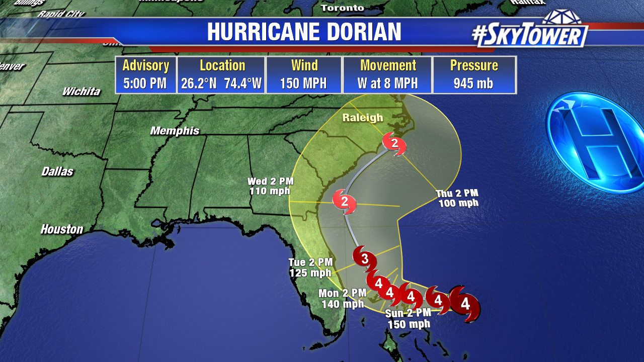
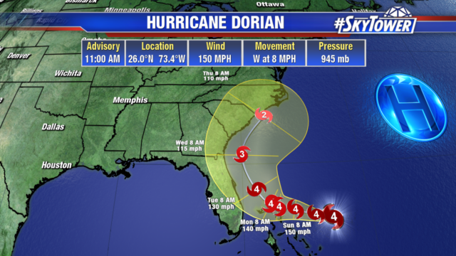
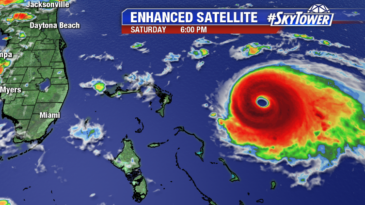
As of 5pm Saturday, Hurricane Dorian was located about 170 miles east of Great Abaco Island in the Bahamas. Max sustained winds are at 150 mph, with gusts to 185 mph. Hurricane-force winds extend out up to 30 miles from the center. Dorian should be nearing the northwestern Bahamas on Sunday afternoon.

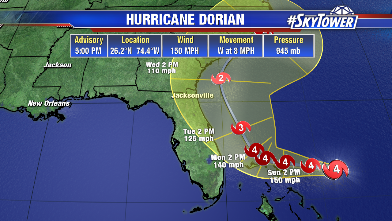
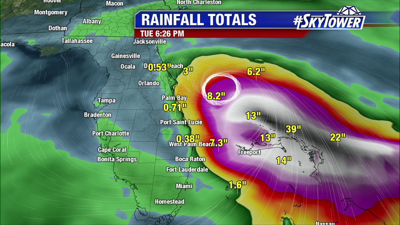
Not only is this a life-threatening hurricane, but it will be moving painfully slow once it reaches the islands. It’s quite possible, some of the northwestern Bahamas will be dealing major hurricane conditions for up to 48 straight hours, before Dorian finally picks up speed again and makes the turn north (Tuesday into Wednesday). Catastrophic damage from wind and surge, in addition to potential for up to 3 feet of rain, is becoming more and more likely in the Northwestern Bahamas.

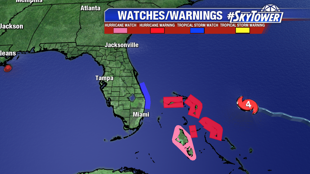
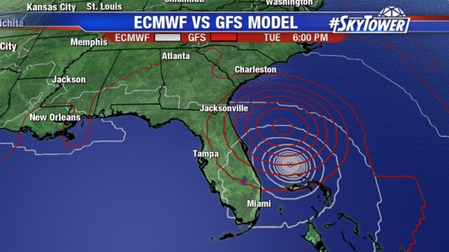
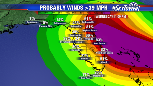
Our confidence in Dorian’s track has continued to increase today. Nearly all reliable model guidance continues to show a turn north after reaching the Bahamas, with many keeping the storm 100+ miles off of Florida’s East Coast. In this scenario, tropical storm force wind gusts and some coastal flooding would still be possible along the coast. Obviously, with a storm a powerful as Dorian there is no margin for error. At this point, we are cautiously optimistic that a Florida landfall will be avoided. However, until we see the northward turn happen, folks along the East Coast of Florida, especially from West Palm Beach northward, need to stay prepared.

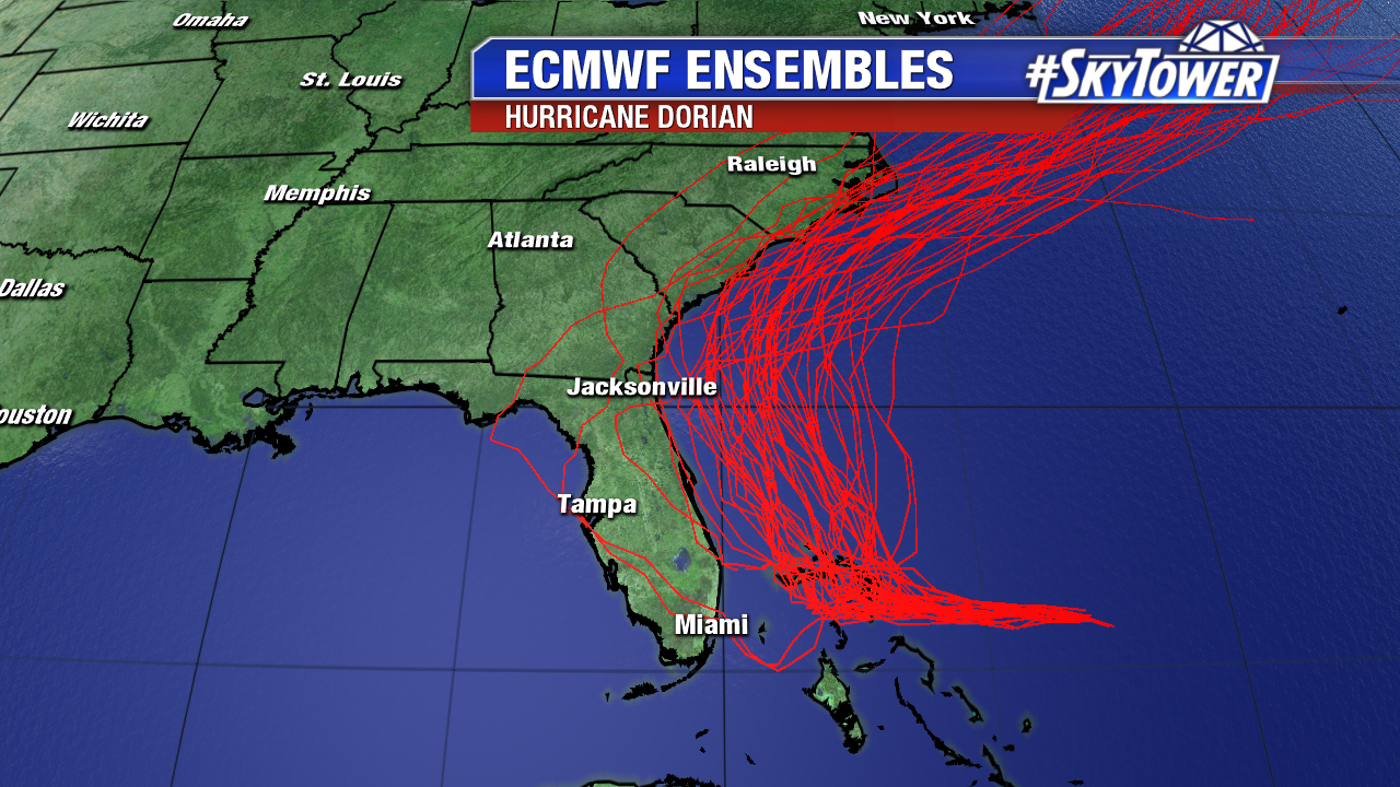
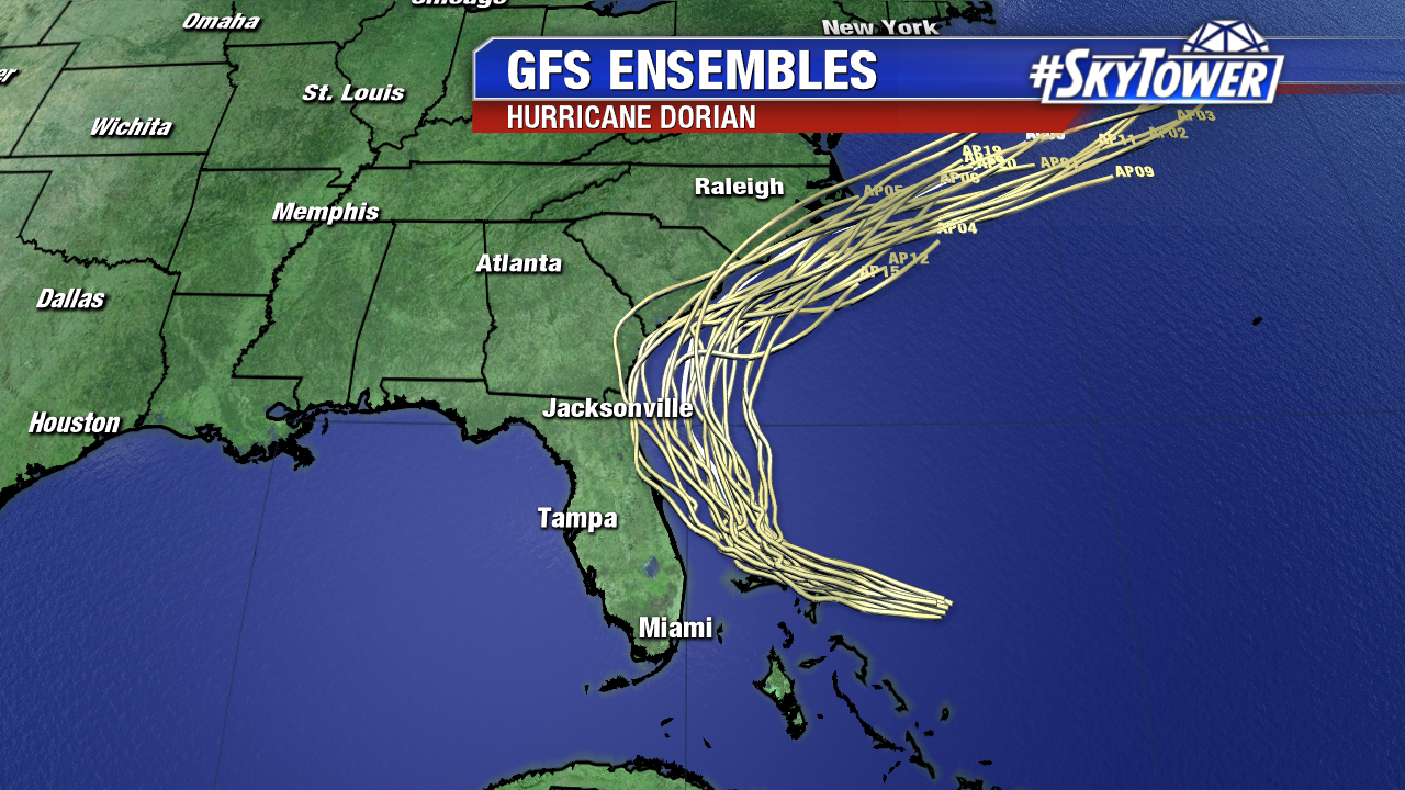
Further north, along the coast of Georgia, South Carolina, and North Carolina, there is the possibility of significant impacts from Dorian later in the week. A track offshore is possible here as well, but there is a little less model consensus at this point. Folks in these areas need to be monitoring the progress of Dorian closely in the coming days.

Dorian’s Track Continues to Shift East

As of 11am, Dorian is a category 4 hurricane with 150 mph. Its wind speeds have increased 10 mph since 5 am this morning. The powerful storm will continue heading west towards the northwestern Bahamas where steering flow breaks down causing the storm to slowly cross the islands.  Impacts include: 10-15″ of rain, isolated 25″ totals, life threatening storm surge 10-15 ft above normal tides in areas of onshore winds. They will begin to feel impacts tomorrow into early Tuesday morning.

Once Dorian turns north, it will pick up speed and on the current track the center looks to remain offshore. We have been seeing this eastward shift from models since yesterday and they continue to be in agreement on the turn taking place over water. Can’t give the all clear just yet, even though Tampa is out of the cone of uncertainty, it still includes the east coast of Florida. It is looking more and more likely Dorian will track over the Atlantic and near the Carolina Coast. The risk of strong winds and dangerous storm surge is increasing along the coasts of Georgia, South Carolina and North Carolina during the middle of next week.

Dorian is forecast to maintain its strength and could strengthen even more as it moves into an area of lower wind shear and over very warm water.

Our most reliable models continue to come into better agreement keeping the center offshore. They differ in speed, with the GFS moving Dorian north faster than the Euro.

The shift to the east continues to lessen the impacts we will likely see in Tampa. The further Dorian passes to the east, the weaker winds we see and less rainfall. The east coast is not out of the woods as storm surge is still a concern for them. Dorian will increase wave heights and push a lot of water along the coastline. The highest wind speeds are on the right side of the storm and those are more likely to stay over water on its current projected path. But the east coast could still see Tropical Storm Force or even category 1 & 2 winds as Dorian passes by.

A new area to watch has developed in the eastern Atlantic. A tropical wave coming off the coast of Africa is entering into a favorable environment and may become a tropical depression next week. The wave is disorganized but producing a large area of showers and a few thunderstorms. Heavy rainfall is possible in the southern Cabo Verde Islands.