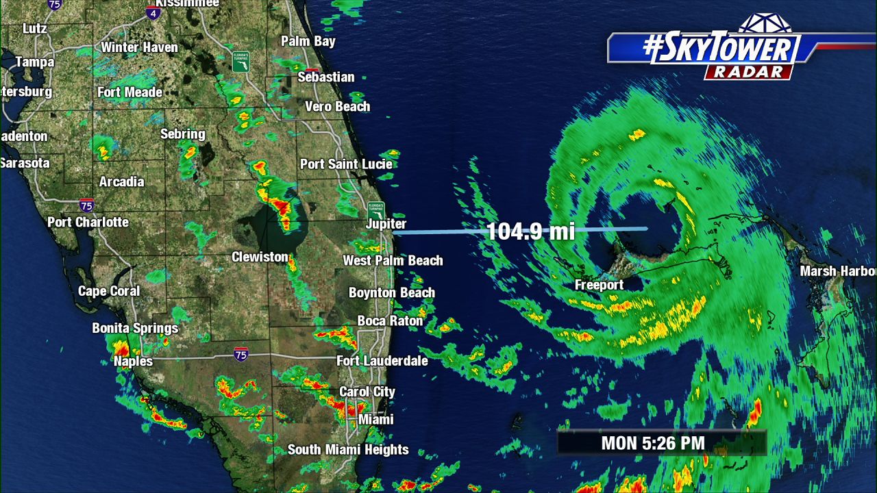
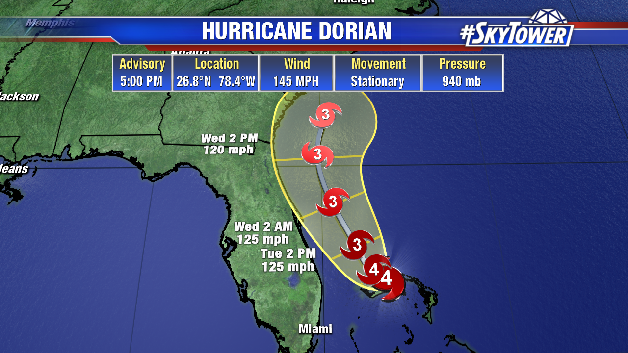
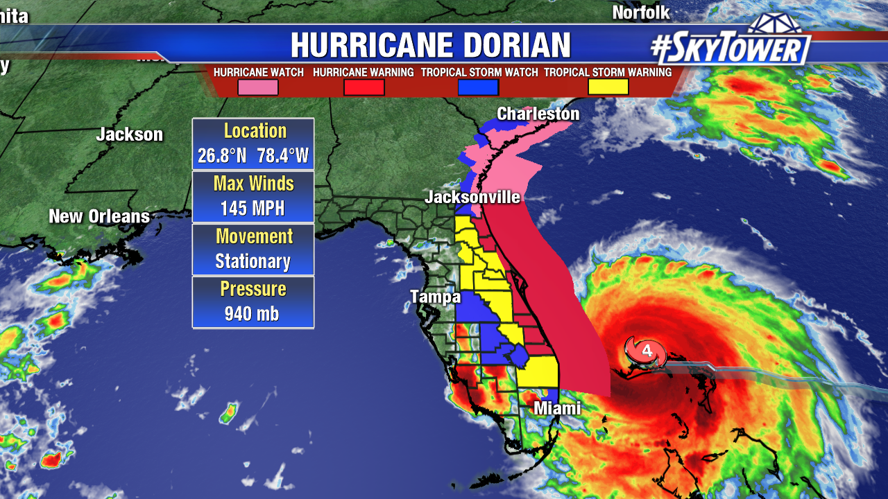
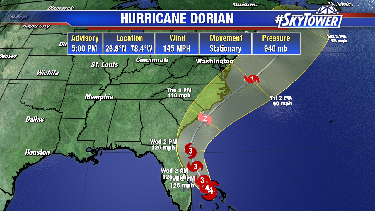
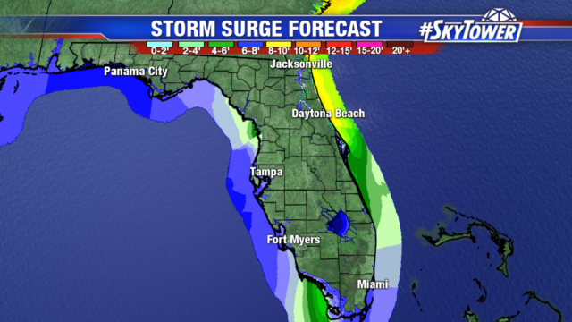
Dorian has weakened to a category 3 hurricane with 120 mph winds and higher gusts. Even though Dorian is no longer a category 5, it is still a powerful and dangerous hurricane. Hurricane force winds extend out 45 miles from the center and tropical storm winds extend out 160 miles.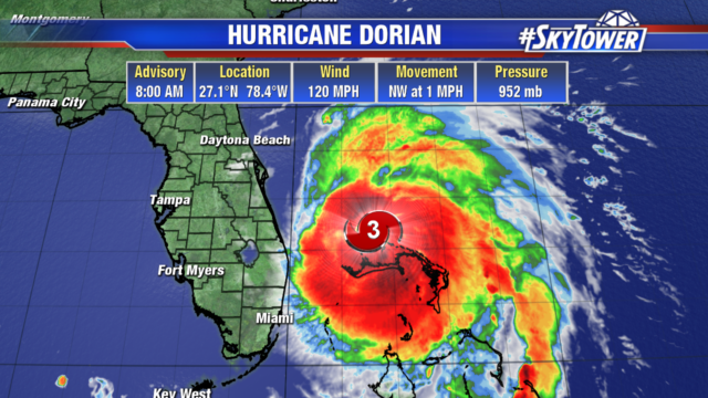 After a day sitting over Grand Bahama Island, Dorian is expected to make its northwestward turn today and begin moving. A trough heading to the east coast will steer Dorian to the north, paralleling Florida’s east coast. There is the potential for the Dorian to not make landfall in the lower 48, but there will still be storm surge along the east coast of Florida, Georgia, and the Carolinas.
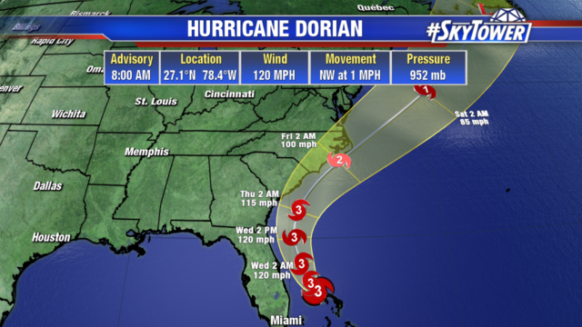
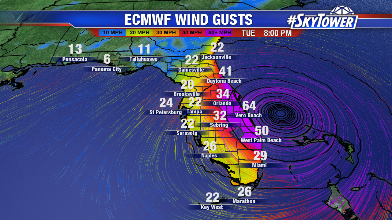
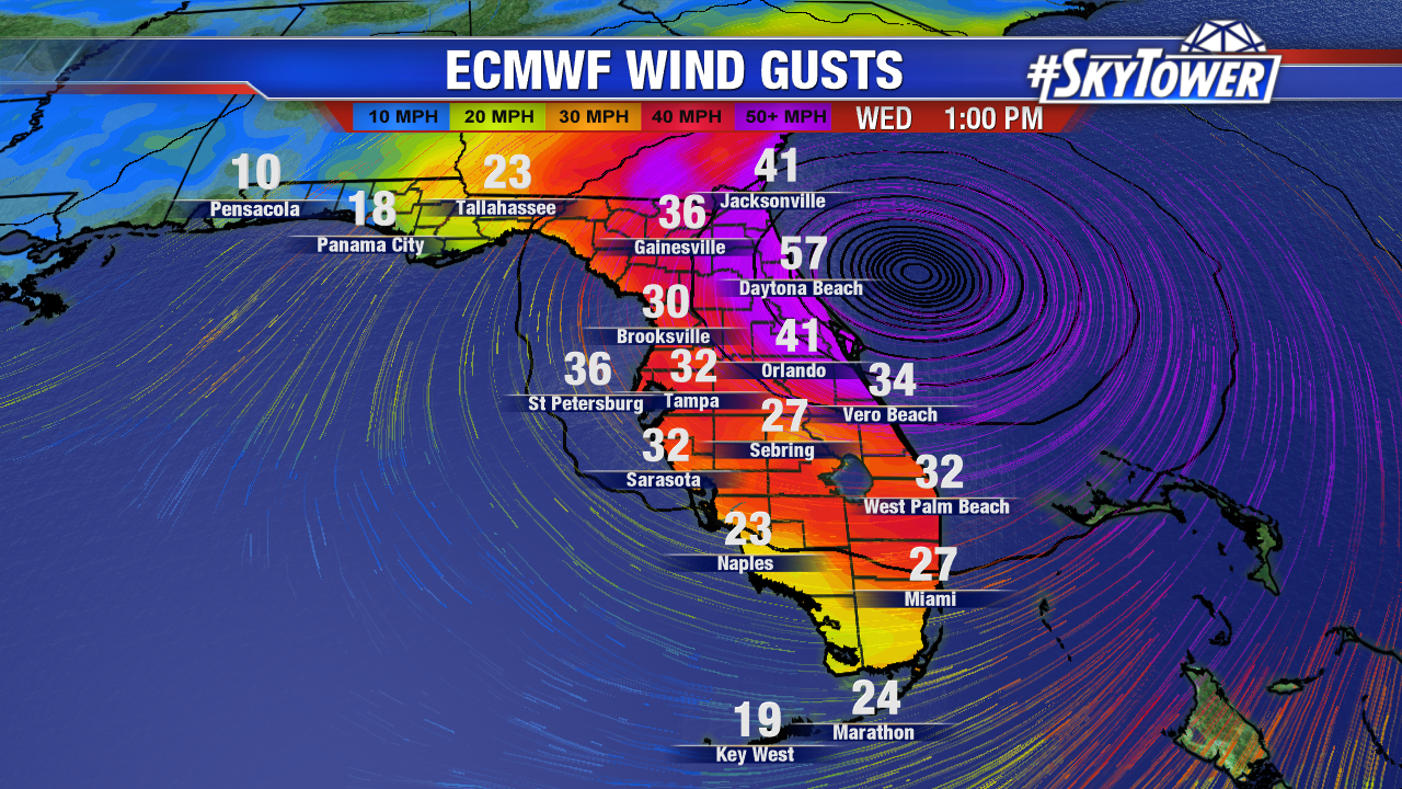
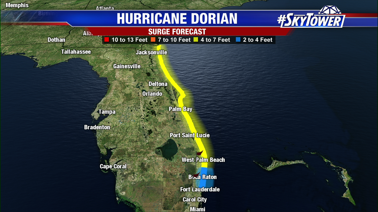
Even though the current track keeps the eye and therefore strongest winds offshore, the east coast will be impacted by storm surge and big waves. Beach erosion and coastal flooding is expected, much like the conditions the east coast saw when Matthew passed by the state. Some tropical storm force wind gusts are possible in eastern Polk and Highlands counties. Tampa will see breezy conditions today with scattered showers and storms.
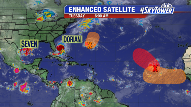
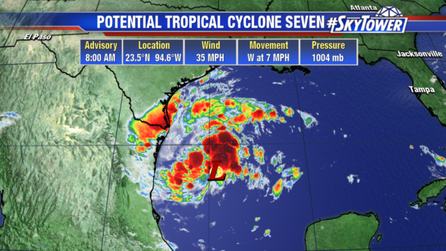
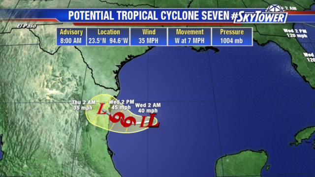
We are in the peak of hurricane season and monitoring other areas in the tropics. We will likely see potential tropical cyclone 7, which is sitting in the southwestern Gulf become a Tropical Storm by tonight. It currently has 35 mph winds and is expected to bring 6-12″ of rain to parts of Mexico.
The trough of low pressure well east of Dorian could become a tropical depression by Thursday as it heads northward. After that, conditions are less favorable for development. Interests in Bermuda should monitor its progress. The area in red is another tropical wave likely to become a tropical depression later today. It will head northwest in the tropical Atlantic. Another wave (in orange) is forecast to emerge off the coast of Africa and could develop into a tropical depression late this week or weekend. It will move west to west-northwestward.