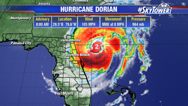
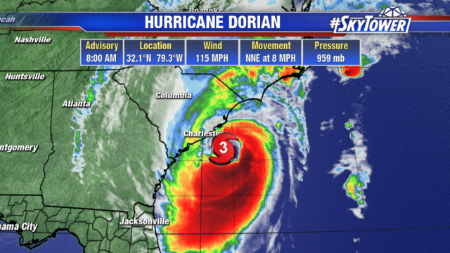
Dorian is sitting just off the South Carolina coast with 115 mph winds. The storm strengthened as it moved over the warm waters of the Gulf Stream. Rain and storm surge are already impacting Georgia and the Carolina coastlines. North Carolina has seen numerous tornado warnings this morning as rain bands wrap around the storm and move into the state.
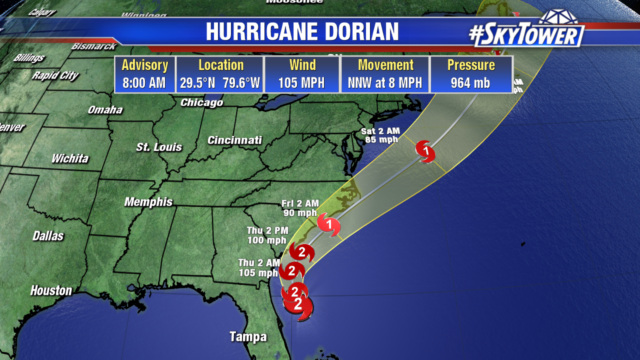
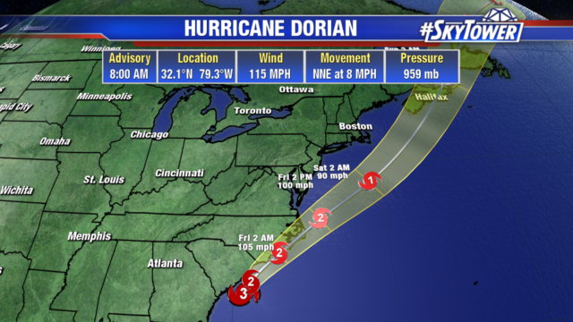 Hurricane force winds may impact the Carolinas into Friday. Dorian is expected to take more of a northeastward turn tonight and pick up speed on Friday, coming very close to the North Carolina coastline.
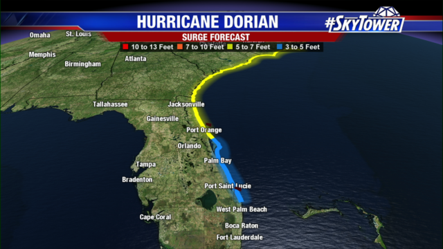
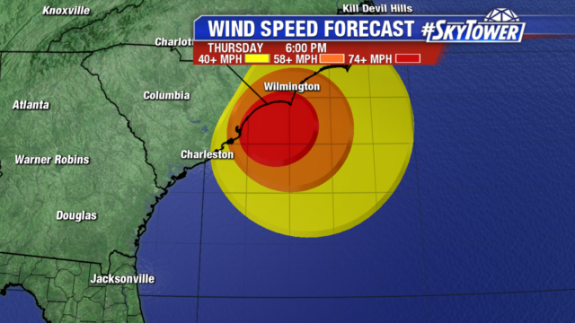 There will be some fluctuations in intensity today followed by a slow weakening through Saturday. Storm surge of 10-12 ft is possible south of Myrtle Beach. Wilmington could see 8-10 ft surge. They are also looking at 6-12″ of rain with isolated 15″ totals.
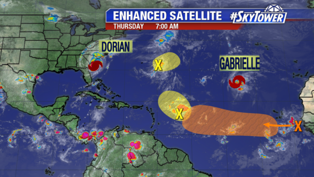
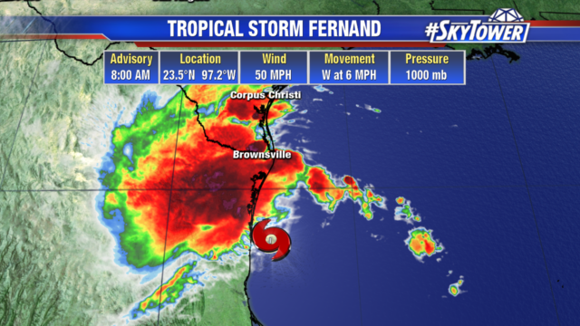
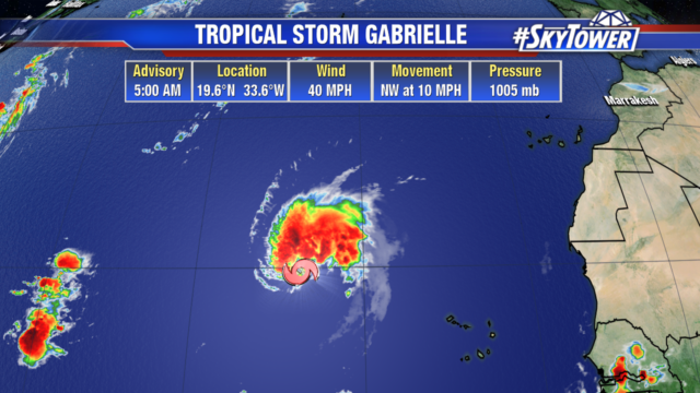
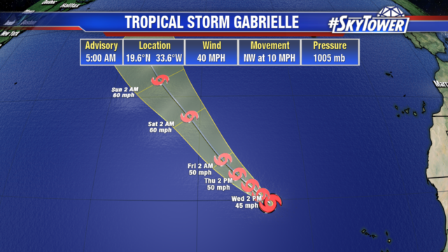
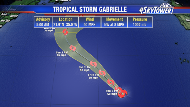
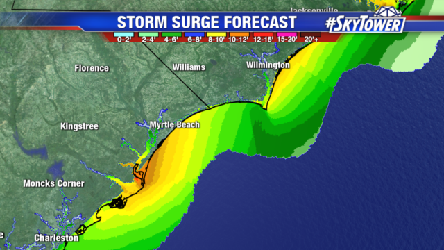 What was Tropical Storm Ferdnand has dissipated as it moved over Mexico yesterday. Tropical Storm Gabrielle remains poorly organized with 50 mph winds. It is not expected to strengthen as it remains in an area of dry air and wind shear. But this weekend conditions become more favorable. It will continue moving northwest in the open Eastern Atlantic not affecting any land masses.
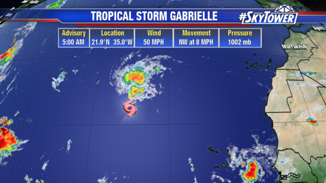
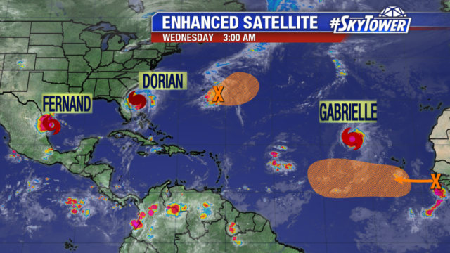
 This disturbance in yellow northeast of Dorian that we have been watching is entering more unfavorable conditions and likely won’t develop. It will remain over the Atlantic, with no impact to the United States. We are still expecting the wave off the coast of Africa in orange to develop into a tropical depression early next week. We will monitor its westward movement in the Atlantic, but it is still several days away from impacting any land areas. There is minimal chance, only 10% of development for the area of low pressure in yellow to the east of the Leeward Islands. It will slowly move northwest.