Dorian Headed to Canada Today; Watching a Wave in the Tropics

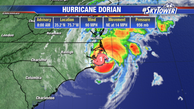
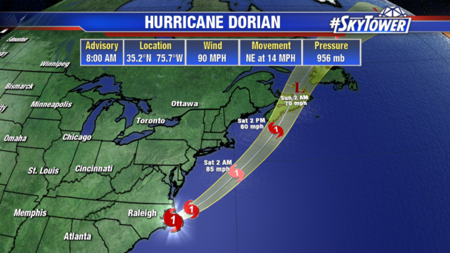
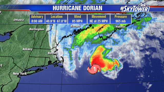
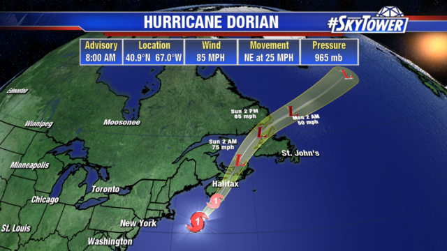
Dorian is still a category 1 hurricane with 85 mph winds. Eastern Canada will begin to feel impacts today as the storm quickly moves northeast at 25 mph. Dangerous storm surge and hurricane force winds will move into the Gulf of St. Lawrence, southwestern Newfoundland, and eastern Nova Scotia today. Hurricane force winds extend out 105 miles from center and tropical storm force winds extend out 310 miles. Nantucket Shoals, Massachusetts is seeing gusts of 80 mph and 51 mph gusts are occurring in Sagamore Beach.

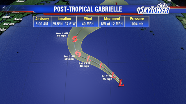
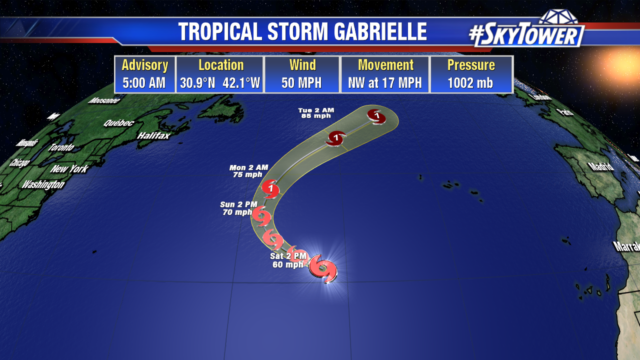
Gabrielle is once again a tropical storm with 50 mph winds. The storm will turn to the northeast and stay out over the open Atlantic not affecting any land areas.

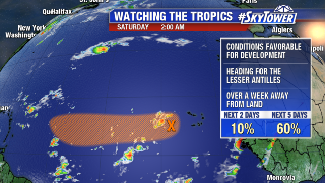
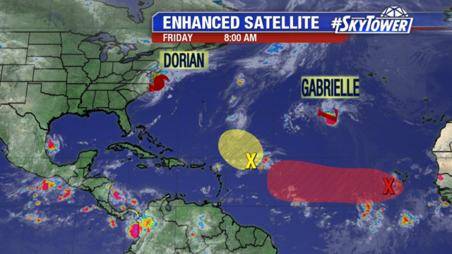
The tropical wave we have been watching is now several hundred miles west of the Cabo Verde Islands. It is still a disorganized area of showers and storms. It will enter into a more favorable environment and may become a tropical depression by the middle of next week. It is heading west towards the Leeward Islands, but it will still be over a week before it impacts any land areas.

Dorian Makes Landfall in Cape Hatteras; Watching Other Areas in the Tropics

Dorian is a category 1 hurricane with 90 mph winds, bringing heavy rain, strong winds, and surge along North Carolina’s east coast. It made landfall in Cape Hatteras at 8:35am this morning for about 20 minutes at half the strength the Bahamas saw. The storm is moving NE at 14 mph and will be out in the Atlantic by this evening and headed up towards Nova Scotia this weekend.

Tropical Storm Gabrielle is now Post Tropical Storm Gabrielle with 40 mph winds. It is expected to gain some strength as it moves northwestward in the open Atlantic. Gabrielle is no threat to any land areas.

We are still monitoring 2 other areas in the tropics. The area in yellow is a disorganized tropical wave with minimal chances of development over the next 5 days. If any strengthening occurs it will be slow as the area moves northwestward. The tropical wave in red off the coast of Africa, isn’t expected to develop over the next 2 days. But conditions become more favorable early next week and a tropical depression may form. The Cabo Verde Islands will see enhanced rainfall today before the wave moves westward in to the Atlantic.