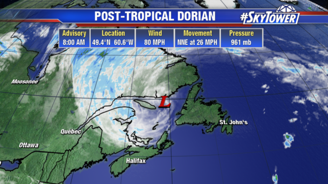
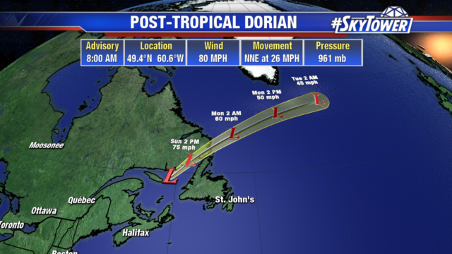
It’s been a flurry of activity in the Atlantic over the last couple of weeks. We had Dorian, Erin, Fernand, Gabrielle, and now a few new areas to watch.

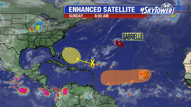
The wave just north of the Dominican Republic will drift across the Bahamas and Florida later this week, boosting rain chances, but not doing much more.
The area of disturbed weather in the Central Atlantic – being deemed Invest 94L – has a window for some gradual development over the next 2-3 days before encountering some hostile areas of higher wind shear. There just isn’t much model support for significant development of this, but it will likely bring some tropical downpours to parts of the Caribbean by the weekend.

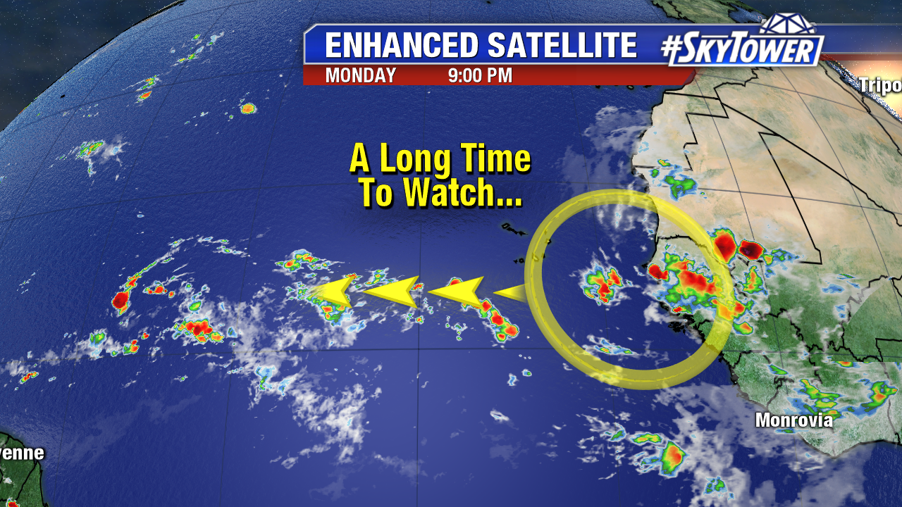
This leaves us with the wave currently coming off the coast of Africa. It’ll likely be one to watch down the road, but it’s a long way away. It’ll be moving over open ocean over the next several days, likely not nearing the Caribbean for about a week.
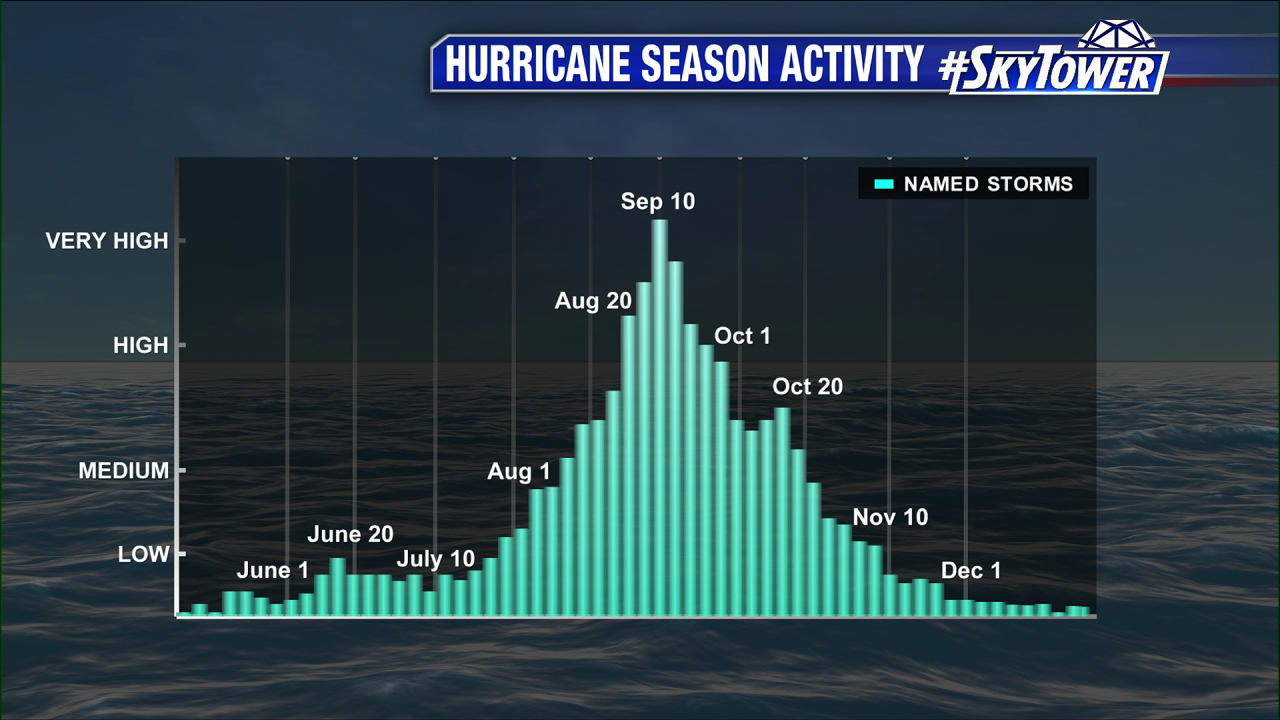
The hurricane season officially peaks tomorrow, September 10th. Think of it as the ‘Hump Day’ of the hurricane season. There’s still some time to go before we’re home free, so to speak. We’ll be here with you the rest of the way!