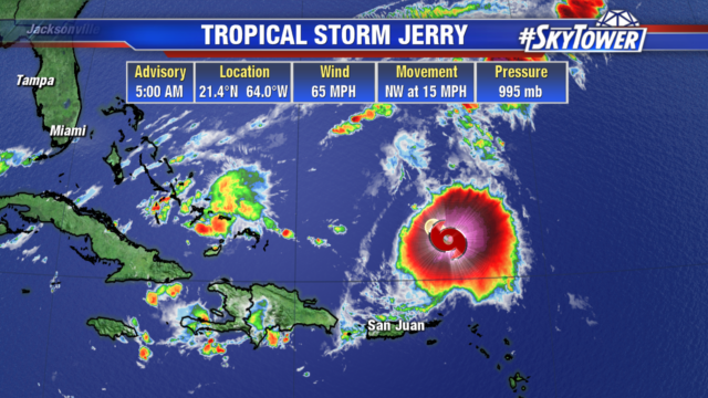
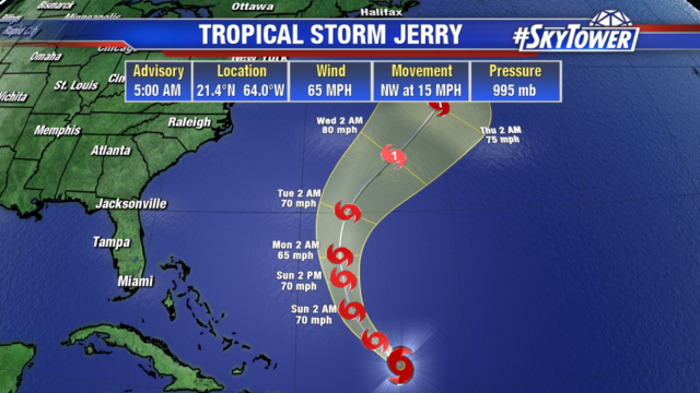
Wind shear has weakened Jerry to a tropical storm with 65 mph winds. Locally heavy rainfall is still possible over the Northern Leeward Islands and Puerto Rico today. The storm will pass well east of the southeastern Bahamas on Sunday and then turn north into the Atlantic on Monday. Jerry could strengthen back into a hurricane next week as it nears Bermuda.
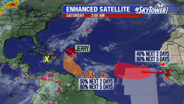
The tropics are still very active. A disturbance over Cuba will bring heavy rain to the area this weekend, but development is not likely. Another wave several hundred miles east of the Windward Islands has a 60% chance of development over the next 5 days. The wave we are keeping a close eye on has yet to come off the coast of Africa. It could become a tropical depression by early next week. Still a long time to watch.
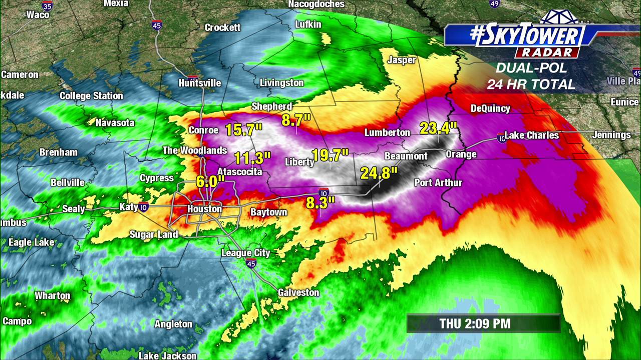
Due to Tropical Depression Imelda, a life-threatening flooding situation has been unfolding over parts of Southeast Texas in the last 24 hours. Reminiscent of Harvey just two years ago, 3-day rainfall totals now exceed 3 feet in the hardest hit areas in and around Beaumont, Texas, with more than 2 feet of that total falling Wednesday night and Thursday morning. Water rescues are ongoing in these areas. The heavy rain should come to an end by Thursday night, but showers will persist through the day on Friday.
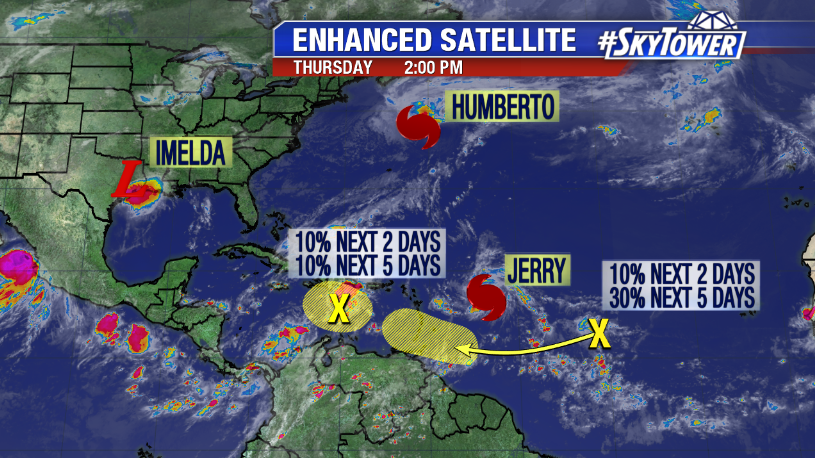
In the Atlantic, activity remains high. Hurricane Humberto passed north of Bermuda last night bringing a period of hurricane-force winds, heavy rain, and minor storm surge to the island. The storm is now heading north into the North Atlantic shipping channels.
Jerry is now a hurricane, and is located about 435 miles east of the Leeward Islands. There is a window for further strengthening today, but an increase in wind shear is expected tonight into tomorrow. This should weaken the storm a bit heading into the weekend. We have fairly good model agreement at this point that Jerry will continue on a west-northwest track into the weekend, passing just north of the northern Leeward Islands and Puerto Rico before making a turn to the north. It should be noted though that if the system is able to maintain its intensity, a track much closer to or over these islands would be possible. In regards to the Bahamas, and southeastern U.S., impacts are unlikely at this point. However, we’ll be watching Jerry closely through the weekend and will keep you updated if anything changes.
An area of disturbed weather south of Hispaniola is unlikely to develop thanks to high wind shear, but it will bring periods of heavy rain to the Dominican Republic, Haiti and eastern Cuba over the next few days. This moisture is also likely to increase rain chances over parts of South Florida and the Keys this weekend.
Additional tropical waves continue to roll off the coast of Africa that will need to be monitored over the next couple of weeks.