Tropical Storm Karen Heading For Puerto Rico and Virgin Islands; One To Watch Over The Next Week

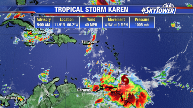
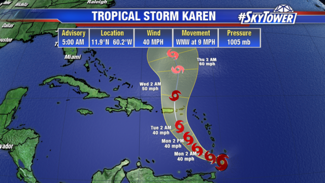
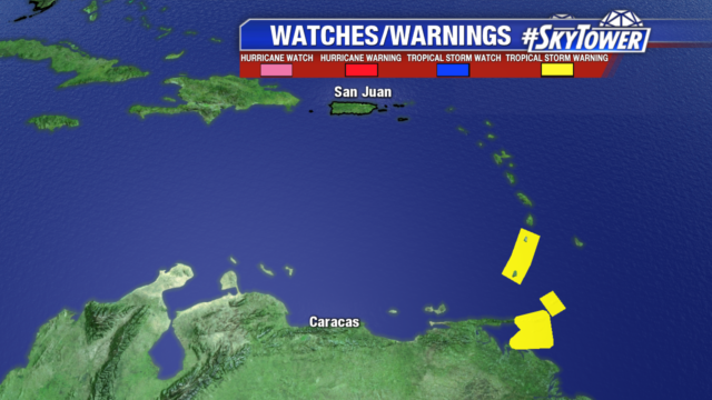
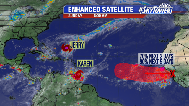
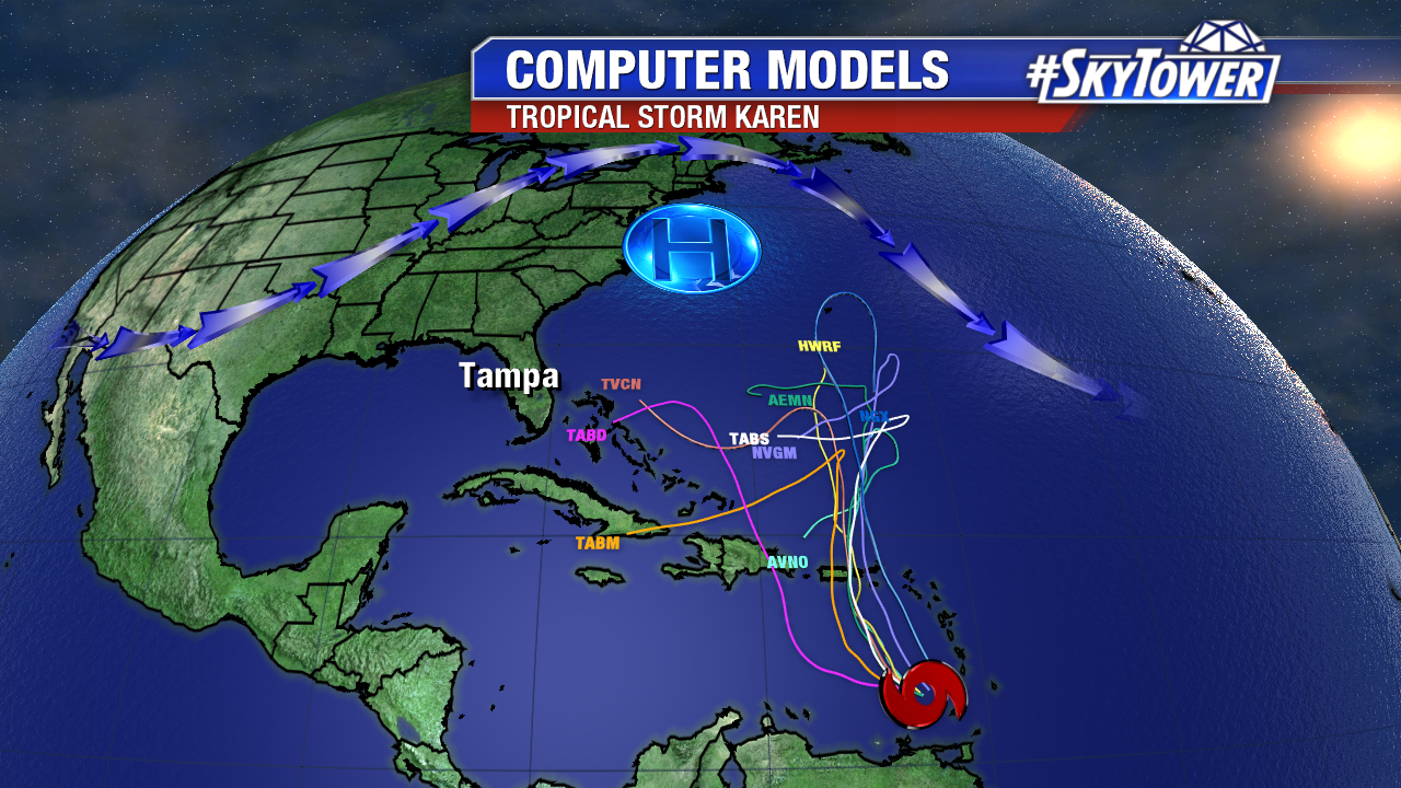
Karen is not a healthy looking storm this evening. Just about all of the convection is displaced south of the center of the storm for now, and wind shear will be increasing over the next 24 hours as it moves north toward Puerto Rico. This is good news for that island and the Virgin Islands, as Karen should remain a weak storm as it moves through on Tuesday.

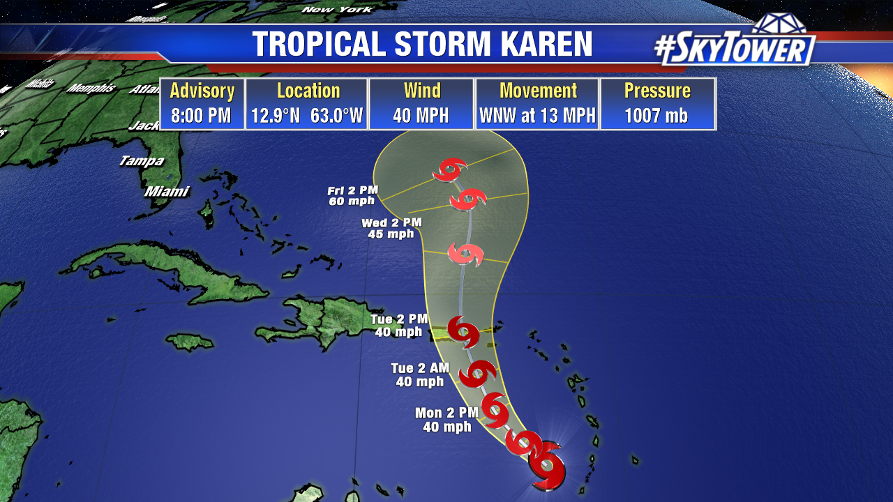
Once the system moves north of these islands by the middle of the week, things get interesting. A strong ridge developing to the north will likely keep the door closed, so to speak, for a track out to sea. So, it’s quite possible a westward turn happens and we end up with a storm heading toward the Bahamas and Florida about a week from now. That’s a long time when it comes to tropical forecasting, and things can and likely will change. We’re not at the point yet where this is something to be concerned about in the U.S., but it is something we’ll be watching closely this week, so be sure to check back for updates.

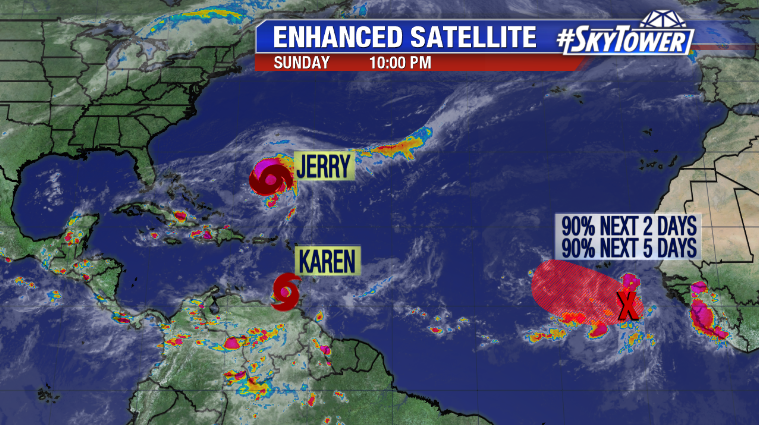
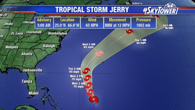
Tropical Storm Jerry should pass just north of Bermuda in a couple of days. This will bring some gusty winds and rain to the island, but no major impacts are expected. Lorenzo is likely to form just off the coast of Africa at really any point in the next 24 hours. It’ll be on the map for a while, but should ultimately stay out to sea.

Tropical Storm Karen Forms Near Windward Islands

Tropical Storm Karen formed early this morning, just east of the southern Windward Islands. It currently has 40 mph winds and little change in strength is expected over the next 48 hours.

On the current track, it will move into the eastern Caribbean by Monday and then turn north. Puerto Rico and the Virgin Islands are within the cone of uncertainty and may see tropical storm watches posted later today. Right now, Karen would still be a tropical storm as it passes over the islands Tuesday into Wednesday. But there is still time for things to change.

Tropical storm watches and warnings are in effect for the southern Windward Islands. Rainfall totals of 3-6″ are possible as well as tropical storm force winds.

Tropical Storm Jerry remains over the Atlantic with no direct impacts to land. It will slowly move north through Tuesday and then pick up speed as it turns out into the Atlantic. Bermuda could see impacts by midweek.

The tropical wave has come off the coast of Africa and is organizing. It will likely become a tropical depression by Monday. The Cabo Verde Islands can expect heavy rain as the storm moves west. Models are suggesting it would take a path similar to Jerry, and head out in to the Atlantic. But we will be watching this wave for quite some time.