Karen A Non-Issue For U.S. And Bahamas; Lorenzo Churning In Central Atlantic

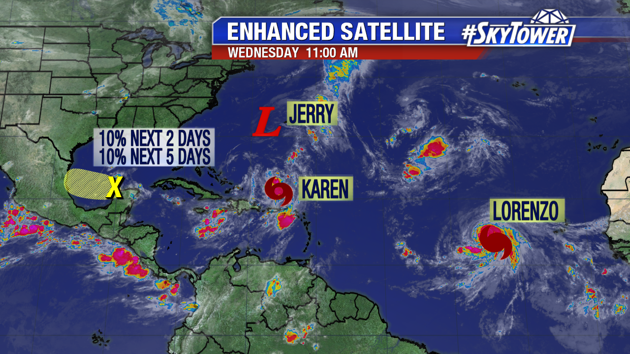
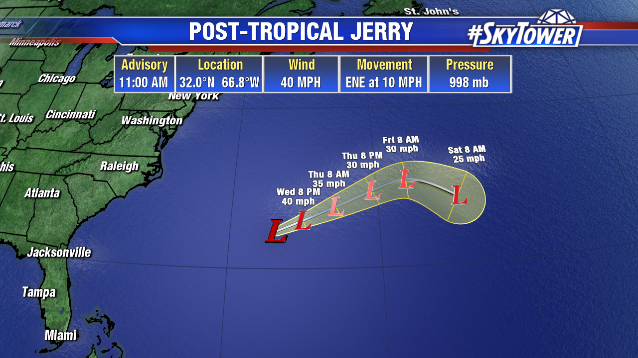
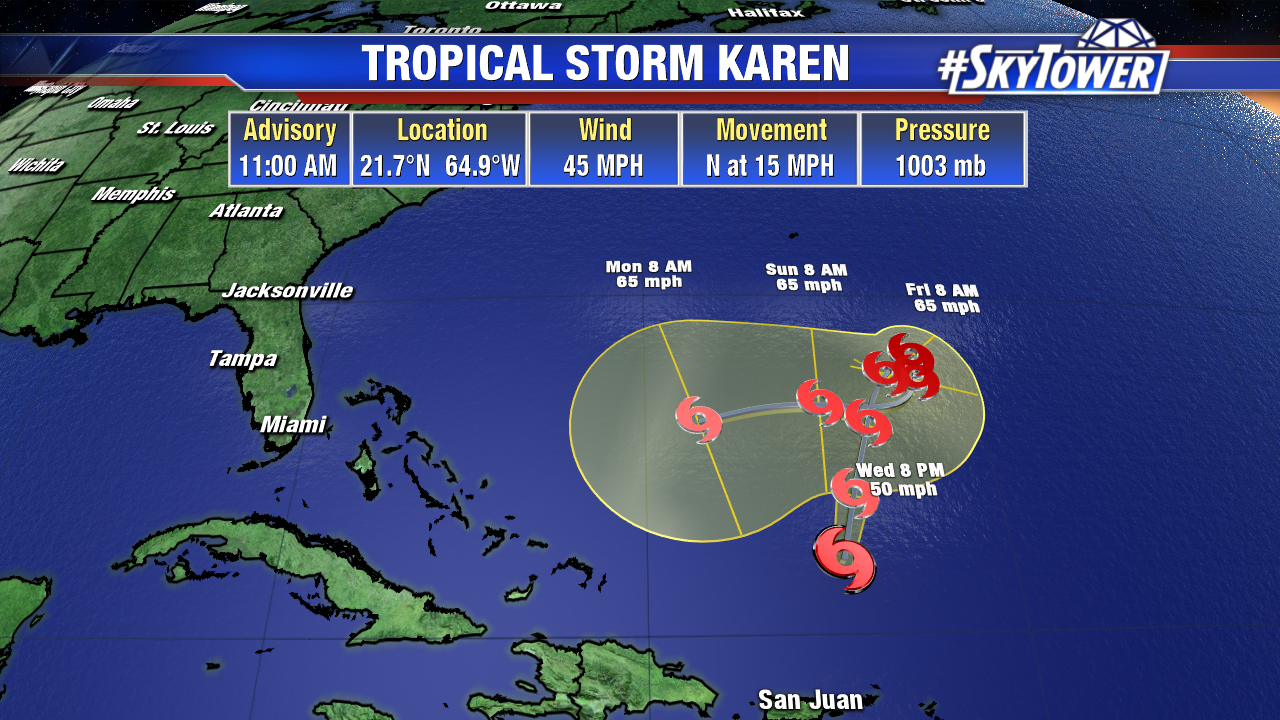
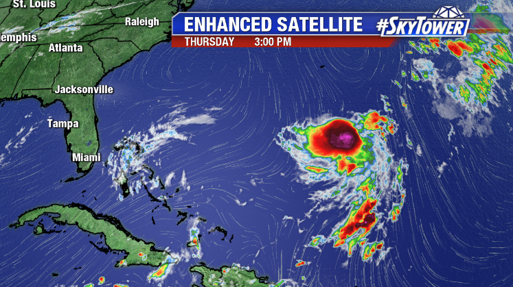
Karen continues to struggle to find sustained organization. Convection has been abundant today, but majority of it has been displaced west of the storm’s low-level center.

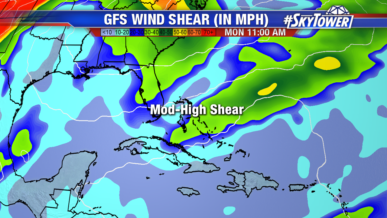
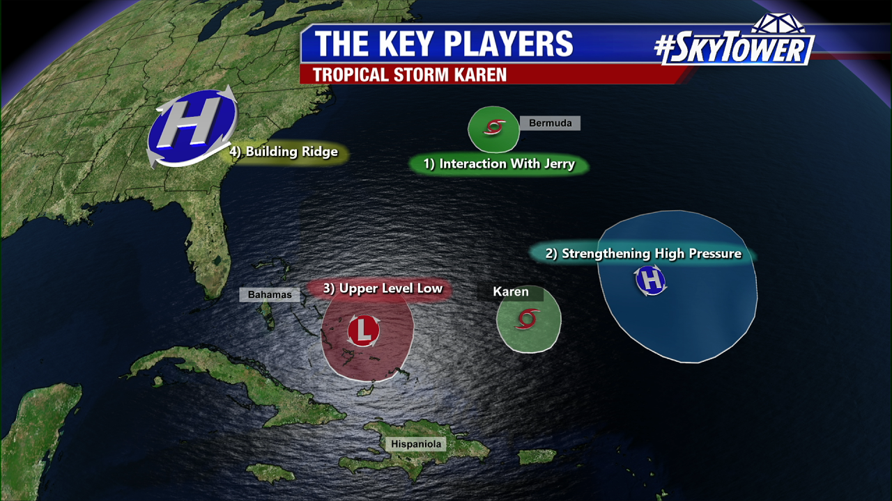
The environment that Karen is currently in should allow it to maintain its intensity for another day or two as it makes a small loop and begins to turn west-southwest over the weekend. This westward motion, thanks to a building ridge over the eastern U.S. and western Atlantic, will take the system into an area of moderate-high wind shear and dry air. At this point, confidence is high that Karen will dissipate late in the weekend or early next week before it can cause any issues for Florida or the Bahamas.

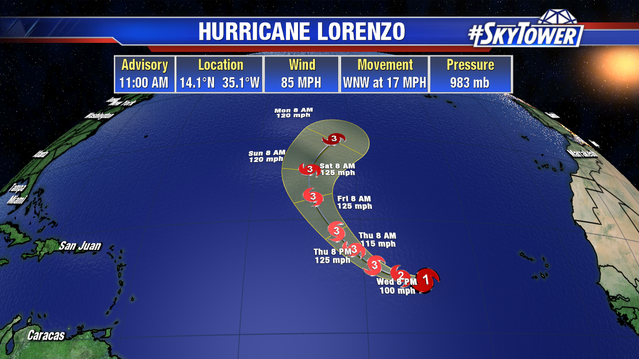
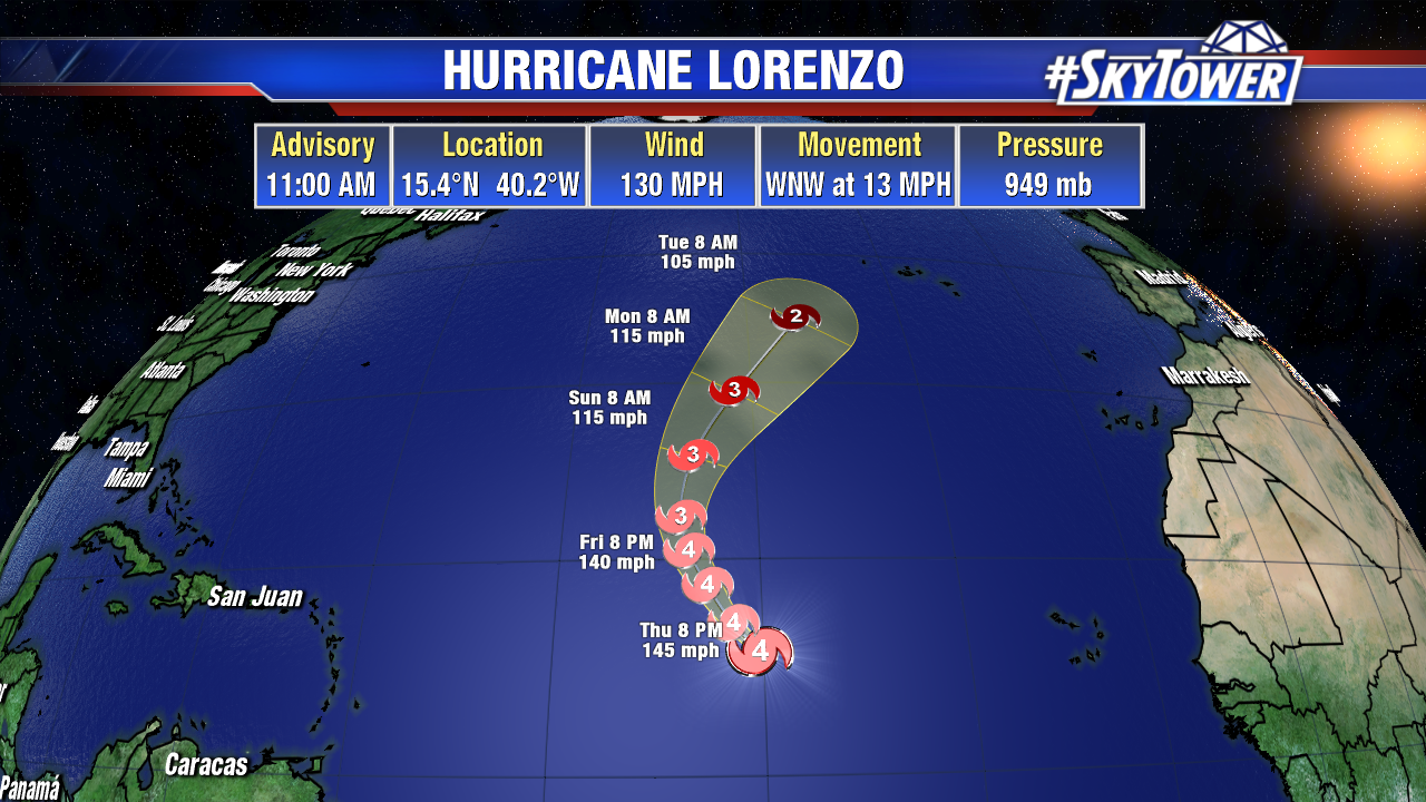
Over the open waters of the central Atlantic, Lorenzo is now a powerful category 4 hurricane. It is one of the most powerful hurricanes – this far east in the Atlantic – on record. Lorenzo will stay over open ocean, curving to the north and eventually northeast over the next 5 days. The only land area potentially in its path will be the Azores by the middle of next week.

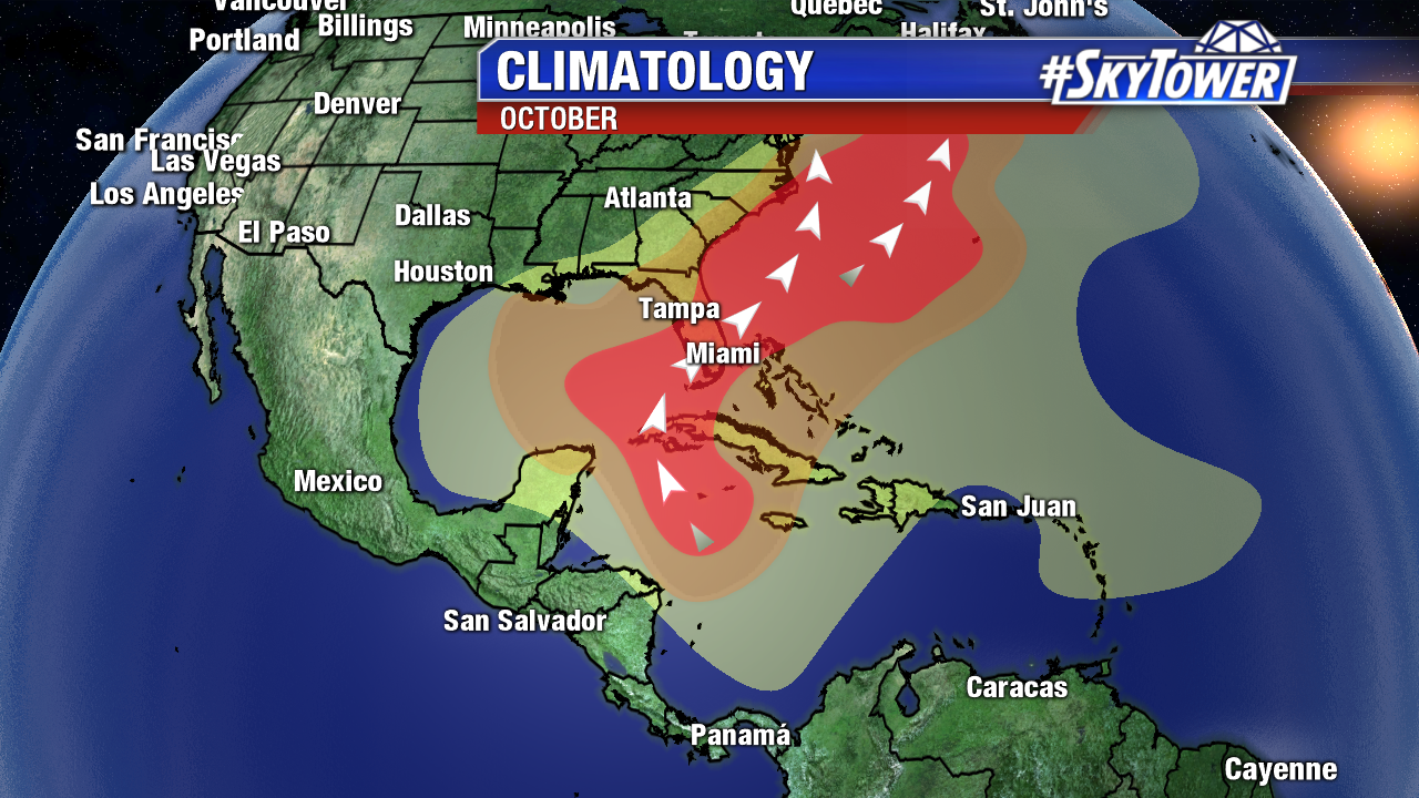
Heading into the month of October, the western Caribbean and Gulf of Mexico quite often become the main area of development. Some long-range models are hinting at the possibility of lowering pressures in this general area in the next 10-14 days. It’s too far out to really say anything more than that at this point, so for now rest easy, and we’ll be checking back in soon.

Tropics Staying Active; A Long Road Ahead For Karen

Jerry, Karen, and Lorenzo on the map today – along with an area in the southwestern Gulf of Mexico. While it’s busy, there are no immediate threats to the United States.

Jerry, now a post-tropical cyclone will slide just north of Bermuda over the next 24 hours. Impacts will be limited to a few tropical storm-force wind gusts and a few downpours.

Lorenzo is likely to become a major hurricane in the coming days over open ocean. It will pose no threat to land.

The disturbance near the Yucatan Peninsula is unlikely to have significant development. It will move west toward eastern Mexico, bringing some pockets of heavy rain through the weekend.

That leaves us with Karen. So far, the storm continues to struggle to maintain bursts of convection and further organize. There is a pretty good consensus in regards to track over the next 3-5 days with Karen moving north-northeast, getting blocked by the building ridge to the north, and then beginning a west-southwest motion this weekend. Intensity forecast remains the biggest question at this point, with multiple factors in play. Latest runs of the Euro and GFS suggest Karen will dissipate after beginning its move to the west; while others suggest the storm will maintain, if not intensify during this part of its journey. At this point, we’re leaning toward the weaker solution, with the possibility of dissipation, given the moderate-high wind shear that should be in place over Florida and the Bahamas next week. That being said, you’ll still want to check back for any updates in the coming days.