We’re currently tracking two disturbances in the Atlantic for development.
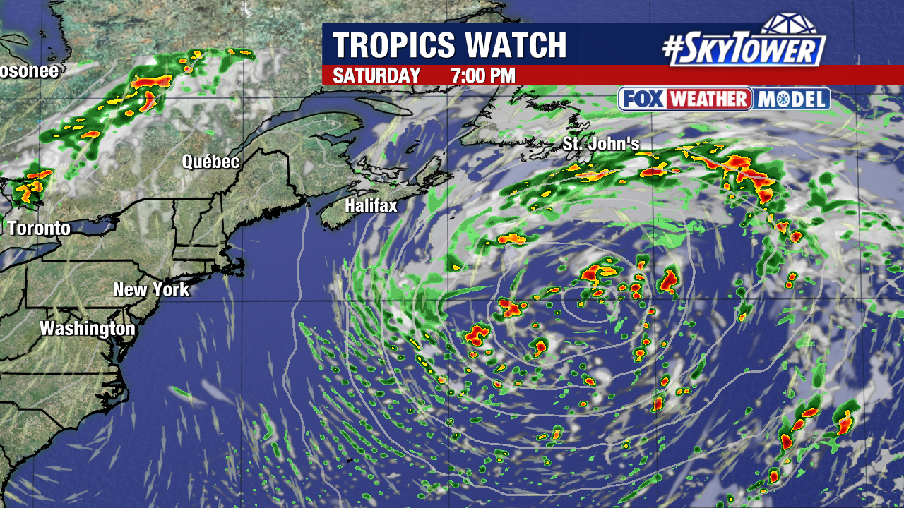
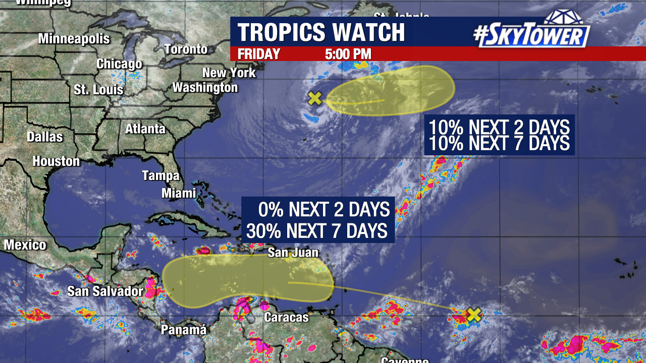
A non-tropical low pressure system in the north Atlantic now has a 10% chance of becoming a subtropical storm within the next few days. If this happens, “Melissa” would be the next name on our 2025 storm naming list. This will be traveling away from the United States and Canada.
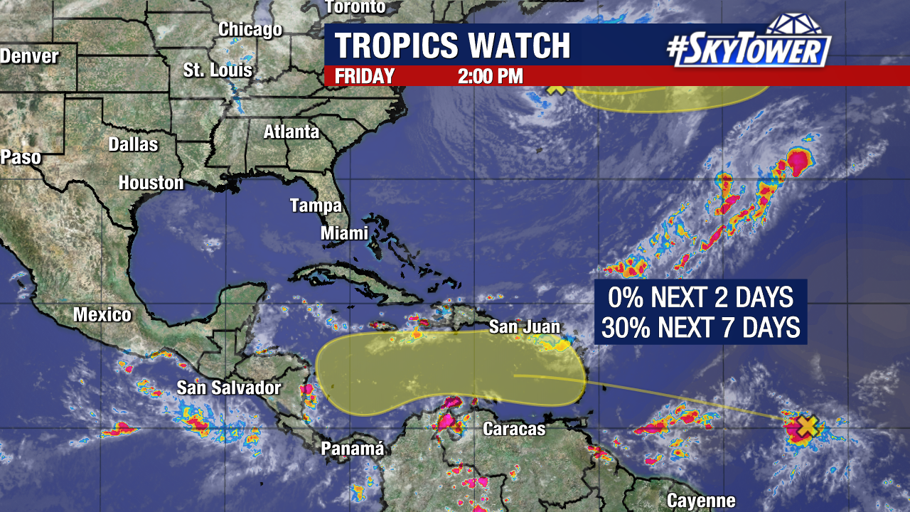
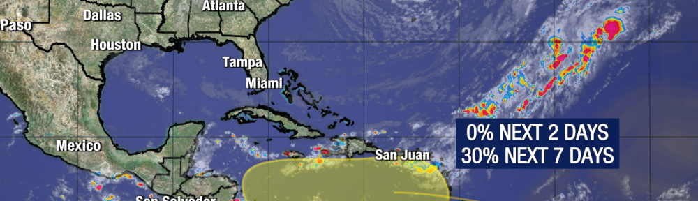
Meanwhile, chances are increasing that a tropical wave will eventually enter the Caribbean, possibly becoming a named storm late this weekend or early next week. The National Hurricane Center has increased its odds of development within the next week to 30%.
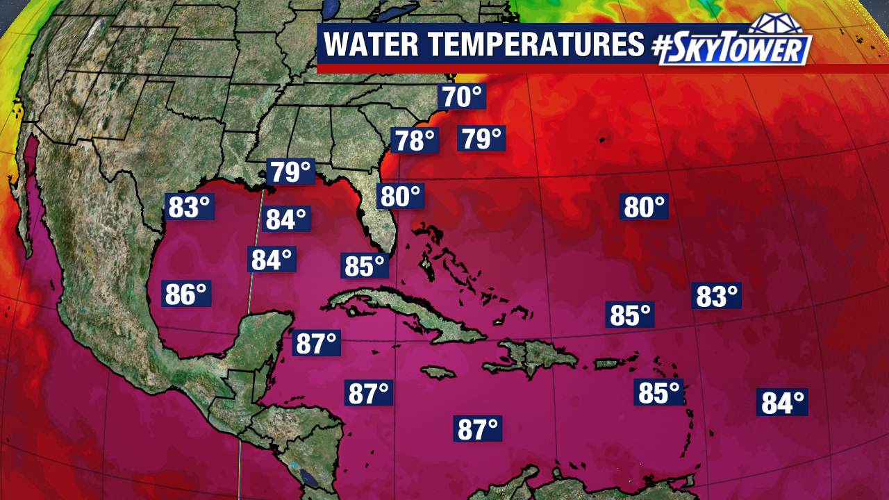
The warm waters of the Caribbean would make for an ideal spot for the wave to organize.
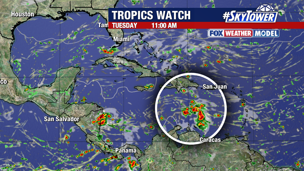
This is a tricky forecast due to questions regarding the timing of an approaching trough, and disagreement in how fast a storm will materialize (if a storm materializes at all). There is growing confidence that the tropical wave will travel into the central Caribbean before developing it at some point.
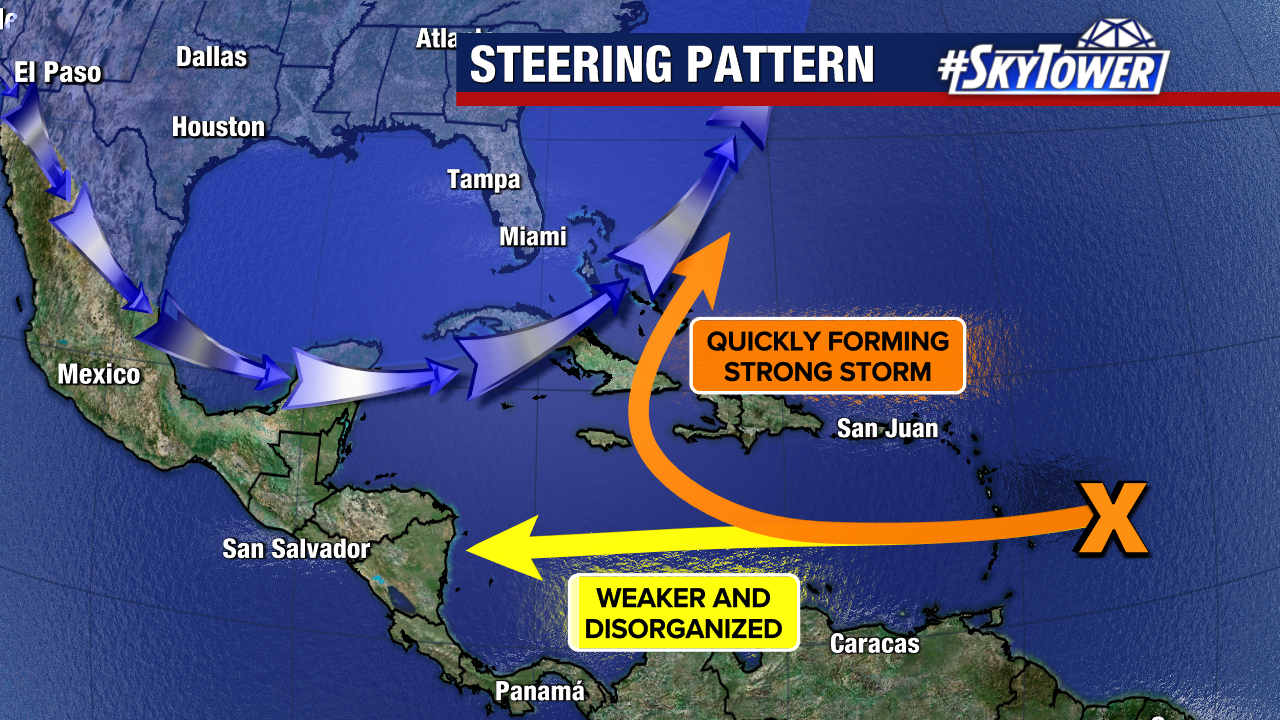
Today, the overwhelming majority of weather models keep the potential storm out of the Gulf. The two favored scenarios would be a track towards Central America, or an eventual turn north/northeast out of the Caribbean. It’s very early in the forecast process. We will not have a solid idea on its potential path until we see more agreement among weather models.
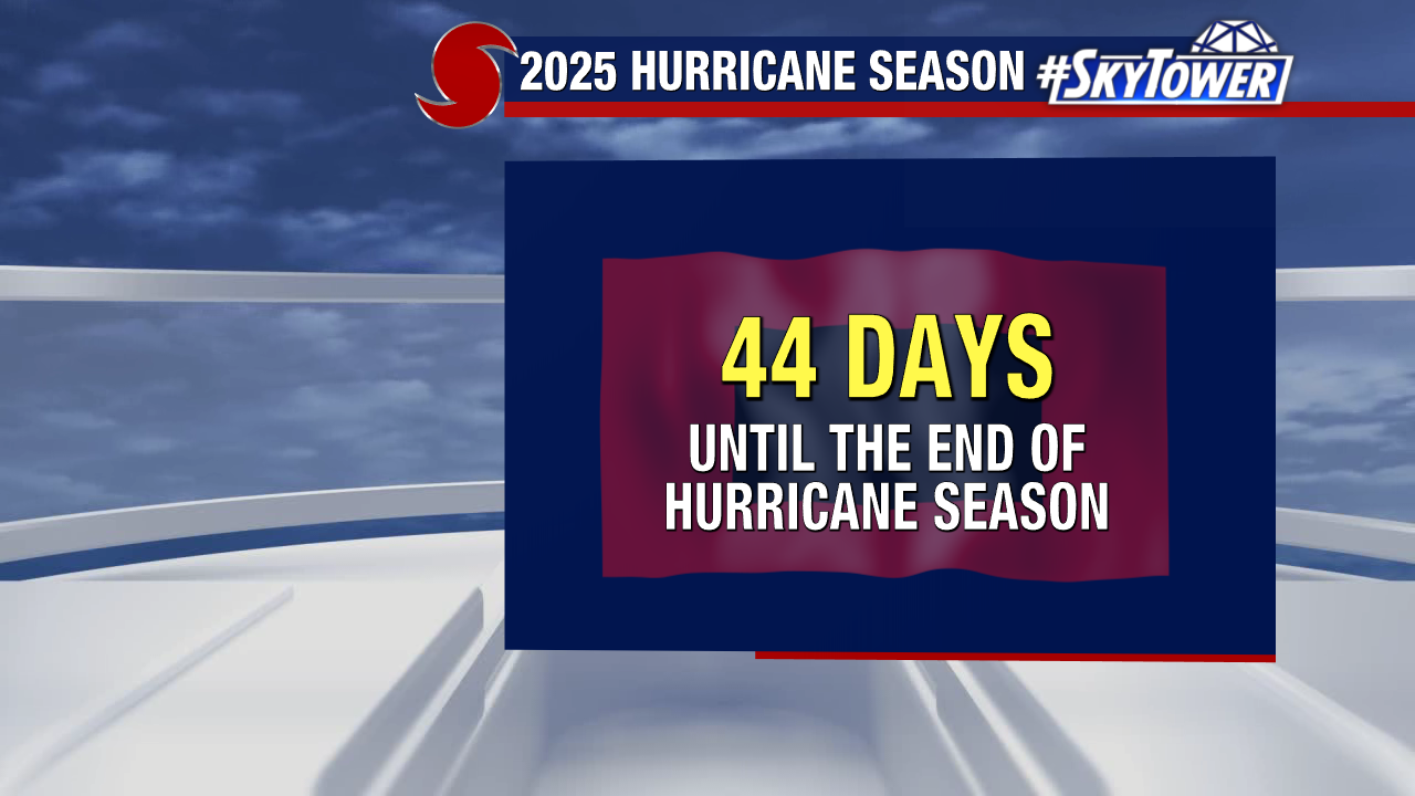
Check back for more updates as we count down the end of this year’s hurricane season.