
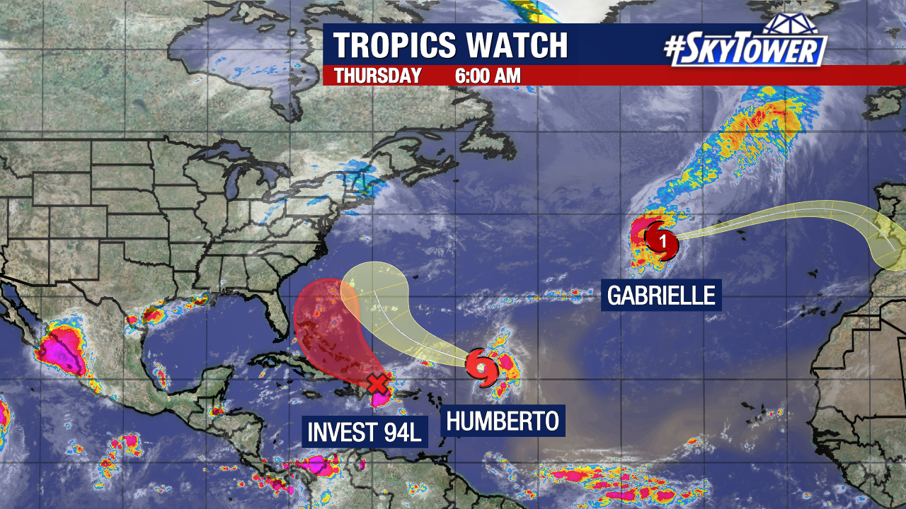
There is no shortage of action in the Atlantic at the moment. While the Gulf and Caribbean are quiet for now, We are tracking two (soon to be three) named storms at this time.
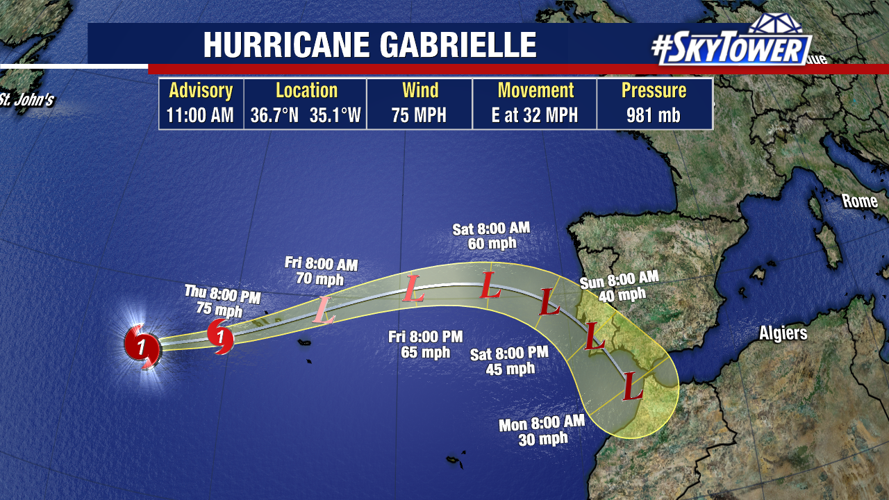
Hurricane Gabrielle will be passing through the Azores in the north Atlantic over the next 24 hours. Hurricane warnings remain in effect for the islands. The storm should become post-tropical before moving east towards Europe and Africa by the end of the weekend. It poses no threat to the United States.
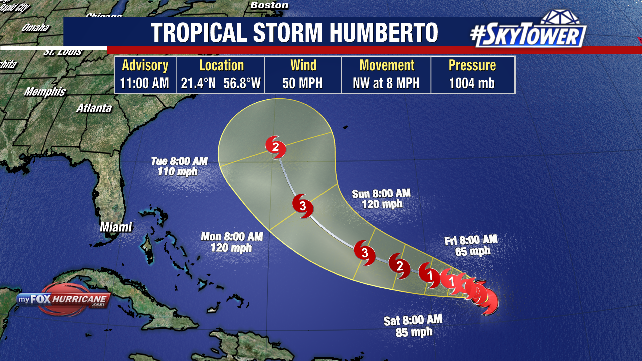
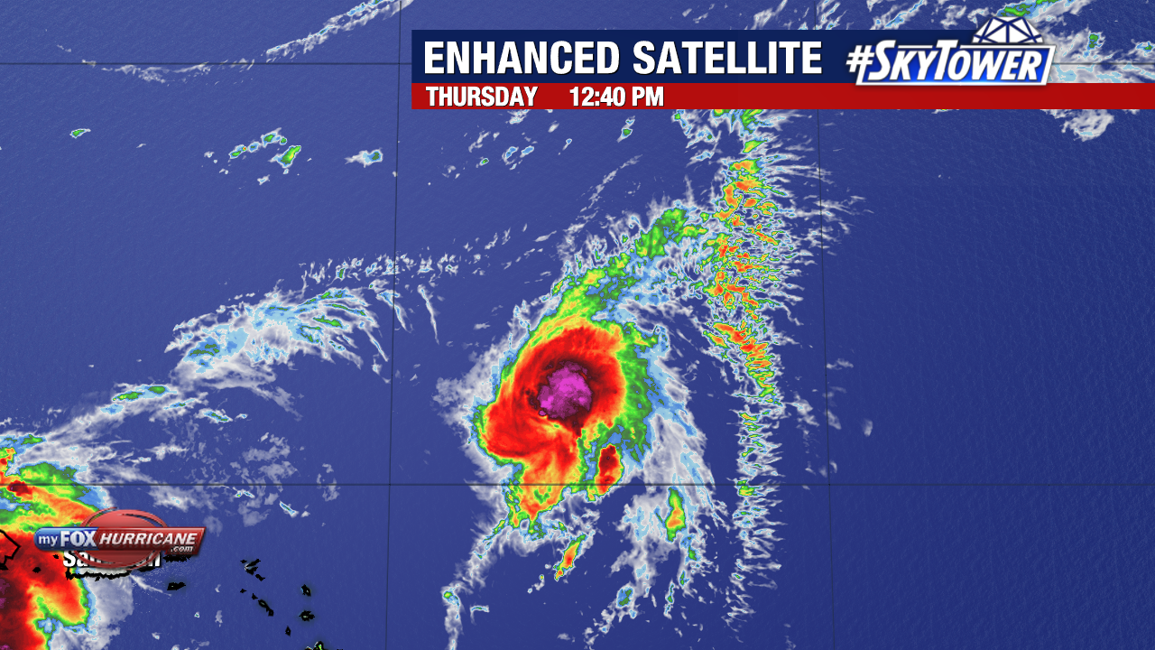
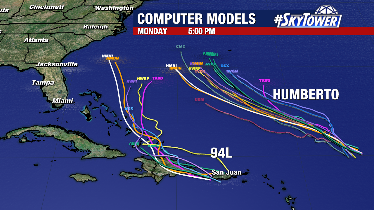
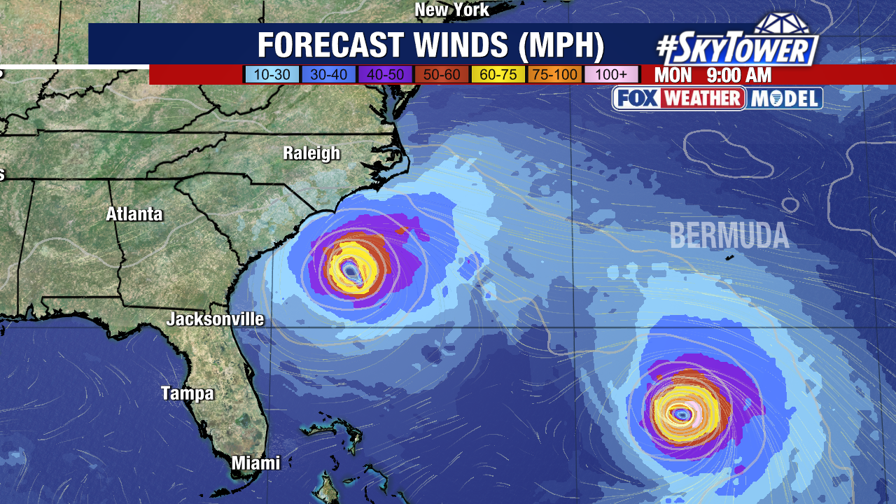
Meanwhile, Tropical Storm Humberto is poised to strengthen into a hurricane within the next day or so. It should remain well east of the United States before turning north east as it nears Bermuda.
It will move very slowly over the next few days, with its movement currently estimated to be less than 10 mph.
Bermuda will need to carefully watch the developing hurricane’s forecast for potential impacts.
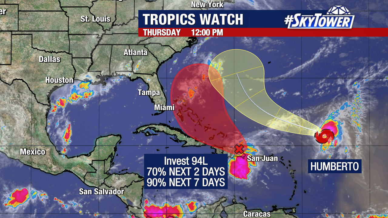
The southeast coastline of the U.S. will need to be monitoring Invest 94L for the next several days.
The tropical wave has a high chance of becoming a tropical depression or tropical storm near the Bahamas in a couple of days.
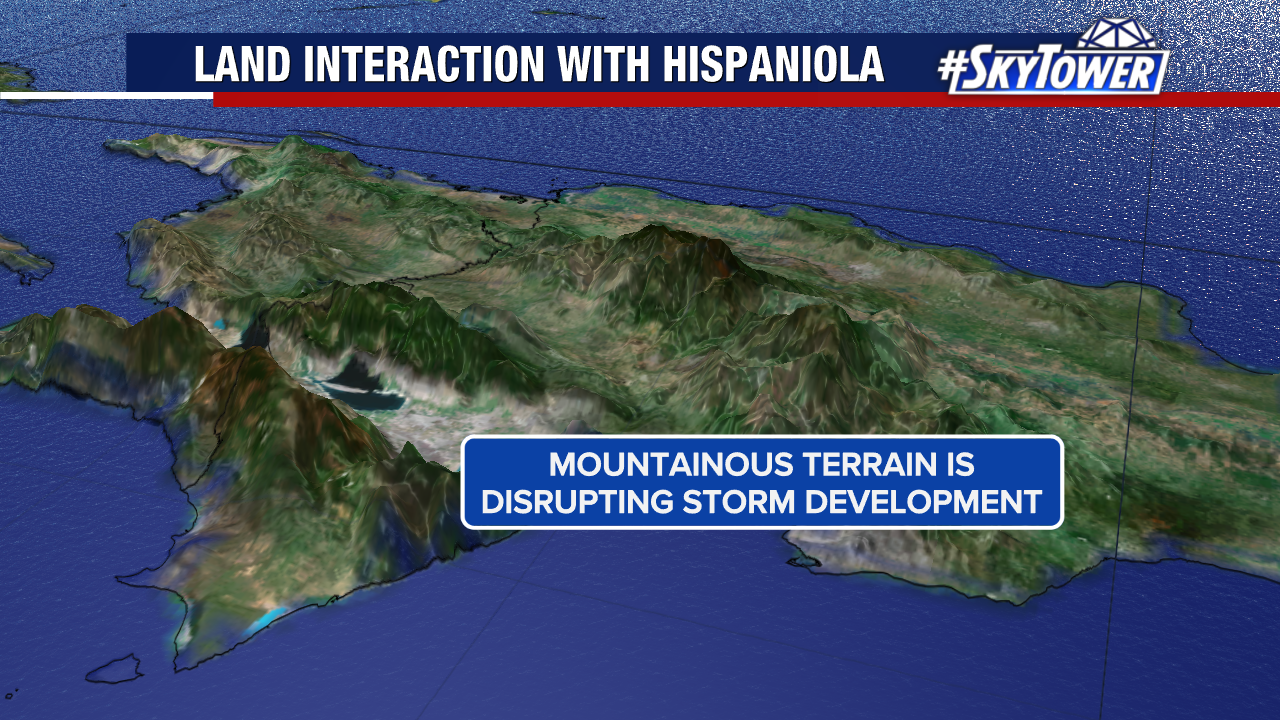
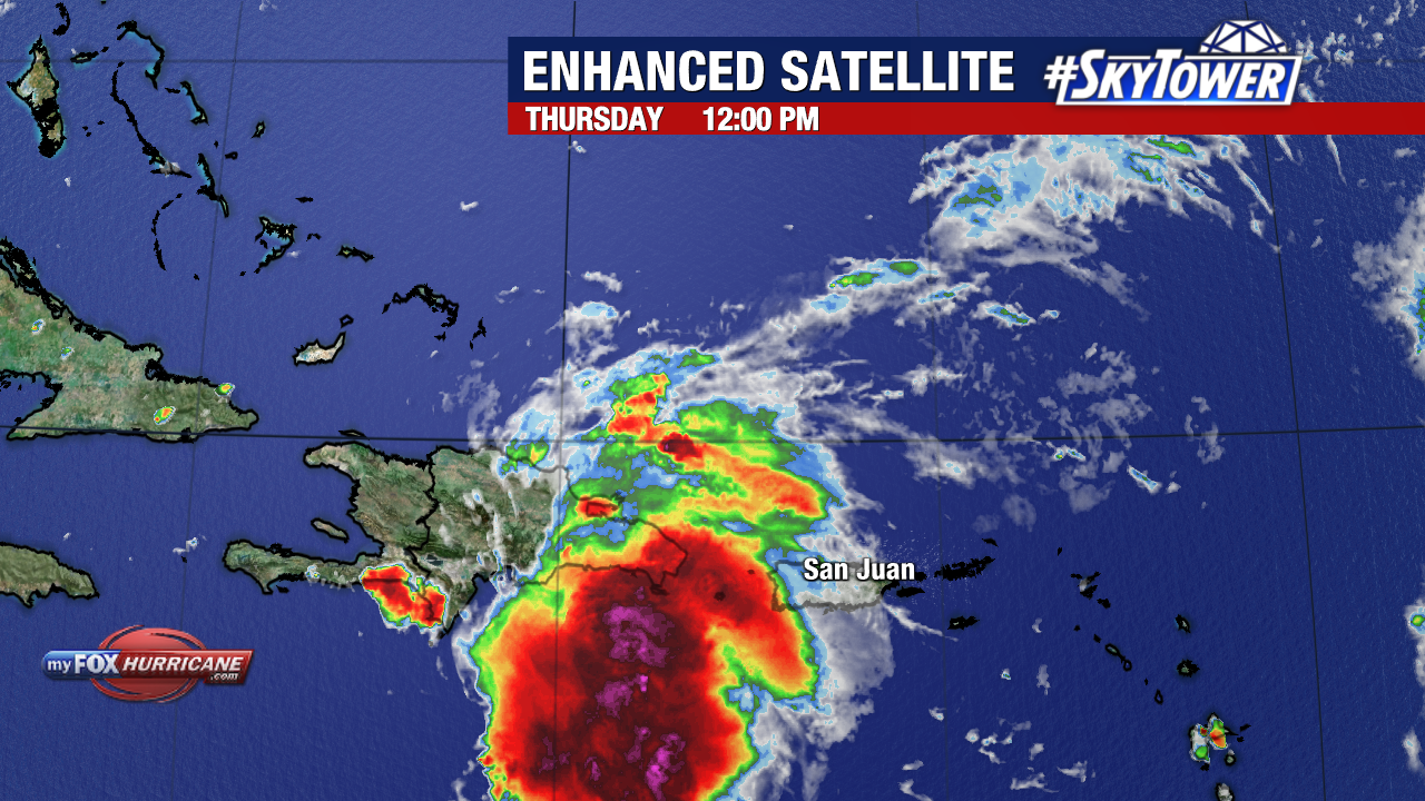
The tropical wave is being somewhat impacted by the mountainous terrain of Hispaniola in the short-term. As it pulls northwest of the island, there will be very little to prevent it from developing.
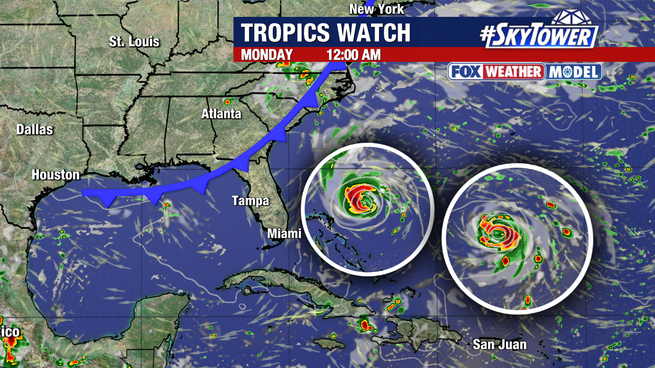
A dip in the jet stream will then begin to pull the system north, likely paralleling Florida’s coastline.
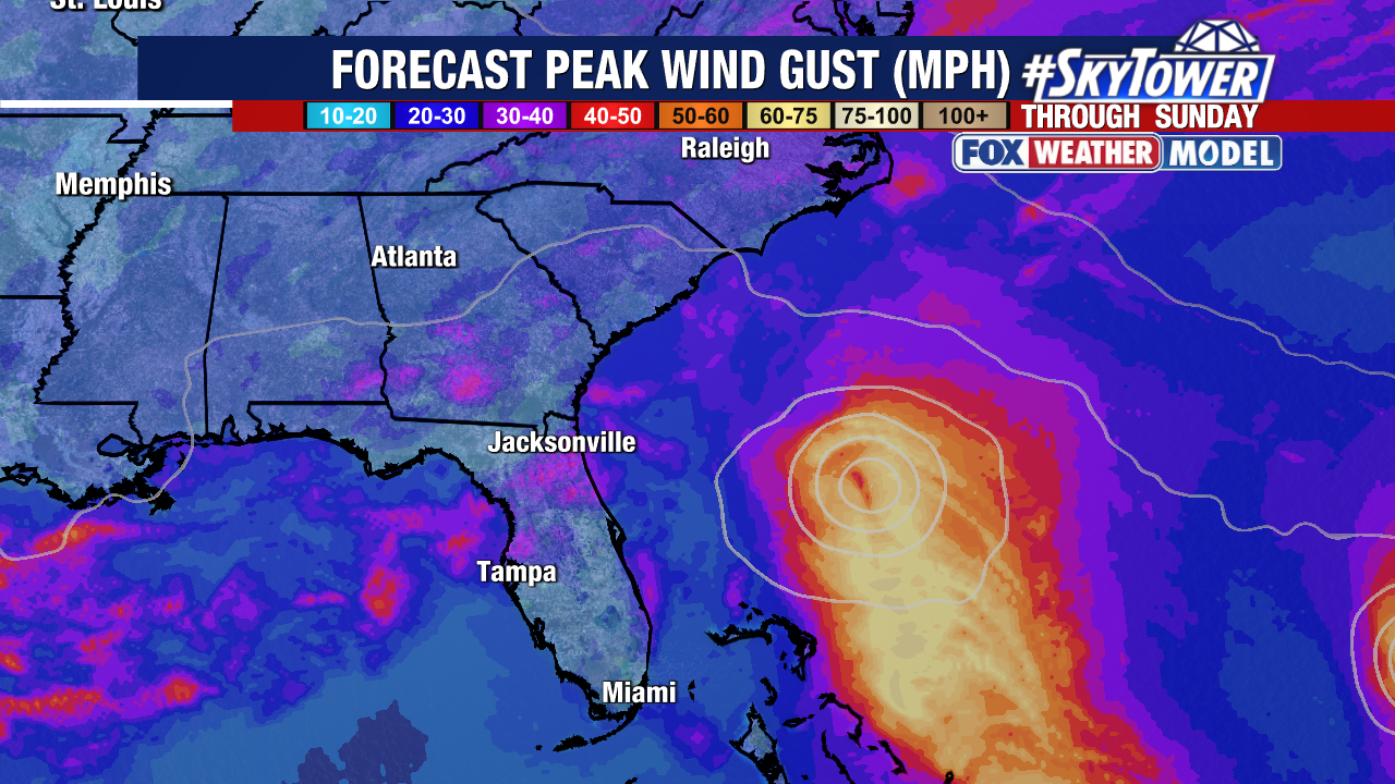
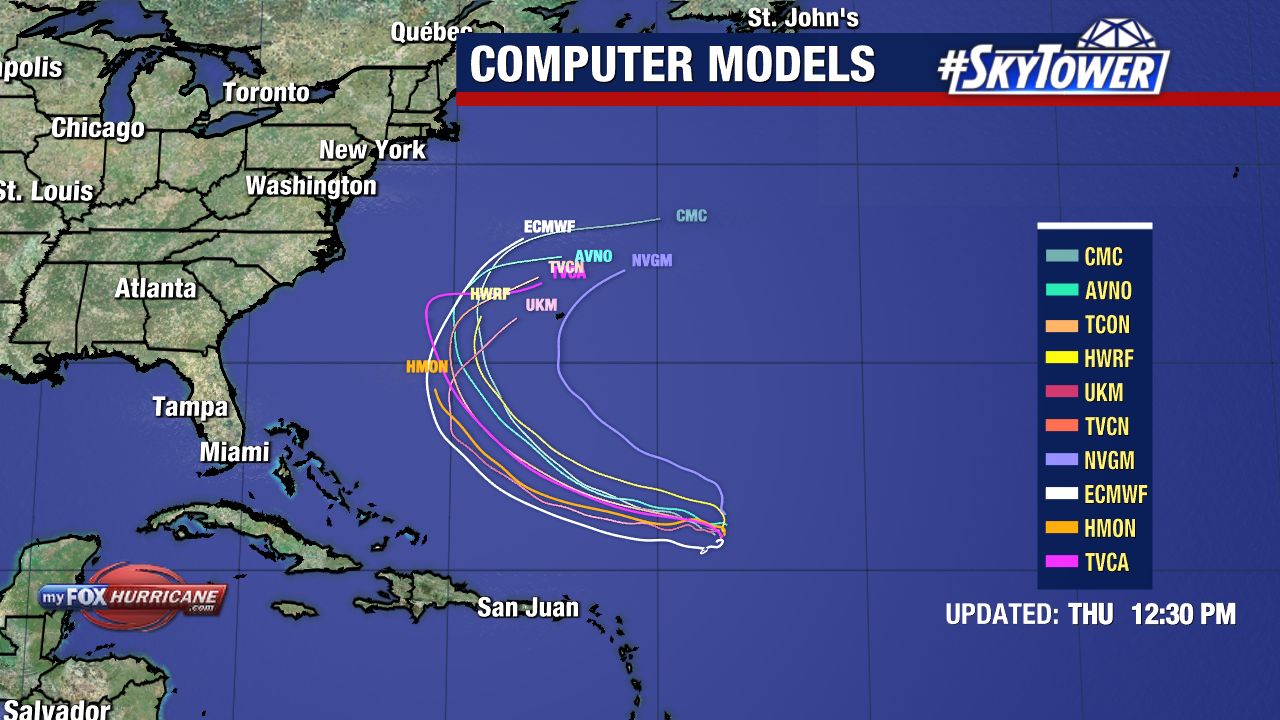
The majority of our weather models keep the storm roughly 100 miles, or more, east of Florida’s Atlantic coast. Florida’s Gulf coast is not currently expecting impacts from this system.
The coasts of North and South Carolina and Georgia should be watching Invest 94L carefully.
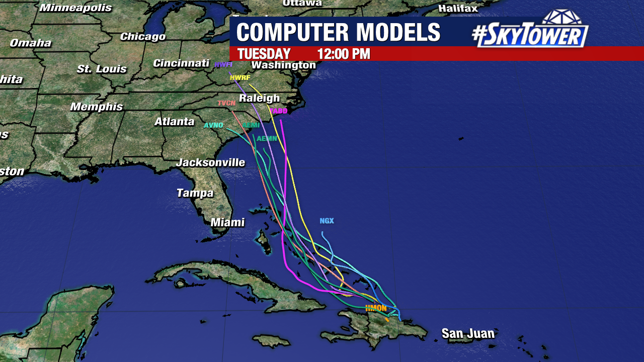
There is growing confidence that this will bring direct or indirect impacts (wind, rain, possibly coastal flooding) to the states in some way by the beginning to middle of next week.
These impacts will remain undefined until a storm develops and there is higher confidence in the storm’s path and ultimate strength. It should also be noted that there are still many weather models still do not dismiss the possibility of this system remaining off the coast entirely. Check back with us daily on MyFoxHurricane.com for updates as the path of this developing storm becomes more defined.