
This tropical wave in the central Atlantic, now deemed Invest 92L, has a high chance to develop this week. The odds are up to 80% in the next 7 days and 40% in the next 2 days.
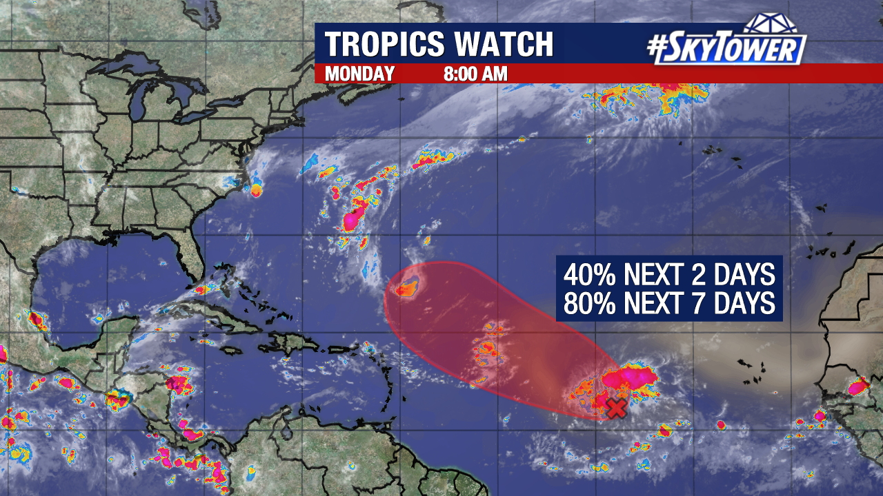
The disturbance is still battling dust and wind shear as it tries to get organized. It is moving west-northwest through the tropical Atlantic.
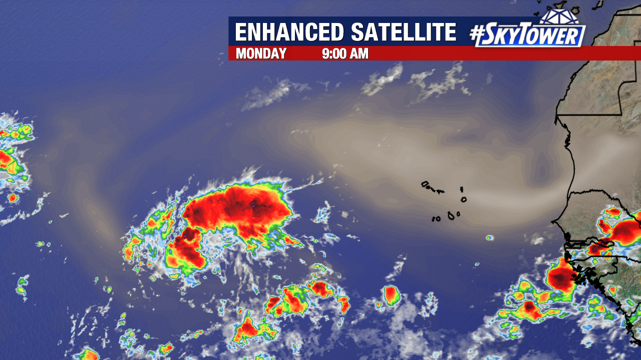
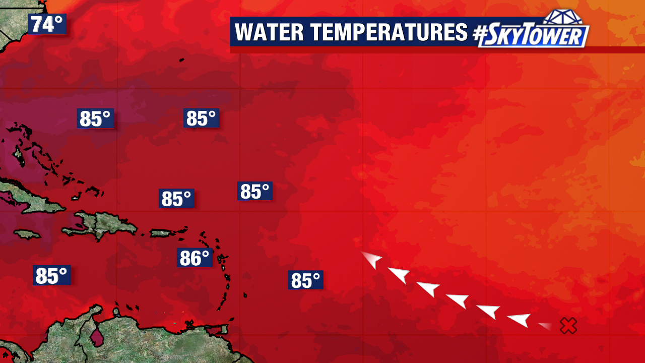
The system will start to tap into more favorable conditions to develop as it moves away from Saharan dust and into warmer waters.
This will likely become a depression around the middle to end of this week. If sustained winds reach 40 mph, this would become the 7th named storm of the season – Tropical Storm Gabrielle.
The main steering will be the Bermuda High and a break in the ridge looks likely to curve the system north. Many models are trending with this happening near/north of the islands and staying well east of Florida and the U.S.
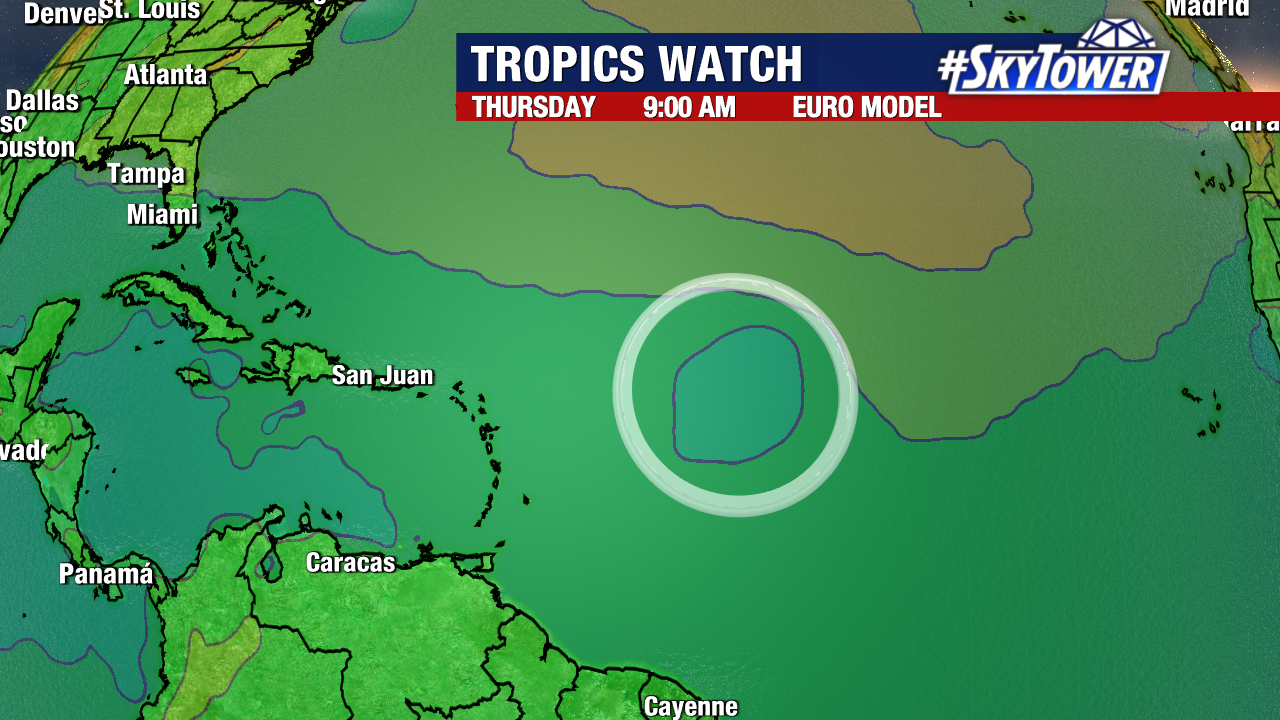
If this forms, it has a good chance becoming a fish storm and staying out to sea. Impacts to Bermuda and/or Caribbean Islands could still happen in that scenario. There’s also the possibility of seeing a track similar to Hurricane Erin with no direct hit.
For now, this tropical wave is not a worry for the Continental U.S. but we will watch the trends evolve as the system gets better organized.