
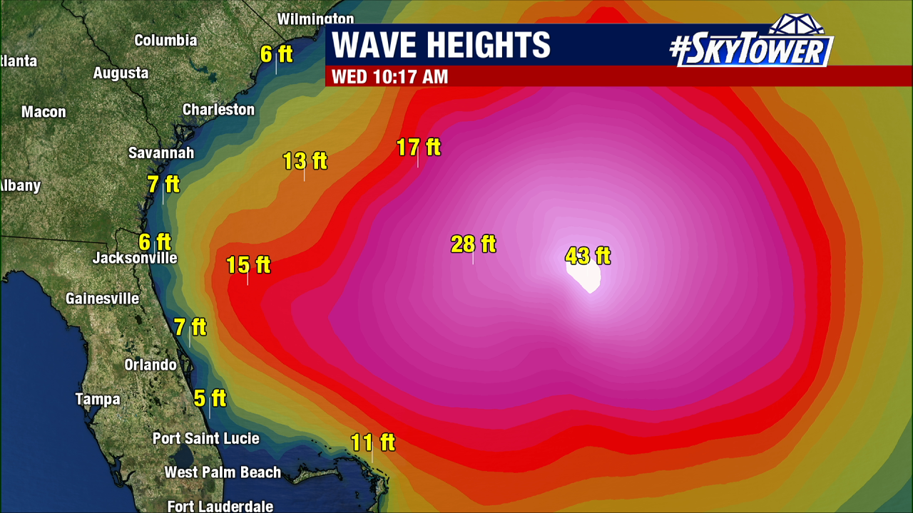
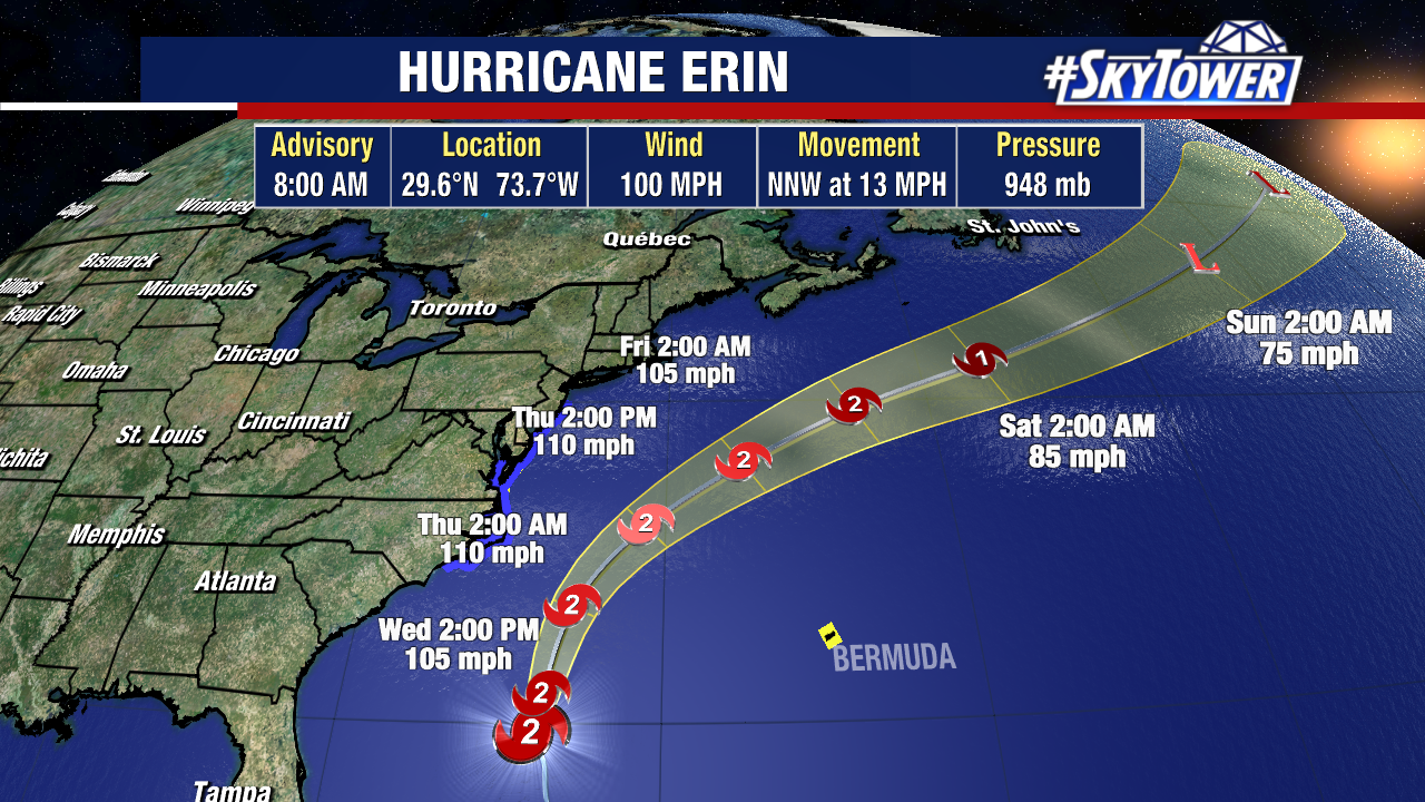
Category 2 Hurricane Erin is bringing rough beach conditions as the storm’s center is passing about 500 miles off Jacksonville Beach.
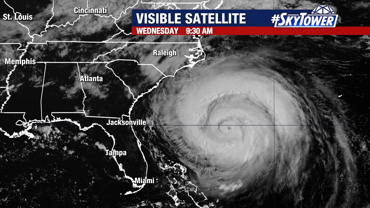
High Surf Advisory includes almost all of Florida’s East Coast through Thursday night with breaking waves between 5 and 10 feet, and up to 8′ waves further south to Saint Lucie/West Palm.
Dangerous rip currents will be possible into this weekend as well – High Rip Current risk through Friday night.
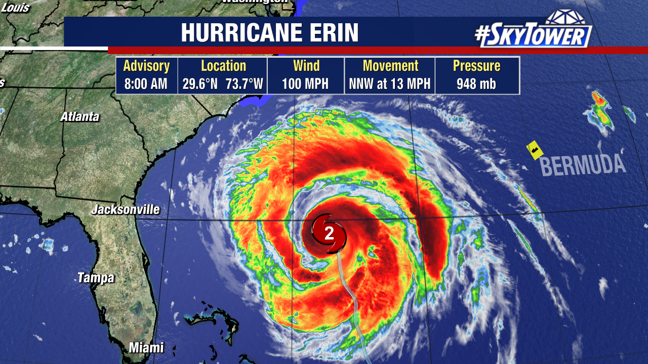
Hurricane Erin is moving north-northwest at a faster clip than yesterday. It remains a healthy Category 2 storm with a slight drop in sustained winds, still maintaining 100 mph winds down from 105 mph.
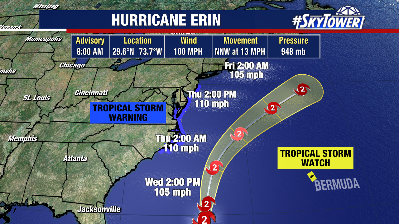
Erin pulls away from Florida Thursday, passing off the Outer Banks of North Carolina, before curving NE out to sea. It will brush by the coasts of NC and Virginia where new advisories are up today.
Here’s a look at advisories in effect from Hurricane Erin:
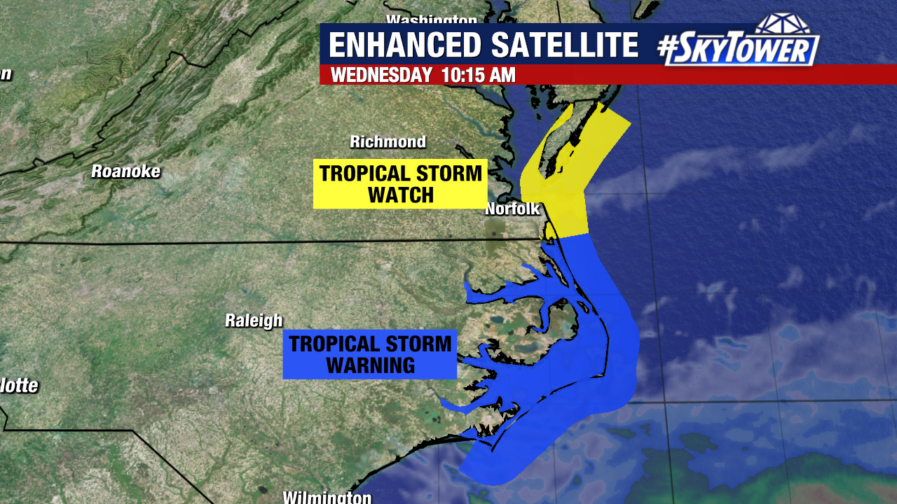
Storm Surge Warning:
- Cape Lookout to Duck, North Carolina
Tropical Storm Warning:
- Beaufort Inlet, NC to the North Carolina/Virginia border, including Pamlico and Albemarle sounds
Tropical Storm Watch:
- North of the North Carolina/Virginia border to Chincoteague, Virginia
- Bermuda
With a storm this large, it will take some time for the ocean to settle down and there will still be choppy conditions this weekend as Erin moves north and northeast.